
SAINT-MALO
Passenger
Current Trip
| Time Travelled | 7 h, 57 mins |
|---|---|
| Remaining Time | 1 h, 31 mins |
| Distance Travelled | 123.59 nm |
| Remaining Distance | 32.84 nm |
| AVG Speed | 15 Knots |
| MAX Speed | 18.7 Knots |
| AVG Wind | 26.1 knots |
| MAX Wind | 41.5 knots |
| MIN Temp | 9.5°C / 49.1°F |
| MAX Temp | 11.7°C / 53.06°F |
| Draught | 6 m |
| Position Received | Now |
Current Position
| Longitude | --- |
|---|---|
| Latitude | --- |
| Status | Under way using engine |
| Speed | 17.5 Knots |
| Course | 41° |
| Area | English Channel |
| Station | T-AIS |
| Position Received | Now |
Info
Information
The current position of SAINT-MALO is in English Channel with coordinates 50.42415° / -1.23848° as reported on 2026-01-08 19:22 by AIS to our vessel tracker app. The vessel's current speed is 17.5 Knots and is heading at the port of PORTSMOUTH. The estimated time of arrival as calculated by MyShipTracking vessel tracking app is 2026-01-08 20:54 LT
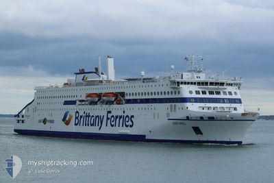
The vessel SAINT-MALO (IMO: 9946336, MMSI: 228457700) is a Passenger It's sailing under the flag of [FR] France.
In this page you can find informations about the vessels current position, last detected port calls, and current voyage information. If the vessels is not in coverage by AIS you will find the latest position.
The current position of SAINT-MALO is detected by our AIS receivers and we are not responsible for the reliability of the data. The last position was recorded while the vessel was in Coverage by the Ais receivers of our vessel tracking app.
The current draught of SAINT-MALO as reported by AIS is 6 meters
Weather
| Temperature | 9.5°C / 49.1°F |
|---|---|
| Wind Speed | 38 knots |
| Direction | 214° SW |
| Pressure | 983.3 hPa |
| Humidity | 80.1 % |
| Cloud Coverage | 100 % |
Featured Company
Last Port Calls
| Port | Arrival | Departure | Time In Port |
|---|---|---|---|
| 2026-01-08 07:05 | 2026-01-08 11:26 | 4 h | |
| 2026-01-07 07:19 | 2026-01-07 20:15 | 12 h | |
| 2026-01-06 06:59 | 2026-01-06 19:30 | 12 h | |
| 2026-01-05 18:11 | 2026-01-05 20:27 | 2 h | |
| 2026-01-05 06:55 | 2026-01-05 09:42 | 2 h | |
| 2026-01-04 07:21 | 2026-01-04 20:49 | 13 h | |
| 2026-01-03 15:06 | 2026-01-03 19:42 | 4 h | |
| 2026-01-03 07:02 | 2026-01-03 10:19 | 3 h | |
| 2026-01-02 16:57 | 2026-01-02 23:27 | 6 h | |
| 2026-01-02 06:54 | 2026-01-02 09:20 | 2 h |
Most Visited Ports (Last year)
| Port | Arrivals | |
|---|---|---|
| 266 | ||
| 260 | ||
| 8 | ||
| 8 | ||
| 7 | ||
| 2 |
Last Trips
| Origin | Departure | Destination | Arrival | Distance | |
|---|---|---|---|---|---|
| 2026-01-07 20:15 | 2026-01-08 08:05 | 154.14 nm | |||
| 2026-01-06 20:30 | 2026-01-07 07:19 | 154.67 nm | |||
| 2026-01-05 20:27 | 2026-01-06 07:59 | 153.41 nm | |||
| 2026-01-05 10:42 | 2026-01-05 18:11 | 155.82 nm | |||
| 2026-01-04 20:49 | 2026-01-05 07:55 | 151.25 nm | |||
| 2026-01-03 20:42 | 2026-01-04 07:21 | 154.39 nm | |||
| 2026-01-03 11:19 | 2026-01-03 16:06 | 31.15 nm | |||
| 2026-01-02 23:27 | 2026-01-03 08:02 | 152.08 nm | |||
| 2026-01-02 10:20 | 2026-01-02 16:57 | 155.14 nm | |||
| 2026-01-01 19:09 | 2026-01-02 07:54 | 13.96 nm |
Events
| Time | Event | Details | Position / Dest | Info |
|---|---|---|---|---|
| 2026-01-08 18:51 | Status Changed | Under way using engine Default |
50.31038 / -1.39146
GB PME
|
Speed: 16.9 kn Course: 47° |
| 2026-01-08 18:47 | Status Changed | Default Under way using engine |
50.29599 / -1.41542
GB PME
|
Speed: 16.8 kn Course: 45.9° |
| 2026-01-08 18:36 | Status Changed | Under way using engine Default |
50.25809 / -1.46643
GB PME
|
Speed: 16.9 kn Course: 33° |
| 2026-01-08 18:35 | Status Changed | Default Under way using engine |
50.25293 / -1.47142
GB PME
|
Speed: 17.1 kn Course: 32.6° |
| 2026-01-08 18:27 | Status Changed | Under way using engine Default |
50.22129 / -1.50220
GB PME
|
Speed: 17.5 kn Course: 31° |
| 2026-01-08 18:23 | Status Changed | Default Under way using engine |
50.20539 / -1.51746
GB PME
|
Speed: 17.6 kn Course: 28° |
| 2026-01-08 18:23 | Status Changed | Under way using engine Default |
50.20412 / -1.51863
GB PME
|
Speed: 17.6 kn Course: 31° |
| 2026-01-08 18:23 | Detected in Sea | United Kingdom part of the English Channel |
50.20412 / -1.51863
English Channel
GB PME
|
Speed: 17.6 kn Course: 28° |
| 2026-01-08 18:11 | IN Coverage |
50.20412 / -1.51863
English Channel
GB PME
|
Speed: 17.6 kn Course: 28° |
|
| 2026-01-08 15:20 | OUT of Coverage |
49.58999 / -2.14012
English Channel
GB PME
|
Speed: 15.4 kn Course: 30.2° |