
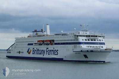
SAINT-MALO
Passenger
Current Trip
| Time Travelled | 1 h, 44 mins |
|---|---|
| Remaining Time | --- |
| Distance Travelled | 21.00 nm |
| Remaining Distance | 134.79 nm |
| AVG Speed | 13.8 Noeuds |
| MAX Speed | 19.1 Noeuds |
| AVG Wind | 11.5 knots |
| MAX Wind | 14.7 knots |
| MIN Temp | 0.6°C / 33.08°F |
| MAX Temp | 3.1°C / 37.58°F |
| Tirant d eau | 6 m |
| Position reçue | 1 m depuis |
Current Position
| Longitude | --- |
|---|---|
| Latitude | --- |
| Etat | Under way using engine |
| Vitesse | 12 Noeuds |
| Parcours | 217.3° |
| Zone | English Channel |
| Station | T-AIS |
| Position reçue | 1 m depuis |
Info
Information
The current position of SAINT-MALO is in English Channel with coordinates 50.52485° / -1.14946° as reported on 2026-01-05 22:09 by AIS to our vessel tracker app. The vessel's current speed is 12 Noeuds and is heading at the port of SAINT MALO. The estimated time of arrival as calculated by MyShipTracking vessel tracking app is 2026-01-06 08:15 LT
The vessel SAINT-MALO (IMO: 9946336, MMSI: 228457700) is a Passenger It's sailing under the flag of [FR] France.
In this page you can find informations about the vessels current position, last detected port calls, and current voyage information. If the vessels is not in coverage by AIS you will find the latest position.
The current position of SAINT-MALO is detected by our AIS receivers and we are not responsible for the reliability of the data. The last position was recorded while the vessel was in Coverage by the Ais receivers of our vessel tracking app.
The current draught of SAINT-MALO as reported by AIS is 6 meters
Weather
| Temperature | 2.4°C / 36.32°F |
|---|---|
| Wind Speed | 12 knots |
| Direction | 349° N |
| Pressure | 1018.7 hPa |
| Humidity | 71.2 % |
| Cloud Coverage | --- |
Featured Company
Last Port Calls
| Port | Arrival | Departure | Time In Port |
|---|---|---|---|
| 2026-01-05 18:11 | 2026-01-05 20:27 | 2 h | |
| 2026-01-05 07:55 | 2026-01-05 10:42 | 2 h | |
| 2026-01-04 07:21 | 2026-01-04 20:49 | 13 h | |
| 2026-01-03 16:06 | 2026-01-03 20:42 | 4 h | |
| 2026-01-03 08:02 | 2026-01-03 11:19 | 3 h | |
| 2026-01-02 16:57 | 2026-01-02 23:27 | 6 h | |
| 2026-01-02 07:54 | 2026-01-02 10:20 | 2 h | |
| 2026-01-01 09:06 | 2026-01-01 19:09 | 10 h | |
| 2025-12-31 08:04 | 2025-12-31 18:12 | 10 h | |
| 2025-12-30 17:58 | 2025-12-30 20:14 | 2 h |
Most Visited Ports (Last year)
| Port | Arrivals | |
|---|---|---|
| 264 | ||
| 259 | ||
| 8 | ||
| 8 | ||
| 7 | ||
| 2 |
Last Trips
| Origin | Departure | Destination | Arrival | Distance | |
|---|---|---|---|---|---|
| 2026-01-05 10:42 | 2026-01-05 18:11 | 155.82 nm | |||
| 2026-01-04 20:49 | 2026-01-05 07:55 | 151.25 nm | |||
| 2026-01-03 20:42 | 2026-01-04 07:21 | 154.39 nm | |||
| 2026-01-03 11:19 | 2026-01-03 16:06 | 31.15 nm | |||
| 2026-01-02 23:27 | 2026-01-03 08:02 | 152.08 nm | |||
| 2026-01-02 10:20 | 2026-01-02 16:57 | 155.14 nm | |||
| 2026-01-01 19:09 | 2026-01-02 07:54 | 13.96 nm | |||
| 2025-12-31 18:12 | 2026-01-01 09:06 | 15.06 nm | |||
| 2025-12-30 20:14 | 2025-12-31 08:04 | 151.32 nm | |||
| 2025-12-30 10:35 | 2025-12-30 17:58 | 150.65 nm |
Events
| Heure | Evenement | Détails | Position/ Destination | Info |
|---|---|---|---|---|
| 2026-01-05 20:56 | Etat Changé | Under way using engine Constrained by her draught |
50.72397 / -1.03203
FR SML
|
Vitesse: 17.1 kn Parcours: 116° |
| 2026-01-05 20:27 | PORT DE DEPART |
|
50.80658 / -1.11504
FR SML
|
Vitesse: 9.9 kn Parcours: 206° |
| 2026-01-05 20:23 | Démarrage |
50.81133 / -1.10094
[GB] PORTSMOUTH
|
Vitesse: 3.1 kn Parcours: 289° |
|
| 2026-01-05 18:49 | Changement de destination | FR SML GB PME |
50.81162 / -1.09545
[GB] PORTSMOUTH
|
Vitesse: Parcours: 79° |
| 2026-01-05 18:49 | Changement d'ETA | 2026/01/06 07:15 2026/01/05 18:20 |
50.81162 / -1.09545
[GB] PORTSMOUTH
|
Vitesse: Parcours: 79° |
| 2026-01-05 18:20 | Arret |
50.81170 / -1.09553
[GB] PORTSMOUTH
|
Vitesse: 0.2 kn Parcours: 78° |
|
| 2026-01-05 18:11 | Port d'arrivée |
|
50.80812 / -1.11278
[GB] PORTSMOUTH
|
Vitesse: 9.2 kn Parcours: 39.8° |
| 2026-01-05 17:18 | Etat Changé | Constrained by her draught Under way using engine |
50.68093 / -.96187
GB PME
|
Vitesse: 12.6 kn Parcours: 9° |
| 2026-01-05 15:45 | Changement de zone | United Kingdom part of the English Channel Guernsey part of the English Channel |
50.35527 / -1.45499
English Channel
GB PME
|
Vitesse: 18.1 kn Parcours: 41° |
| 2026-01-05 15:44 | Etat Changé | Under way using engine Default |
50.35256 / -1.45867
GB PME
|
Vitesse: 18.1 kn Parcours: 41° |