
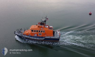
RNLI LIFEBOAT 14-37
Search and Rescue vessel
Current Trip
| Trip Time | 5 h, 37 mins |
|---|---|
| Trip Distance | 96.87 nm |
| AVG Speed | 16.6 Knots |
| MAX Speed | 16.6 Knots |
| Draught | 1.6 m |
| AVG Wind | 6.4 knots |
| MAX Wind | 9 knots |
| MIN Temp | 5.6°C / 42.08°F |
| MAX Temp | 8.2°C / 46.76°F |
| Position Received | 2 d ago |
Current Position
| Longitude | --- |
|---|---|
| Latitude | --- |
| Status | Under way using engine |
| Speed | |
| Course | --- |
| Area | English Channel |
| Station | T-AIS |
| Position Received | 2 d ago |
Info
Information
The current position of RNLI LIFEBOAT 14-37 is in English Channel with coordinates 50.15211° / -5.06082° as reported on 2025-02-28 14:42 by AIS to our vessel tracker app. The vessel's current speed is 0 Knots and is currently inside the port of FALMOUTH.
The vessel RNLI LIFEBOAT 14-37 (MMSI: 235010879) is a Search and Rescue vessel It's sailing under the flag of [GB] United Kingdom.
In this page you can find informations about the vessels current position, last detected port calls, and current voyage information. If the vessels is not in coverage by AIS you will find the latest position.
The current position of RNLI LIFEBOAT 14-37 is detected by our AIS receivers and we are not responsible for the reliability of the data. The last position was recorded while the vessel was in Coverage by the Ais receivers of our vessel tracking app.
The current draught of RNLI LIFEBOAT 14-37 as reported by AIS is 1.6 meters
Weather
| Temperature | 8.2°C / 46.76°F |
|---|---|
| Wind Speed | 6 knots |
| Direction | 120° ESE |
| Pressure | 1028.7 hPa |
| Humidity | 66.4 % |
| Cloud Coverage | 4 % |
Featured Company
Events
| Time | Event | Details | Position / Dest | Info |
|---|---|---|---|---|
| 2025-02-28 14:42 | OUT of Coverage |
50.15211 / -5.06082
English Channel
[GB] FALMOUTH
|
Speed: Course: 312.8° |
|
| 2025-02-28 14:18 | STOP Moving |
50.15216 / -5.06099
[GB] FALMOUTH
|
Speed: 0.1 kn Course: 511° |
|
| 2025-02-28 14:09 | PORT ARRIVAL |
|
50.15890 / -5.04777
[GB] FALMOUTH
|
Speed: 7 kn Course: 275.3° |
| 2025-02-28 11:34 | IN Coverage |
50.20969 / -3.52869
English Channel
FALMOUTH
|
Speed: 23.3 kn Course: 263.3° |
|
| 2025-02-28 09:55 | OUT of Coverage |
50.40472 / -2.61966
English Channel
FALMOUTH
|
Speed: 21.7 kn Course: 258.4° |
|
| 2025-02-28 09:55 | IN Coverage |
50.40472 / -2.61966
English Channel
FALMOUTH
|
Speed: 21.7 kn Course: 258.4° |
|
| 2025-02-28 08:32 | PORT DEPARTURE |
|
50.40472 / -2.61966
FALMOUTH
|
Speed: 5.4 kn Course: 161.8° |
| 2025-02-28 07:49 | OUT of Coverage |
50.71045 / -1.98620
English Channel
[GB] POOLE
|
Speed: 5.4 kn Course: 161.8° |
|
| 2025-02-28 07:48 | START Moving |
50.71148 / -1.98780
[GB] POOLE
|
Speed: 5.3 kn Course: 112.9° |
|
| 2025-02-28 07:37 | STOP Moving |
50.71464 / -1.99397
[GB] POOLE
|
Speed: 0.3 kn Course: 511° |