
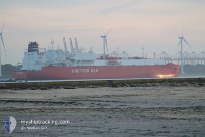
RIAS BAIXAS KNUTSEN
Tanker
Current Trip
LAST UPDATE TIME
| Time Travelled | 11 days |
|---|---|
| Remaining Time | --- |
| Distance Travelled | 4779.68 nm |
| Remaining Distance | --- |
| AVG Speed | 16.7 Knots |
| MAX Speed | 20.9 Knots |
| AVG Wind | 13.1 knots |
| MAX Wind | 25.8 knots |
| MIN Temp | 6.8°C / 44.24°F |
| MAX Temp | 25.9°C / 78.62°F |
| Draught | 9.8 m |
| Position Received | 11 h, 37 m ago |
Current Position
| Longitude | -75.73000° |
|---|---|
| Latitude | 21.53000° |
| Status | Under way using engine |
| Speed | 17 Knots |
| Course | 266° |
| Area | North Atlantic Ocean |
| Station | T-AIS |
| Position Received | 11 h, 37 m ago |
Info
Information
The current position of RIAS BAIXAS KNUTSEN is in North Atlantic Ocean with coordinates 21.53000° / -75.73000° as reported on 2024-05-03 01:30 by AIS to our vessel tracker app. The vessel's current speed is 17 Knots
The vessel RIAS BAIXAS KNUTSEN (IMO: 9825568, MMSI: 224989000) is a Tanker It's sailing under the flag of [ES] Spain.
In this page you can find informations about the vessels current position, last detected port calls, and current voyage information. If the vessels is not in coverage by AIS you will find the latest position.
The current position of RIAS BAIXAS KNUTSEN is detected by our AIS receivers and we are not responsible for the reliability of the data. The last position was recorded while the vessel was in Coverage by the Ais receivers of our vessel tracking app.
The current draught of RIAS BAIXAS KNUTSEN as reported by AIS is 9.8 meters
Weather
| Temperature | 25.4°C / 77.72°F |
|---|---|
| Wind Speed | 15 knots |
| Direction | 68° ENE |
| Pressure | 1013.4 hPa |
| Humidity | 73.7 % |
| Cloud Coverage | 100 % |
Featured Company
Last Port Calls
| Port | Arrival | Departure | Time In Port |
|---|---|---|---|
| 2024-04-20 08:45 | 2024-04-21 21:00 | 1 d | |
| 2024-03-13 22:33 | 2024-03-14 23:49 | 1 d |
Most Visited Ports (Last year)
| Port | Arrivals | |
|---|---|---|
| 2 | ||
| 1 | ||
| 1 | ||
| 1 | ||
| 1 | ||
| 1 |
Last Trips
| Origin | Departure | Destination | Arrival | Distance | |
|---|---|---|---|---|---|
| 2024-03-15 00:49 | 2024-04-20 10:45 | 10984.29 nm | |||
| 2024-01-03 13:35 | 2024-03-13 23:33 | 14823.44 nm |
Events
| Time | Event | Details | Position / Dest | Info |
|---|---|---|---|---|
| 2024-05-03 01:40 | Status Changed | Default Under way using engine |
21.52500 / -75.79166
LAST UPDATE TIME
|
Speed: 17 kn Course: 266° |
| 2024-05-03 01:30 | ETA Changed | 2024/05/03 01:28 2024/05/03 01:22 |
21.53000 / -75.73000
LAST UPDATE TIME
|
Speed: 17 kn Course: 266° |
| 2024-05-03 01:30 | OUT of Coverage |
21.53000 / -75.73000
North Atlantic Ocean
LAST UPDATE TIME
|
Speed: 17 kn Course: 266° |
|
| 2024-05-03 01:23 | ETA Changed | 2024/05/03 01:22 2024/05/03 01:19 |
21.53330 / -75.68330
LAST UPDATE TIME
|
Speed: 17 kn Course: 262° |
| 2024-05-03 01:21 | ETA Changed | 2024/05/03 01:19 2024/05/03 01:16 |
21.53330 / -75.68330
LAST UPDATE TIME
|
Speed: 17 kn Course: 262° |
| 2024-05-03 01:17 | ETA Changed | 2024/05/03 01:16 2024/05/03 01:13 |
21.54670 / -75.61000
LAST UPDATE TIME
|
Speed: 17 kn Course: 257° |
| 2024-05-03 01:14 | ETA Changed | 2024/05/03 01:13 2024/05/03 01:04 |
21.54670 / -75.61000
LAST UPDATE TIME
|
Speed: 17 kn Course: 257° |
| 2024-05-03 01:05 | ETA Changed | 2024/05/03 01:04 2024/05/03 01:02 |
21.55330 / -75.57830
LAST UPDATE TIME
|
Speed: 17 kn Course: 257° |
| 2024-05-03 01:04 | ETA Changed | 2024/05/03 01:02 2024/05/03 01:01 |
21.55330 / -75.57830
LAST UPDATE TIME
|
Speed: 17 kn Course: 257° |
| 2024-05-03 01:03 | ETA Changed | 2024/05/03 01:01 2024/05/03 00:58 |
21.55330 / -75.57830
LAST UPDATE TIME
|
Speed: 17 kn Course: 257° |