
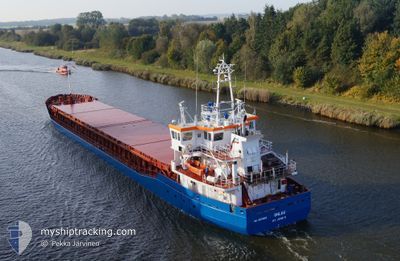
RHEINTAL
General Cargo
Current Trip
| Time Travelled | 1 day |
|---|---|
| Remaining Time | 21 h, 47 mins |
| Distance Travelled | 193.93 nm |
| Remaining Distance | 136.92 nm |
| AVG Speed | 7.3 Knots |
| MAX Speed | 9.8 Knots |
| AVG Wind | 18 knots |
| MAX Wind | 23.4 knots |
| MIN Temp | 17.3°C / 63.14°F |
| MAX Temp | 18.6°C / 65.48°F |
| Draught | 3.6 m |
| Position Received | 1 m ago |
Current Position
| Longitude | -8.93314° |
|---|---|
| Latitude | 36.33306° |
| Status | Under way using engine |
| Speed | 6.5 Knots |
| Course | 352.4° |
| Area | North Atlantic Ocean |
| Station | T-AIS |
| Position Received | 1 m ago |
Info
Information
The current position of RHEINTAL is in North Atlantic Ocean with coordinates 36.33306° / -8.93314° as reported on 2024-05-12 21:37 by AIS to our vessel tracker app. The vessel's current speed is 6.5 Knots and is heading at the port of SETUBAL. The estimated time of arrival as calculated by MyShipTracking vessel tracking app is 2024-05-13 19:25 LT
The vessel RHEINTAL (IMO: 9375903, MMSI: 255806466) is a General Cargo that was built in 2007 ( 17 years old ). It's sailing under the flag of [PT] Portugal.
In this page you can find informations about the vessels current position, last detected port calls, and current voyage information. If the vessels is not in coverage by AIS you will find the latest position.
The current position of RHEINTAL is detected by our AIS receivers and we are not responsible for the reliability of the data. The last position was recorded while the vessel was in Coverage by the Ais receivers of our vessel tracking app.
The current draught of RHEINTAL as reported by AIS is 3.6 meters
Weather
| Temperature | 17.3°C / 63.14°F |
|---|---|
| Wind Speed | 23 knots |
| Direction | 341° NNW |
| Pressure | 1017.4 hPa |
| Humidity | 84.4 % |
| Cloud Coverage | 44 % |
Featured Company
Last Port Calls
| Port | Arrival | Departure | Time In Port |
|---|---|---|---|
| 2024-05-10 19:25 | 2024-05-11 20:23 | 1 d | |
| 2024-05-02 21:06 | 2024-05-04 09:47 | 1 d | |
| 2024-05-01 00:39 | 2024-05-01 16:17 | 15 h | |
| 2024-04-28 14:54 | 2024-04-29 14:11 | 23 h | |
| 2024-04-24 07:09 | 2024-04-27 19:34 | 3 d | |
| 2024-04-17 06:50 | 2024-04-19 10:23 | 2 d | |
| 2024-03-27 04:28 | 2024-04-15 18:17 | 19 d | |
| 2024-03-22 06:23 | 2024-03-25 17:38 | 3 d | |
| 2024-03-10 12:53 | 2024-03-13 16:46 | 3 d | |
| 2024-03-07 05:09 | 2024-03-07 21:26 | 16 h |
Last Trips
| Origin | Departure | Destination | Arrival | Distance | |
|---|---|---|---|---|---|
| 2024-05-04 11:47 | 2024-05-10 20:25 | 1454.26 nm | |||
| 2024-05-01 18:17 | 2024-05-02 23:06 | 77.86 nm | |||
| 2024-04-29 15:11 | 2024-05-01 02:39 | 278.88 nm | |||
| 2024-04-27 20:34 | 2024-04-28 15:54 | 148.33 nm | |||
| 2024-04-19 12:23 | 2024-04-24 08:09 | 940.64 nm | |||
| 2024-04-15 20:17 | 2024-04-17 08:50 | 248.55 nm | |||
| 2024-03-25 18:38 | 2024-03-27 05:28 | 285.68 nm | |||
| 2024-03-13 17:46 | 2024-03-22 07:23 | 1002.77 nm | |||
| 2024-03-07 21:26 | 2024-03-10 13:53 | 188.66 nm | |||
| 2024-03-06 00:30 | 2024-03-07 05:09 | 283.74 nm |
Events
| Time | Event | Details | Position / Dest | Info |
|---|---|---|---|---|
| 2024-05-12 21:37 | Status Changed | Under way using engine Default |
36.33306 / -8.93314
PTSET
|
Speed: 6.9 kn Course: 352° |
| 2024-05-12 21:34 | Status Changed | Default Under way using engine |
36.32847 / -8.93229
PTSET
|
Speed: 7.1 kn Course: 350.1° |
| 2024-05-12 17:23 | Status Changed | Under way using engine Default |
35.87779 / -8.91217
PTSET
|
Speed: 6.9 kn Course: 356° |
| 2024-05-12 17:15 | IN Coverage |
35.88141 / -8.91245
North Atlantic Ocean
PTSET
|
Speed: 6.6 kn Course: 355° |
|
| 2024-05-12 16:08 | Status Changed | Default Under way using engine |
35.74166 / -8.90167
PTSET
|
Speed: 7 kn Course: 358.5° |
| 2024-05-12 16:03 | OUT of Coverage |
35.73316 / -8.90142
North Atlantic Ocean
PTSET
|
Speed: 7 kn Course: 358.5° |
|
| 2024-05-12 14:26 | Status Changed | Under way using engine Default |
35.55495 / -8.88817
PTSET
|
Speed: 6.8 kn Course: 356° |
| 2024-05-12 14:19 | Status Changed | Default Under way using engine |
35.54122 / -8.88789
PTSET
|
Speed: 5.8 kn Course: 0.9° |
| 2024-05-12 14:11 | Status Changed | Under way using engine Default |
35.52730 / -8.88780
PTSET
|
Speed: 5.9 kn Course: 358° |
| 2024-05-12 14:08 | Status Changed | Default Under way using engine |
35.52229 / -8.88779
PTSET
|
Speed: 6.4 kn Course: 357.3° |