

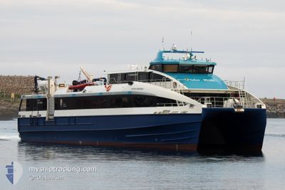
REGINE NORMANN
High speed craft

Current Trip
| Trip Time | 3 h, 45 mins |
|---|---|
| Trip Distance | 84.22 nm |
| AVG Speed | 27.2 Knots |
| MAX Speed | 33.1 Knots |
| Draught | 1.2 m |
| AVG Wind | 10.6 knots |
| MAX Wind | 15.5 knots |
| MIN Temp | -0.6°C / 30.92°F |
| MAX Temp | 1.6°C / 34.88°F |
| Position Received | 2 m ago |
Current Position
| Longitude | --- |
|---|---|
| Latitude | --- |
| Status | Under way using engine |
| Speed | 0.1 Knots |
| Course | 141° |
| Area | Norwegian Sea |
| Station | T-AIS |
| Position Received | 2 m ago |
Information
The current position of REGINE NORMANN is in Norwegian Sea with coordinates 68.23148° / 14.56680° as reported on 2025-03-03 04:01 by AIS to our vessel tracker app. The vessel's current speed is 0.1 Knots and is currently inside the port of SVOLVAER.
The vessel REGINE NORMANN (IMO: 9845623, MMSI: 257058290) is a High speed craft It's sailing under the flag of [NO] Norway.
In this page you can find informations about the vessels current position, last detected port calls, and current voyage information. If the vessels is not in coverage by AIS you will find the latest position.
The current position of REGINE NORMANN is detected by our AIS receivers and we are not responsible for the reliability of the data. The last position was recorded while the vessel was in Coverage by the Ais receivers of our vessel tracking app.
The current draught of REGINE NORMANN as reported by AIS is 1.2 meters
Weather
| Temperature | 2.9°C / 37.22°F |
|---|---|
| Wind Speed | 23 knots |
| Direction | 246° WSW |
| Pressure | 984.2 hPa |
| Humidity | 98.3 % |
| Cloud Coverage | 100 % |


Featured Company
Last Port Calls
| Port | Arrival | Departure | Time In Port |
|---|---|---|---|
| 2025-03-02 21:48 | |||
| 2025-03-02 17:26 | 2025-03-02 18:03 | 36 m | |
| 2025-03-02 16:55 | 2025-03-02 17:01 | 6 m | |
| 2025-03-02 15:55 | 2025-03-02 15:59 | 4 m | |
| 2025-03-02 14:36 | 2025-03-02 14:40 | 4 m | |
| 2025-03-02 13:15 | 2025-03-02 13:19 | 4 m | |
| 2025-03-01 20:10 | 2025-03-02 12:51 | 16 h | |
| 2025-03-01 19:37 | 2025-03-01 19:41 | 4 m | |
| 2025-03-01 18:15 | 2025-03-01 18:17 | 2 m | |
| 2025-03-01 16:48 | 2025-03-01 16:54 | 6 m |
Last Trips
| Origin | Departure | Destination | Arrival | Distance | |
|---|---|---|---|---|---|
| 2025-03-02 19:03 | 2025-03-02 22:48 | 84.22 nm | |||
| 2025-03-02 18:01 | 2025-03-02 18:26 | 13.38 nm | |||
| 2025-03-02 16:59 | 2025-03-02 17:55 | 26.54 nm | |||
| 2025-03-02 15:40 | 2025-03-02 16:55 | 30.49 nm | |||
| 2025-03-02 14:19 | 2025-03-02 15:36 | 31.53 nm | |||
| 2025-03-02 13:51 | 2025-03-02 14:15 | 13.30 nm | |||
| 2025-03-01 20:41 | 2025-03-01 21:10 | 14.07 nm | |||
| 2025-03-01 19:17 | 2025-03-01 20:37 | 31.76 nm | |||
| 2025-03-01 17:54 | 2025-03-01 19:15 | 30.72 nm | |||
| 2025-03-01 16:17 | 2025-03-01 17:48 | 39.39 nm |
Events
| Time | Event | Details | Position / Dest | Info |
|---|---|---|---|---|
| 2025-03-02 21:49 | STOP Moving |
68.23146 / 14.56692
[NO] SVOLVAER
|
Speed: Course: 140° |
|
| 2025-03-02 21:48 | PORT ARRIVAL |
|
68.23146 / 14.56692
[NO] SVOLVAER
|
Speed: 2.9 kn Course: 214° |
| 2025-03-02 20:26 | START Moving | 16.78 nm, West of DRAG |
68.00927 / 15.34186
SSJ - BOO - SVJ T/R
|
Speed: 25.2 kn Course: 200.1° |
| 2025-03-02 20:22 | STOP Moving | 16.83 nm, West of DRAG |
68.01529 / 15.33747
SSJ - BOO - SVJ T/R
|
Speed: Course: 70° |
| 2025-03-02 20:04 | START Moving | 20.92 nm, South West of DRAG |
67.90811 / 15.23193
SSJ - BOO - SVJ T/R
|
Speed: 32.3 kn Course: 63.4° |
| 2025-03-02 19:58 | STOP Moving |
67.89996 / 15.18931
SSJ - BOO - SVJ T/R
|
Speed: 0.1 kn Course: 261° |
|
| 2025-03-02 19:32 | START Moving |
67.83679 / 14.78365
SSJ - BOO - SVJ T/R
|
Speed: 9.1 kn Course: 322.9° |
|
| 2025-03-02 19:26 | STOP Moving |
67.83523 / 14.78788
SSJ - BOO - SVJ T/R
|
Speed: 0.2 kn Course: 274° |
|
| 2025-03-02 19:09 | START Moving | 17.36 nm, North of MISTEN |
67.73979 / 14.77182
SSJ - BOO - SVJ T/R
|
Speed: 32.1 kn Course: 339.2° |
| 2025-03-02 19:03 | STOP Moving | 16.95 nm, North of MISTEN |
67.73295 / 14.77264
SSJ - BOO - SVJ T/R
|
Speed: 0.2 kn Course: 202° |