

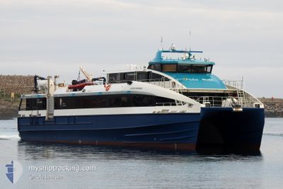
REGINE NORMANN
High speed craft

Current Trip
| Time Travelled | 46 mins |
|---|---|
| Remaining Time | 1 mins |
| Distance Travelled | 21.35 nm |
| Remaining Distance | 4.68 nm |
| AVG Speed | 30.6 Knop |
| MAX Speed | 32.3 Knop |
| AVG Wind | 9.4 knots |
| MAX Wind | 13 knots |
| MIN Temp | -6.3°C / 20.66°F |
| MAX Temp | --- |
| Djupgående | 1.2 m |
| Position mottagen | 1 m sen |
Current Position
| Longitud | --- |
|---|---|
| Latitude | --- |
| Status | Under way using engine |
| Fart | 30.2 Knop |
| Kurs | 18.4° |
| Område | Norwegian Sea |
| Station | T-AIS |
| Position mottagen | 1 m sen |
Information
The current position of REGINE NORMANN is in Norwegian Sea with coordinates 67.10899° / 13.94576° as reported on 2025-02-02 16:49 by AIS to our vessel tracker app. The vessel's current speed is 30.2 Knop and is heading at the port of SOR ARNOY. The estimated time of arrival as calculated by MyShipTracking vessel tracking app is 2025-02-02 16:51 LT
The vessel REGINE NORMANN (IMO: 9845623, MMSI: 257058290) is a High speed craft It's sailing under the flag of [NO] Norway.
In this page you can find informations about the vessels current position, last detected port calls, and current voyage information. If the vessels is not in coverage by AIS you will find the latest position.
The current position of REGINE NORMANN is detected by our AIS receivers and we are not responsible for the reliability of the data. The last position was recorded while the vessel was in Coverage by the Ais receivers of our vessel tracking app.
The current draught of REGINE NORMANN as reported by AIS is 1.2 meters
Weather
| Temperature | -6°C / 21.2°F |
|---|---|
| Wind Speed | 13 knots |
| Direction | 136° SE |
| Pressure | 1024.8 hPa |
| Humidity | 72.5 % |
| Cloud Coverage | --- |


Featured Company
Last Port Calls
| Port | Arrival | Departure | Time In Port |
|---|---|---|---|
| 2025-02-02 16:00 | 2025-02-02 16:04 | 4 m | |
| 2025-02-02 14:39 | 2025-02-02 14:41 | 2 m | |
| 2025-02-02 13:17 | 2025-02-02 13:19 | 2 m | |
| 2025-02-01 20:10 | 2025-02-02 12:48 | 16 h | |
| 2025-02-01 19:40 | 2025-02-01 19:44 | 4 m | |
| 2025-02-01 18:17 | 2025-02-01 18:19 | 2 m | |
| 2025-02-01 16:50 | 2025-02-01 16:54 | 4 m | |
| 2025-02-01 15:45 | 2025-02-01 15:51 | 6 m | |
| 2025-02-01 10:16 | 2025-02-01 15:18 | 5 h | |
| 2025-02-01 09:43 | 2025-02-01 09:49 | 6 m |
Last Trips
| Origin | Departure | Destination | Arrival | Distance | |
|---|---|---|---|---|---|
| 2025-02-02 15:41 | 2025-02-02 17:00 | 31.30 nm | |||
| 2025-02-02 14:19 | 2025-02-02 15:39 | 32.18 nm | |||
| 2025-02-02 13:48 | 2025-02-02 14:17 | 13.59 nm | |||
| 2025-02-01 20:44 | 2025-02-01 21:10 | 13.64 nm | |||
| 2025-02-01 19:19 | 2025-02-01 20:40 | 31.35 nm | |||
| 2025-02-01 19:19 | 2025-02-01 19:17 | 31.35 nm | |||
| 2025-02-01 16:51 | 2025-02-01 17:50 | 26.51 nm | |||
| 2025-02-01 16:18 | 2025-02-01 16:45 | 13.03 nm | |||
| 2025-02-01 10:49 | 2025-02-01 11:16 | 13.28 nm | |||
| 2025-02-01 09:46 | 2025-02-01 10:43 | 25.70 nm |
Events
| Tid | Event | Detaljer | Position / Dest | Information |
|---|---|---|---|---|
| 2025-02-02 16:04 | AVGÅTT HAMN |
|
66.87604 / 13.68018
SSJ - BOO - SVJ T/R
|
Fart: 4.1 kn Kurs: 62° |
| 2025-02-02 16:00 | ANLÄNDER HAMN |
|
66.86941 / 13.70390
[NO] ORNES
|
Fart: 8.1 kn Kurs: 12.1° |
| 2025-02-02 15:44 | STARTAR förflyttning | 6.69 nm, South West of ORNES |
66.80298 / 13.47217
SSJ - BOO - SVJ T/R
|
Fart: 31.9 kn Kurs: 44.9° |
| 2025-02-02 15:42 | STOPPAR förflyttning | 7.38 nm, South West of ORNES |
66.79426 / 13.45223
SSJ - BOO - SVJ T/R
|
Fart: Kurs: 42° |
| 2025-02-02 15:12 | STARTAR förflyttning | 5.1 nm, North of JEKTVIK |
66.70806 / 13.26115
SSJ - BOO - SVJ T/R
|
Fart: 32.6 kn Kurs: 284.1° |
| 2025-02-02 15:08 | STOPPAR förflyttning | 5.19 nm, North of JEKTVIK |
66.70994 / 13.27950
SSJ - BOO - SVJ T/R
|
Fart: 0.2 kn Kurs: 46° |
| 2025-02-02 14:51 | STARTAR förflyttning | 0.87 nm, West of RODOY |
66.65100 / 13.04192
SSJ - BOO - SVJ T/R
|
Fart: 32.5 kn Kurs: 228.2° |
| 2025-02-02 14:49 | STOPPAR förflyttning | 0.25 nm, West of RODOY |
66.65611 / 13.06589
SSJ - BOO - SVJ T/R
|
Fart: Kurs: 250° |
| 2025-02-02 14:41 | STARTAR förflyttning | 0.46 nm, North of GJERDOYA |
66.62212 / 12.98725
SSJ - BOO - SVJ T/R
|
Fart: 31 kn Kurs: 16° |
| 2025-02-02 14:41 | AVGÅTT HAMN |
|
66.62212 / 12.98725
SSJ - BOO - SVJ T/R
|
Fart: 0.2 kn Kurs: 18° |