
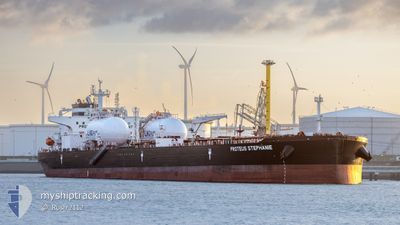
PROTEUS STEPHANIE
Tanker
Current Trip
| Time Travelled | 5 days |
|---|---|
| Remaining Time | 32 days |
| Distance Travelled | 1584.34 nm |
| Remaining Distance | 9857.30 nm |
| AVG Speed | 11.2 Knots |
| MAX Speed | 13.4 Knots |
| AVG Wind | 11 knots |
| MAX Wind | 25 knots |
| MIN Temp | 16.9°C / 62.42°F |
| MAX Temp | 20.5°C / 68.9°F |
| Draught | 13.1 m |
| Position Received | 19 h, 52 m ago |
Current Position
| Longitude | -15.25938° |
|---|---|
| Latitude | 27.63395° |
| Status | Under way using engine |
| Speed | 12.8 Knots |
| Course | 215.1° |
| Area | North Atlantic Ocean |
| Station | T-AIS |
| Position Received | 19 h, 52 m ago |
Info
Information
The current position of PROTEUS STEPHANIE is in North Atlantic Ocean with coordinates 27.63395° / -15.25938° as reported on 2024-05-14 23:38 by AIS to our vessel tracker app. The vessel's current speed is 12.8 Knots and is heading at the port of SINGAPORE. The estimated time of arrival as calculated by MyShipTracking vessel tracking app is 2024-06-17 17:06 LT
The vessel PROTEUS STEPHANIE (IMO: 9914694, MMSI: 563163100) is a Tanker It's sailing under the flag of [SG] Singapore.
In this page you can find informations about the vessels current position, last detected port calls, and current voyage information. If the vessels is not in coverage by AIS you will find the latest position.
The current position of PROTEUS STEPHANIE is detected by our AIS receivers and we are not responsible for the reliability of the data. The last position was recorded while the vessel was in Coverage by the Ais receivers of our vessel tracking app.
The current draught of PROTEUS STEPHANIE as reported by AIS is 13.1 meters
Weather
| Temperature | 20.2°C / 68.36°F |
|---|---|
| Wind Speed | 17 knots |
| Direction | 23° NNE |
| Pressure | 1013.8 hPa |
| Humidity | 76.5 % |
| Cloud Coverage | 13 % |
Featured Company
Most Visited Ports (Last year)
| Port | Arrivals | |
|---|---|---|
| 3 | ||
| 2 | ||
| 2 | ||
| 2 | ||
| 1 | ||
| 1 |
Last Trips
| Origin | Departure | Destination | Arrival | Distance | |
|---|---|---|---|---|---|
| 2024-05-02 05:07 | 2024-05-08 14:12 | 2045.22 nm | |||
| 2024-02-26 12:24 | 2024-03-11 00:37 | 3703.45 nm |
Events
| Time | Event | Details | Position / Dest | Info |
|---|---|---|---|---|
| 2024-05-14 23:46 | Status Changed | Default Under way using engine |
27.60926 / -15.27912
SGSIN
|
Speed: 12.8 kn Course: 215.1° |
| 2024-05-14 23:38 | OUT of Coverage |
27.63395 / -15.25938
North Atlantic Ocean
|
Speed: 12.8 kn Course: 215.1° |
|
| 2024-05-14 23:36 | Status Changed | Under way using engine Default |
27.64025 / -15.25432
SGSIN
|
Speed: 12.8 kn Course: 215° |
| 2024-05-14 23:30 | Status Changed | Default Under way using engine |
27.65585 / -15.24204
SGSIN
|
Speed: 12.8 kn Course: 214.4° |
| 2024-05-14 18:17 | Status Changed | Under way using engine Default |
28.64567 / -14.72359
SGSIN
|
Speed: 12.3 kn Course: 206° |
| 2024-05-14 18:01 | Status Changed | Default Under way using engine |
28.69258 / -14.69702
SGSIN
|
Speed: 12.2 kn Course: 209.6° |
| 2024-05-14 17:27 | Status Changed | Under way using engine Default |
28.79661 / -14.63466
SGSIN
|
Speed: 12.2 kn Course: 209° |
| 2024-05-14 17:18 | Status Changed | Default Under way using engine |
28.82259 / -14.61840
SGSIN
|
Speed: 12.2 kn Course: 208.9° |
| 2024-05-14 17:04 | Status Changed | Under way using engine Default |
28.86456 / -14.59198
SGSIN
|
Speed: 12.2 kn Course: 210° |
| 2024-05-14 17:04 | IN Coverage |
28.86456 / -14.59198
North Atlantic Ocean
|
Speed: 12.4 kn Course: 209° |