
PROGRES
Cargo
Current Trip
| Time Travelled | 9 h, 57 mins |
|---|---|
| Remaining Time | --- |
| Distance Travelled | 63.97 nm |
| Remaining Distance | --- |
| AVG Speed | 8.7 Knots |
| MAX Speed | 10.2 Knots |
| AVG Wind | 8.4 knots |
| MAX Wind | 12 knots |
| MIN Temp | 8.2°C / 46.76°F |
| MAX Temp | 9.8°C / 49.64°F |
| Draught | 2.3 m |
| Position Received | 2 h, 34 m ago |
Current Position
| Longitude | --- |
|---|---|
| Latitude | --- |
| Status | Under way using engine |
| Speed | 10.2 Knots |
| Course | 323° |
| Area | North Sea |
| Station | T-AIS |
| Position Received | 2 h, 34 m ago |
Info
Information
The current position of PROGRES is in North Sea with coordinates 50.05442° / 7.77869° as reported on 2026-02-11 11:46 by AIS to our vessel tracker app. The vessel's current speed is 10.2 Knots and is heading at the port of MAASVLAKTE - ROTTERDAM. The estimated time of arrival as calculated by MyShipTracking vessel tracking app is 2026-02-10 12:00 LT
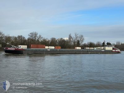
The vessel PROGRES (MMSI: 244620993) is a Cargo It's sailing under the flag of [NL] Netherlands.
In this page you can find informations about the vessels current position, last detected port calls, and current voyage information. If the vessels is not in coverage by AIS you will find the latest position.
The current position of PROGRES is detected by our AIS receivers and we are not responsible for the reliability of the data. The last position was recorded while the vessel was in Coverage by the Ais receivers of our vessel tracking app.
The current draught of PROGRES as reported by AIS is 2.3 meters
Weather
| Temperature | 8.5°C / 47.3°F |
|---|---|
| Wind Speed | 14 knots |
| Direction | 257° WSW |
| Pressure | 986.9 hPa |
| Humidity | 90.9 % |
| Cloud Coverage | 100 % |
Featured Company
Last Port Calls
| Port | Arrival | Departure | Time In Port |
|---|---|---|---|
| 2026-02-10 21:48 | 2026-02-11 05:23 | 7 h | |
| 2026-02-07 14:34 | 2026-02-07 14:59 | 25 m | |
| 2026-02-07 08:18 | 2026-02-07 14:28 | 6 h | |
| 2026-02-02 07:05 | 2026-02-05 07:52 | 3 d | |
| 2026-02-02 04:33 | 2026-02-02 04:59 | 25 m | |
| 2026-01-30 23:22 | 2026-01-31 11:14 | 11 h | |
| 2026-01-26 17:27 | 2026-01-26 19:55 | 2 h | |
| 2026-01-25 09:50 | 2026-01-25 18:24 | 8 h | |
| 2026-01-24 16:07 | 2026-01-25 09:47 | 17 h | |
| 2026-01-22 21:02 | 2026-01-24 16:02 | 1 d |
Most Visited Ports (Last year)
| Port | Arrivals | |
|---|---|---|
| 121 | ||
| 44 | ||
| 42 | ||
| 41 | ||
| 14 | ||
| 14 |
Last Trips
| Origin | Departure | Destination | Arrival | Distance | |
|---|---|---|---|---|---|
| 2026-02-07 14:59 | 2026-02-10 21:48 | 158.35 nm | |||
| 2026-02-07 14:28 | 2026-02-07 14:34 | 0.25 nm | |||
| 2026-02-05 07:52 | 2026-02-07 08:18 | 162.71 nm | |||
| 2026-02-02 04:59 | 2026-02-02 07:05 | 11.93 nm | |||
| 2026-01-31 11:14 | 2026-02-02 04:33 | 326.18 nm | |||
| 2026-01-26 19:55 | 2026-01-30 23:22 | 185.49 nm | |||
| 2026-01-25 18:24 | 2026-01-26 17:27 | 148.58 nm | |||
| 2026-01-25 09:47 | 2026-01-25 09:50 | 0.79 nm | |||
| 2026-01-24 16:02 | 2026-01-24 16:07 | 1.39 nm | |||
| 2026-01-22 16:26 | 2026-01-22 21:02 | 28.16 nm |
Events
| Time | Event | Details | Position / Dest | Info |
|---|---|---|---|---|
| 2026-02-11 11:46 | OUT of Coverage |
50.05442 / 7.77869
North Sea
|
Speed: 10.2 kn Course: 323° |
|
| 2026-02-11 07:25 | Destination Changed | MAASVLAKTE MAASVLAKTD |
49.80472 / 8.39975
MAASVLAKTE
|
Speed: 9.4 kn Course: 327.1° |
| 2026-02-11 05:51 | IN Coverage |
49.65895 / 8.36998
North Sea
|
Speed: 8.4 kn Course: 341.6° |
|
| 2026-02-11 04:37 | Destination Changed | MAASVLAKTD LUDWIGSHAFEN |
49.46945 / 8.46392
MAASVLAKTD
|
Speed: 7.8 kn Course: 9.3° |
| 2026-02-11 04:37 | ETA Changed | 2026/02/10 11:00 2026/02/01 11:00 |
49.46945 / 8.46392
MAASVLAKTD
|
Speed: 7.8 kn Course: 9.3° |
| 2026-02-11 04:27 | OUT of Coverage |
49.46945 / 8.46392
North Sea
|
Speed: 7.8 kn Course: 9.3° |
|
| 2026-02-11 04:23 | PORT DEPARTURE |
|
49.46368 / 8.45661
LUDWIGSHAFEN
|
Speed: 7.3 kn Course: 69° |
| 2026-02-11 04:20 | START Moving |
49.46308 / 8.44744
[DE] LUDWIGSHAFEN
|
Speed: 4.2 kn Course: 101° |
|
| 2026-02-11 04:14 | IN Coverage |
49.46323 / 8.44337
North Sea
[DE] LUDWIGSHAFEN
|
Speed: 0.4 kn Course: 302.9° |
|
| 2026-02-11 02:30 | OUT of Coverage |
49.45984 / 8.43991
North Sea
[DE] LUDWIGSHAFEN
|
Speed: Course: 10.8° |