

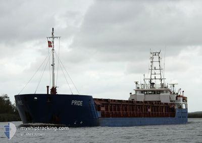
PRIDE
General Cargo

Current Trip
| Time Travelled | 1 day |
|---|---|
| Remaining Time | --- |
| Distance Travelled | 347.57 nm |
| Remaining Distance | --- |
| AVG Speed | 7.8 Knots |
| MAX Speed | 11 Knots |
| AVG Wind | 8.3 knots |
| MAX Wind | 19.7 knots |
| MIN Temp | 12.8°C / 55.04°F |
| MAX Temp | 17°C / 62.6°F |
| Draught | 5.2 m |
| Position Received | 47 m ago |
Current Position
| Longitude | --- |
|---|---|
| Latitude | --- |
| Status | At anchor |
| Speed | 0.1 Knots |
| Course | 10° |
| Area | North Atlantic Ocean |
| Station | T-AIS |
| Position Received | 47 m ago |
Information
The current position of PRIDE is in North Atlantic Ocean with coordinates 33.63820° / -7.60666° as reported on 2025-02-20 15:41 by AIS to our vessel tracker app. The vessel's current speed is 0.1 Knots
The vessel PRIDE (IMO: 9252931, MMSI: 236166000) is a General Cargo that was built in 2002 ( 23 years old ). It's sailing under the flag of [GI] Gibraltar.
In this page you can find informations about the vessels current position, last detected port calls, and current voyage information. If the vessels is not in coverage by AIS you will find the latest position.
The current position of PRIDE is detected by our AIS receivers and we are not responsible for the reliability of the data. The last position was recorded while the vessel was in Coverage by the Ais receivers of our vessel tracking app.
The current draught of PRIDE as reported by AIS is 5.2 meters
Weather
| Temperature | 17.2°C / 62.96°F |
|---|---|
| Wind Speed | 9 knots |
| Direction | 17° NNE |
| Pressure | 1023 hPa |
| Humidity | 80.1 % |
| Cloud Coverage | 52 % |


Featured Company
Last Port Calls
| Port | Arrival | Departure | Time In Port |
|---|---|---|---|
| 2025-02-16 08:50 | 2025-02-18 20:04 | 2 d | |
| 2025-02-11 18:38 | 2025-02-12 04:13 | 9 h | |
| 2025-02-10 04:08 | 2025-02-10 09:22 | 5 h | |
| 2025-02-02 08:35 | 2025-02-03 23:35 | 1 d | |
| 2025-01-29 19:23 | 2025-01-29 20:46 | 1 h | |
| 2025-01-28 20:46 | 2025-01-29 17:45 | 20 h | |
| 2025-01-24 20:00 | 2025-01-28 16:33 | 3 d | |
| 2025-01-20 19:13 | 2025-01-21 15:36 | 20 h | |
| 2025-01-14 17:43 | 2025-01-15 20:53 | 1 d | |
| 2025-01-04 22:29 | 2025-01-05 16:37 | 18 h |
Last Trips
| Origin | Departure | Destination | Arrival | Distance | |
|---|---|---|---|---|---|
| 2025-02-12 05:13 | 2025-02-16 08:50 | 849.16 nm | |||
| 2025-02-10 10:22 | 2025-02-11 19:38 | 313.84 nm | |||
| 2025-02-04 00:35 | 2025-02-10 05:08 | 1209.05 nm | |||
| 2025-01-29 21:46 | 2025-02-02 09:35 | 733.03 nm | |||
| 2025-01-29 18:45 | 2025-01-29 20:23 | 8.65 nm | |||
| 2025-01-28 17:33 | 2025-01-28 21:46 | 33.67 nm | |||
| 2025-01-21 16:36 | 2025-01-24 21:00 | 774.31 nm | |||
| 2025-01-15 20:53 | 2025-01-20 20:13 | 603.95 nm | |||
| 2025-01-05 18:37 | 2025-01-14 17:43 | 1600.97 nm | |||
| 2025-01-02 15:32 | 2025-01-05 00:29 | 370.65 nm |
Events
| Time | Event | Details | Position / Dest | Info |
|---|---|---|---|---|
| 2025-02-20 15:44 | Status Changed | Default At anchor |
33.63815 / -7.60680
MACAS :
|
Speed: 0.1 kn Course: 10° |
| 2025-02-20 15:41 | Status Changed | At anchor Default |
33.63820 / -7.60666
MACAS :
|
Speed: 0.1 kn Course: 2° |
| 2025-02-20 15:37 | Status Changed | Default At anchor |
33.63821 / -7.60649
MACAS :
|
Speed: 0.2 kn Course: 11° |
| 2025-02-20 15:34 | Status Changed | At anchor Default |
33.63819 / -7.60650
MACAS :
|
Speed: 0.1 kn Course: 18° |
| 2025-02-20 15:24 | Status Changed | Default At anchor |
33.63821 / -7.60684
MACAS :
|
Speed: 0.3 kn Course: 6° |
| 2025-02-20 15:18 | Draught Changed | 5.2 5.3 |
33.63819 / -7.60659
MACAS :
|
Speed: 0.1 kn Course: 0° |
| 2025-02-20 15:12 | Status Changed | At anchor Default |
33.63818 / -7.60640
MACAS :
|
Speed: 0.1 kn Course: 23° |
| 2025-02-20 15:00 | Status Changed | Default At anchor |
33.63818 / -7.60693
MACAS :
|
Speed: 0.2 kn Course: 354° |
| 2025-02-20 14:55 | Status Changed | At anchor Under way using engine |
33.63822 / -7.60663
MACAS :
|
Speed: 0.1 kn Course: 350° |
| 2025-02-20 14:37 | STOP Moving | 1.58 nm, North of CASABLANCA |
33.63944 / -7.60639
MACAS :
|
Speed: 0.3 kn Course: 1° |