

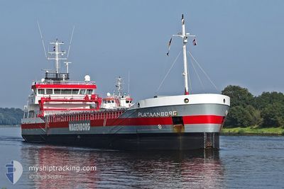
PLATAANBORG
General Cargo

Current Trip
| Time Travelled | 17 h, 36 mins |
|---|---|
| Remaining Time | 2 days |
| Distance Travelled | 159.05 nm |
| Remaining Distance | 561.99 nm |
| AVG Speed | 10.1 Knots |
| MAX Speed | 12.9 Knots |
| AVG Wind | 14.4 knots |
| MAX Wind | 24.2 knots |
| MIN Temp | 6.8°C / 44.24°F |
| MAX Temp | 9°C / 48.2°F |
| Draught | 5.4 m |
| Position Received | 3 h, 25 m ago |
Current Position
| Longitude | --- |
|---|---|
| Latitude | --- |
| Status | Under way using engine |
| Speed | 10.8 Knots |
| Course | 185.1° |
| Area | Irish Sea and St. George's Channel |
| Station | T-AIS |
| Position Received | 3 h, 25 m ago |
Information
The current position of PLATAANBORG is in Irish Sea and St. George's Channel with coordinates 52.67903° / -5.71433° as reported on 2025-02-26 01:44 by AIS to our vessel tracker app. The vessel's current speed is 10.8 Knots and is heading at the port of DAGENHAM. The estimated time of arrival as calculated by MyShipTracking vessel tracking app is 2025-02-28 11:39 LT
The vessel PLATAANBORG (IMO: 9489522, MMSI: 245169000) is a General Cargo that was built in 2009 ( 16 years old ). It's sailing under the flag of [NL] Netherlands.
In this page you can find informations about the vessels current position, last detected port calls, and current voyage information. If the vessels is not in coverage by AIS you will find the latest position.
The current position of PLATAANBORG is detected by our AIS receivers and we are not responsible for the reliability of the data. The last position was recorded while the vessel was in Coverage by the Ais receivers of our vessel tracking app.
The current draught of PLATAANBORG as reported by AIS is 5.4 meters
Weather
| Temperature | 9°C / 48.2°F |
|---|---|
| Wind Speed | 24 knots |
| Direction | 255° WSW |
| Pressure | 1009 hPa |
| Humidity | 80 % |
| Cloud Coverage | 77 % |


Featured Company
Last Port Calls
| Port | Arrival | Departure | Time In Port |
|---|---|---|---|
| 2025-02-24 22:58 | 2025-02-25 11:33 | 12 h | |
| 2025-02-20 18:31 | 2025-02-24 15:59 | 3 d | |
| 2025-02-18 13:14 | 2025-02-20 15:18 | 2 d | |
| 2025-02-13 11:34 | 2025-02-15 12:52 | 2 d | |
| 2025-02-11 19:05 | |||
| 2025-02-04 11:15 | 2025-02-06 00:59 | 1 d | |
| 2025-01-28 06:14 | 2025-02-01 20:27 | 4 d | |
| 2025-01-24 07:40 | 2025-01-24 17:30 | 9 h | |
| 2025-01-18 13:33 | 2025-01-22 17:46 | 4 d | |
| 2025-01-12 11:29 | 2025-01-14 11:36 | 2 d |
Last Trips
| Origin | Departure | Destination | Arrival | Distance | |
|---|---|---|---|---|---|
| 2025-02-24 15:59 | 2025-02-24 22:58 | 77.62 nm | |||
| 2025-02-20 15:18 | 2025-02-20 18:31 | 31.82 nm | |||
| 2025-02-15 13:52 | 2025-02-18 13:14 | 693.89 nm | |||
| 2025-02-06 01:59 | 2025-02-13 12:34 | 849.56 nm | |||
| 2025-02-06 01:59 | 2025-02-11 20:05 | 848.90 nm | |||
| 2025-02-01 20:27 | 2025-02-04 12:15 | 217.27 nm | |||
| 2025-01-24 18:30 | 2025-01-28 06:14 | 494.83 nm | |||
| 2025-01-22 18:46 | 2025-01-24 08:40 | 341.24 nm | |||
| 2025-01-14 12:36 | 2025-01-18 14:33 | 877.53 nm | |||
| 2025-01-03 10:02 | 2025-01-12 12:29 | 1281.25 nm |
Events
| Time | Event | Details | Position / Dest | Info |
|---|---|---|---|---|
| 2025-02-26 01:51 | Status Changed | Default Under way using engine |
52.65842 / -5.71760
DAGENHAM
|
Speed: 10.8 kn Course: 185.1° |
| 2025-02-26 01:44 | OUT of Coverage |
52.67903 / -5.71433
Irish Sea and St. George's Channel
DAGENHAM
|
Speed: 10.8 kn Course: 185.1° |
|
| 2025-02-25 20:57 | Status Changed | Under way using engine Default |
53.50309 / -5.54468
DAGENHAM
|
Speed: 8.9 kn Course: 188° |
| 2025-02-25 20:47 | Status Changed | Default Under way using engine |
53.52440 / -5.53916
DAGENHAM
|
Speed: 8.8 kn Course: 187.6° |
| 2025-02-25 20:41 | Status Changed | Under way using engine Default |
53.54050 / -5.53524
DAGENHAM
|
Speed: 8.7 kn Course: 186° |
| 2025-02-25 20:24 | Status Changed | Default Under way using engine |
53.57984 / -5.52498
DAGENHAM
|
Speed: 8.6 kn Course: 189.3° |
| 2025-02-25 20:10 | Detected in Sea | Irish part of the Irish Sea and St. George's Channel |
53.61158 / -5.51661
Irish Sea and St. George's Channel
DAGENHAM
|
Speed: 8.6 kn Course: 189.3° |
| 2025-02-25 20:09 | Status Changed | Under way using engine Default |
53.61427 / -5.51592
DAGENHAM
|
Speed: 8.9 kn Course: 190° |
| 2025-02-25 20:03 | IN Coverage |
53.61158 / -5.51661
Irish Sea and St. George's Channel
DAGENHAM
|
Speed: 8.6 kn Course: 189.3° |
|
| 2025-02-25 17:43 | OUT of Coverage |
53.98157 / -5.45525
Irish Sea and St. George's Channel
DAGENHAM
|
Speed: 9.6 kn Course: 191° |