
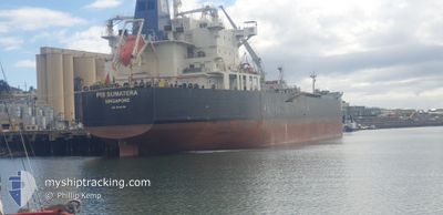
PIS SUMATERA
Oil/Chemical Tanker
Current Trip
| Time Travelled | 5 days |
|---|---|
| Remaining Time | 1 day |
| Distance Travelled | 1654.30 nm |
| Remaining Distance | 348.00 nm |
| AVG Speed | 12.6 Knots |
| MAX Speed | 15 Knots |
| AVG Wind | 6.9 knots |
| MAX Wind | 13 knots |
| MIN Temp | 25.3°C / 77.54°F |
| MAX Temp | 29.5°C / 85.1°F |
| Draught | 11.8 m |
| Position Received | 5 d ago |
Current Position
| Longitude | --- |
|---|---|
| Latitude | --- |
| Status | Under way using engine |
| Speed | 13 Knots |
| Course | 79.4° |
| Area | Singapore Strait |
| Station | T-AIS |
| Position Received | 5 d ago |
Info
Information
The current position of PIS SUMATERA is in Singapore Strait with coordinates 1.24755° / 104.08765° as reported on 2025-02-20 23:35 by AIS to our vessel tracker app. The vessel's current speed is 13 Knots and is heading at the port of DARWIN. The estimated time of arrival as calculated by MyShipTracking vessel tracking app is 2025-02-27 05:14 LT
The vessel PIS SUMATERA (IMO: 9645798, MMSI: 563185000) is a Oil/Chemical Tanker that was built in 2013 ( 12 years old ). It's sailing under the flag of [SG] Singapore.
In this page you can find informations about the vessels current position, last detected port calls, and current voyage information. If the vessels is not in coverage by AIS you will find the latest position.
The current position of PIS SUMATERA is detected by our AIS receivers and we are not responsible for the reliability of the data. The last position was recorded while the vessel was in Coverage by the Ais receivers of our vessel tracking app.
The current draught of PIS SUMATERA as reported by AIS is 11.8 meters
Weather
| Temperature | 29.5°C / 85.1°F |
|---|---|
| Wind Speed | 7 knots |
| Direction | 203° SSW |
| Pressure | 1010.4 hPa |
| Humidity | 70.6 % |
| Cloud Coverage | --- |
Featured Company
Last Port Calls
| Port | Arrival | Departure | Time In Port |
|---|---|---|---|
| 2025-02-19 22:34 | 2025-02-20 19:13 | 20 h | |
| 2025-02-18 18:31 | 2025-02-19 21:28 | 1 d | |
| 2025-02-07 21:41 | 2025-02-08 22:09 | 1 d | |
| 2025-02-05 13:04 | 2025-02-06 09:32 | 20 h | |
| 2025-01-30 00:08 | 2025-01-31 19:32 | 1 d | |
| 2025-01-22 04:37 | 2025-01-23 07:53 | 1 d | |
| 2025-01-20 15:24 | 2025-01-21 23:04 | 1 d | |
| 2024-12-25 06:34 | 2024-12-26 21:32 | 1 d | |
| 2024-12-05 10:17 | 2024-12-06 19:33 | 1 d | |
| 2024-12-04 04:51 | 2024-12-04 18:27 | 13 h |
Most Visited Ports (Last year)
| Port | Arrivals | |
|---|---|---|
| 3 | ||
| 2 | ||
| 2 | ||
| 2 | ||
| 2 | ||
| 2 |
Last Trips
| Origin | Departure | Destination | Arrival | Distance | |
|---|---|---|---|---|---|
| 2025-02-20 05:28 | 2025-02-20 06:34 | 6.34 nm | |||
| 2025-02-09 07:39 | 2025-02-19 02:31 | 2315.28 nm | |||
| 2025-02-06 19:32 | 2025-02-08 07:11 | 321.20 nm | |||
| 2025-02-01 05:02 | 2025-02-05 23:04 | 891.12 nm | |||
| 2025-01-23 15:53 | 2025-01-30 09:38 | 1992.64 nm | |||
| 2025-01-22 07:04 | 2025-01-22 12:37 | 50.72 nm | |||
| 2024-12-27 03:02 | 2025-01-20 23:24 | 3374.94 nm | |||
| 2024-12-07 05:33 | 2024-12-25 12:04 | 5207.25 nm | |||
| 2024-12-05 04:27 | 2024-12-05 20:17 | 171.68 nm | |||
| 2024-12-03 19:47 | 2024-12-04 14:51 | 247.29 nm |
Events
| Time | Event | Details | Position / Dest | Info |
|---|---|---|---|---|
| 2025-02-20 23:41 | Status Changed | Default Under way using engine |
1.25160 / 104.11062
AU DRW
|
Speed: 13 kn Course: 79.4° |
| 2025-02-20 23:35 | OUT of Coverage |
1.24755 / 104.08765
Singapore Strait
AU DRW
|
Speed: 13 kn Course: 79.4° |
|
| 2025-02-20 21:10 | Change Sea Area | Indonesian part of the Singapore Strait Indonesian part of the South China Sea |
1.03705 / 103.65940
Singapore Strait
AU DRW
|
Speed: 9.2 kn Course: 45.2° |
| 2025-02-20 21:07 | Change Sea Area | Indonesian part of the South China Sea Indonesian part of the Singapore Strait |
1.03293 / 103.65368
South China Sea
AU DRW
|
Speed: 10.5 kn Course: 97.6° |
| 2025-02-20 20:57 | Status Changed | Under way using engine Default |
1.05454 / 103.62803
AU DRW
|
Speed: 11.8 kn Course: 123° |
| 2025-02-20 20:49 | Status Changed | Default Under way using engine |
1.06849 / 103.60712
AU DRW
|
Speed: 11.9 kn Course: 122.5° |
| 2025-02-20 20:40 | Change Sea Area | Indonesian part of the Singapore Strait Malaysian part of the Singapore Strait |
1.08531 / 103.58132
Singapore Strait
AU DRW
|
Speed: 11.9 kn Course: 122.3° |
| 2025-02-20 20:40 | Status Changed | Under way using engine Default |
1.08531 / 103.58132
AU DRW
|
Speed: 11.8 kn Course: 122° |
| 2025-02-20 20:09 | Status Changed | Default Under way using engine |
1.16020 / 103.55686
AU DRW
|
Speed: 11.6 kn Course: 231.3° |
| 2025-02-20 20:04 | Change Sea Area | Malaysian part of the Singapore Strait Indonesian part of the Singapore Strait |
1.17258 / 103.56806
Singapore Strait
AU DRW
|
Speed: 11.6 kn Course: 231.3° |