
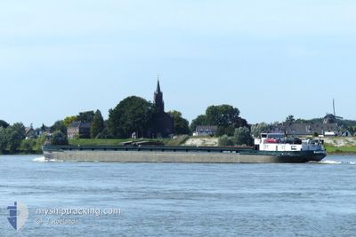
PAULINE
Not available
Current Trip
KRIMPEN AD IJSSEL
| Time Travelled | 1 day |
|---|---|
| Remaining Time | --- |
| Distance Travelled | 90.23 nm |
| Remaining Distance | --- |
| AVG Speed | 9.6 Knots |
| MAX Speed | 12.2 Knots |
| AVG Wind | 10.7 knots |
| MAX Wind | 12 knots |
| MIN Temp | 11.2°C / 52.16°F |
| MAX Temp | 12.2°C / 53.96°F |
| Draught | 0.2 m |
| Position Received | 15 h, 58 m ago |
Current Position
| Longitude | --- |
|---|---|
| Latitude | --- |
| Status | Under way using engine |
| Speed | 10.5 Knots |
| Course | 307° |
| Area | North Sea |
| Station | T-AIS |
| Position Received | 15 h, 58 m ago |
Info
Information
The current position of PAULINE is in North Sea with coordinates 52.11228° / 6.21146° as reported on 2025-12-09 15:59 by AIS to our vessel tracker app. The vessel's current speed is 10.5 Knots
The vessel PAULINE (MMSI: 244730460) is a Not available It's sailing under the flag of [NL] Netherlands.
In this page you can find informations about the vessels current position, last detected port calls, and current voyage information. If the vessels is not in coverage by AIS you will find the latest position.
The current position of PAULINE is detected by our AIS receivers and we are not responsible for the reliability of the data. The last position was recorded while the vessel was in Coverage by the Ais receivers of our vessel tracking app.
The current draught of PAULINE as reported by AIS is 0.2 meters
Weather
| Temperature | 12°C / 53.6°F |
|---|---|
| Wind Speed | 12 knots |
| Direction | 198° SSW |
| Pressure | 1009.3 hPa |
| Humidity | 77.2 % |
| Cloud Coverage | 100 % |
Featured Company
Last Port Calls
| Port | Arrival | Departure | Time In Port |
|---|---|---|---|
| 2025-12-08 09:54 | 2025-12-09 06:12 | 20 h | |
| 2025-12-04 14:54 | 2025-12-08 08:47 | 3 d | |
| 2025-12-04 11:57 | 2025-12-04 12:22 | 25 m | |
| 2025-12-03 19:16 | 2025-12-04 08:18 | 13 h | |
| 2025-11-28 08:37 | 2025-11-28 09:46 | 1 h | |
| 2025-11-27 07:31 | 2025-11-27 14:40 | 7 h | |
| 2025-11-26 21:45 | 2025-11-27 06:54 | 9 h | |
| 2025-11-19 18:22 | 2025-11-20 14:09 | 19 h | |
| 2025-11-17 20:20 | 2025-11-19 08:45 | 1 d | |
| 2025-11-17 18:26 | 2025-11-17 18:33 | 6 m |
Last Trips
| Origin | Departure | Destination | Arrival | Distance | |
|---|---|---|---|---|---|
| 2025-12-08 08:47 | 2025-12-08 09:54 | 5.39 nm | |||
| 2025-12-04 12:22 | 2025-12-04 14:54 | 15.92 nm | |||
| 2025-12-04 08:18 | 2025-12-04 11:57 | 31.40 nm | |||
| 2025-11-28 09:46 | 2025-12-03 19:16 | 79.09 nm | |||
| 2025-11-27 14:40 | 2025-11-28 08:37 | 40.79 nm | |||
| 2025-11-27 06:54 | 2025-11-27 07:31 | 3.84 nm | |||
| 2025-11-20 14:09 | 2025-11-26 21:45 | 193.92 nm | |||
| 2025-11-19 08:45 | 2025-11-19 18:22 | 49.88 nm | |||
| 2025-11-17 18:33 | 2025-11-17 20:20 | 16.61 nm | |||
| 2025-11-12 06:59 | 2025-11-17 18:26 | 172.64 nm |
Events
| Time | Event | Details | Position / Dest | Info |
|---|---|---|---|---|
| 2025-12-09 15:59 | OUT of Coverage |
52.11228 / 6.21146
North Sea
|
Speed: 10.5 kn Course: 307° |
|
| 2025-12-09 13:19 | START Moving | 0.4 nm, North West of DRIEL |
51.96838 / 5.80901
KRIMPEN AD IJSSEL
|
Speed: 8.1 kn Course: 58.9° |
| 2025-12-09 13:03 | STOP Moving | 0.47 nm, North West of DRIEL |
51.96709 / 5.80546
KRIMPEN AD IJSSEL
|
Speed: 0.2 kn Course: 511° |
| 2025-12-09 13:01 | START Moving | 0.54 nm, West of DRIEL |
51.96620 / 5.80303
KRIMPEN AD IJSSEL
|
Speed: 4.8 kn Course: 57.3° |
| 2025-12-09 12:48 | STOP Moving | 0.61 nm, West of DRIEL |
51.96511 / 5.80069
KRIMPEN AD IJSSEL
|
Speed: 0.2 kn Course: 511° |
| 2025-12-09 10:43 | START Moving | 0.45 nm, North of MAURIK |
51.97678 / 5.41084
KRIMPEN AD IJSSEL
|
Speed: 6.1 kn Course: 72.9° |
| 2025-12-09 10:23 | STOP Moving | 0.46 nm, North West of MAURIK |
51.97619 / 5.40782
KRIMPEN AD IJSSEL
|
Speed: 0.3 kn Course: 511° |
| 2025-12-09 10:18 | START Moving | 0.51 nm, North West of MAURIK |
51.97512 / 5.40308
KRIMPEN AD IJSSEL
|
Speed: 3.3 kn Course: 64.9° |
| 2025-12-09 10:12 | STOP Moving | 0.56 nm, North West of MAURIK |
51.97440 / 5.40035
KRIMPEN AD IJSSEL
|
Speed: 0.3 kn Course: 511° |
| 2025-12-09 08:45 | START Moving | 1.42 nm, East of VIANEN |
51.99128 / 5.13583
KRIMPEN AD IJSSEL
|
Speed: 6.3 kn Course: 147.7° |