
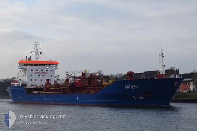
PATALYA
Oil/Chemical Tanker
Current Trip
| Time Travelled | 5 days |
|---|---|
| Remaining Time | 1 day |
| Distance Travelled | 554.54 nm |
| Remaining Distance | 254.92 nm |
| AVG Speed | 7.4 Knots |
| MAX Speed | 13.9 Knots |
| AVG Wind | 7 knots |
| MAX Wind | 14.8 knots |
| MIN Temp | -0.5°C / 31.1°F |
| MAX Temp | 13°C / 55.4°F |
| Draught | 5 m |
| Position Received | Now |
Current Position
| Longitude | 19.70990° |
|---|---|
| Latitude | 59.75221° |
| Status | Under way using engine |
| Speed | 7.5 Knots |
| Course | 139.5° |
| Area | Baltic Sea |
| Station | T-AIS |
| Position Received | Now |
Info
Information
The current position of PATALYA is in Baltic Sea with coordinates 59.75221° / 19.70990° as reported on 2024-05-02 07:10 by AIS to our vessel tracker app. The vessel's current speed is 7.5 Knots and is heading at the port of KLAIPEDA. The estimated time of arrival as calculated by MyShipTracking vessel tracking app is 2024-05-03 17:34 LT
The vessel PATALYA (IMO: 9305180, MMSI: 255806456) is a Oil/Chemical Tanker that was built in 2005 ( 19 years old ). It's sailing under the flag of [PT] Portugal.
In this page you can find informations about the vessels current position, last detected port calls, and current voyage information. If the vessels is not in coverage by AIS you will find the latest position.
The current position of PATALYA is detected by our AIS receivers and we are not responsible for the reliability of the data. The last position was recorded while the vessel was in Coverage by the Ais receivers of our vessel tracking app.
The current draught of PATALYA as reported by AIS is 5 meters
Weather
| Temperature | 5.4°C / 41.72°F |
|---|---|
| Wind Speed | 7 knots |
| Direction | 112° ESE |
| Pressure | 1024.9 hPa |
| Humidity | 81.2 % |
| Cloud Coverage | 100 % |
Featured Company
Last Trips
| Origin | Departure | Destination | Arrival | Distance | |
|---|---|---|---|---|---|
| 2024-04-18 11:58 | 2024-04-21 13:12 | 737.77 nm | |||
| 2024-04-01 14:40 | 2024-04-18 11:55 | 4582.56 nm | |||
| 2024-03-19 10:18 | 2024-03-29 16:34 | 2110.67 nm | |||
| 2024-02-26 12:57 | 2024-03-17 14:54 | 4334.87 nm |
Events
| Time | Event | Details | Position / Dest | Info |
|---|---|---|---|---|
| 2024-05-02 06:38 | Change Sea Area | Swedish part of the Baltic Sea Swedish part of the Gulf of Bothnia |
59.80487 / 19.63018
Baltic Sea
LTKLJ
|
Speed: 7.5 kn Course: 141.1° |
| 2024-05-01 22:30 | Status Changed | Under way using engine Default |
60.66693 / 19.03403
LTKLJ
|
Speed: 7.1 kn Course: 188° |
| 2024-05-01 22:00 | Status Changed | Default Under way using engine |
60.72622 / 19.05312
LTKLJ
|
Speed: 7.1 kn Course: 189° |
| 2024-05-01 21:57 | Status Changed | Under way using engine Default |
60.73236 / 19.05495
LTKLJ
|
Speed: 7.2 kn Course: 192° |
| 2024-05-01 21:29 | Status Changed | Default Under way using engine |
60.78628 / 19.07595
LTKLJ
|
Speed: 7.2 kn Course: 190.9° |
| 2024-05-01 21:20 | Status Changed | Under way using engine Default |
60.80322 / 19.08245
LTKLJ
|
Speed: 6.8 kn Course: 193° |
| 2024-05-01 21:10 | IN Coverage |
60.80036 / 19.08123
Gulf of Bothnia
LTKLJ
|
Speed: 7.1 kn Course: 190.1° |
|
| 2024-05-01 18:44 | Status Changed | Default Under way using engine |
61.10997 / 19.18408
LTKLJ
|
Speed: 7.1 kn Course: 188.5° |
| 2024-05-01 18:40 | OUT of Coverage |
61.11847 / 19.18673
Gulf of Bothnia
LTKLJ
|
Speed: 7.1 kn Course: 188.5° |
|
| 2024-05-01 18:19 | Status Changed | Under way using engine Default |
61.15937 / 19.20082
LTKLJ
|
Speed: 7.3 kn Course: 190° |