
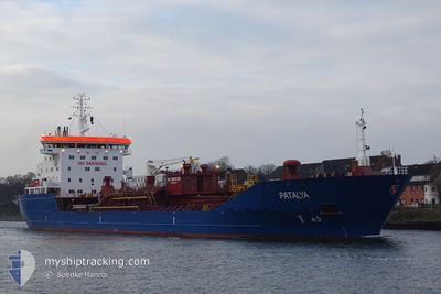
PATALYA
Oil/Chemical Tanker
Current Trip
| Time Travelled | 2 days |
|---|---|
| Remaining Time | --- |
| Distance Travelled | 550.95 nm |
| Remaining Distance | --- |
| AVG Speed | 9.8 Knots |
| MAX Speed | 9.8 Knots |
| AVG Wind | 8.3 knots |
| MAX Wind | 12.5 knots |
| MIN Temp | 6.6°C / 43.88°F |
| MAX Temp | 15.2°C / 59.36°F |
| Dybgang | 9.2 m |
| Position Modtaget | 1 h, 2 m siden |
Current Position
| Longitude | 7.20538° |
|---|---|
| Latitude | 54.37824° |
| Status | Under way using engine |
| Fart | 10.4 Knots |
| Kurs | 310.1° |
| Område | North Sea |
| Station | T-AIS |
| Position Modtaget | 1 h, 2 m siden |
Info
Information
The current position of PATALYA is in North Sea with coordinates 54.37824° / 7.20538° as reported on 2024-05-07 23:36 by AIS to our vessel tracker app. The vessel's current speed is 10.4 Knots and is heading at the port of KIEL. The estimated time of arrival as calculated by MyShipTracking vessel tracking app is 2024-06-07 00:01 LT
The vessel PATALYA (IMO: 9305180, MMSI: 255806456) is a Oil/Chemical Tanker that was built in 2005 ( 19 år gamle ). It's sailing under the flag of [PT] Portugal.
In this page you can find informations about the vessels current position, last detected port calls, and current voyage information. If the vessels is not in coverage by AIS you will find the latest position.
The current position of PATALYA is detected by our AIS receivers and we are not responsible for the reliability of the data. The last position was recorded while the vessel was in Coverage by the Ais receivers of our vessel tracking app.
The current draught of PATALYA as reported by AIS is 9.2 meters
Weather
| Temperature | 11.5°C / 52.7°F |
|---|---|
| Wind Speed | 7 knots |
| Direction | 346° NNW |
| Pressure | 1024.5 hPa |
| Humidity | 85.2 % |
| Cloud Coverage | 1 % |
Featured Company
Last Port Calls
| Port | Arrival | Departure | Time In Port |
|---|---|---|---|
| 2024-05-04 11:00 | 2024-05-05 11:24 | 1 d | |
| 2024-04-26 16:27 | |||
| 2024-04-21 10:12 | 2024-04-21 23:08 | 12 h | |
| 2024-04-18 09:55 | 2024-04-18 09:58 | 3 m | |
| 2024-03-29 20:34 | 2024-04-01 18:40 | 2 d | |
| 2024-03-17 18:54 | 2024-03-19 14:18 | 1 d |
Last Trips
| Origin | Departure | Destination | Arrival | Distance | |
|---|---|---|---|---|---|
| 2024-04-26 19:27 | 2024-05-04 14:00 | 883.51 nm | |||
| 2024-04-18 11:58 | 2024-04-21 13:12 | 737.77 nm | |||
| 2024-04-01 14:40 | 2024-04-18 11:55 | 4582.56 nm | |||
| 2024-03-19 10:18 | 2024-03-29 16:34 | 2110.67 nm | |||
| 2024-02-26 12:57 | 2024-03-17 14:54 | 4334.87 nm |
Events
| Tid | Hændelsen | Detaljer | Position / Dest | Info |
|---|---|---|---|---|
| 2024-05-07 23:42 | Status er ændret | Default Under way using engine |
54.38961 / 7.17978
DECKL
|
Fart: 10.4 kn Kurs: 310.1° |
| 2024-05-07 23:36 | Udenfor Dækning |
54.37824 / 7.20538
North Sea
DECKL
|
Fart: 10.4 kn Kurs: 310.1° |
|
| 2024-05-07 23:30 | Status er ændret | Under way using engine Default |
54.36781 / 7.22688
DECKL
|
Fart: 10.2 kn Kurs: 308° |
| 2024-05-07 22:48 | Status er ændret | Default Under way using engine |
54.29557 / 7.38438
DECKL
|
Fart: 9.7 kn Kurs: 308.4° |
| 2024-05-07 22:36 | Status er ændret | Under way using engine Default |
54.27482 / 7.42947
DECKL
|
Fart: 9.5 kn Kurs: 312° |
| 2024-05-07 22:22 | Indenfor Dækning |
54.27482 / 7.42947
North Sea
|
Fart: 9.7 kn Kurs: 308.4° |
|
| 2024-05-07 21:12 | Status er ændret | Default Under way using engine |
54.14133 / 7.74857
DECKL
|
Fart: 9.7 kn Kurs: 304.5° |
| 2024-05-07 21:07 | Status er ændret | Under way using engine Default |
54.13407 / 7.76772
DECKL
|
Fart: 9.7 kn Kurs: 303° |
| 2024-05-07 21:07 | Udenfor Dækning |
54.13407 / 7.76772
North Sea
|
Fart: 9.7 kn Kurs: 304.5° |
|
| 2024-05-07 20:52 | Status er ændret | Default Under way using engine |
54.11212 / 7.82506
DECKL
|
Fart: 9.8 kn Kurs: 302.2° |