
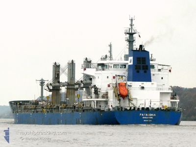
PATAGONIA
Bulk Carrier
Current Trip
PUERTO QUETZAL
| Time Travelled | 5 days |
|---|---|
| Remaining Time | --- |
| Distance Travelled | 1479.73 nm |
| Remaining Distance | --- |
| AVG Speed | 10.3 Knots |
| MAX Speed | 12 Knots |
| AVG Wind | 8.4 knots |
| MAX Wind | 21 knots |
| MIN Temp | 23.1°C / 73.58°F |
| MAX Temp | 32°C / 89.6°F |
| Draught | 10.8 m |
| Position Received | 3 d ago |
Current Position
| Longitude | --- |
|---|---|
| Latitude | --- |
| Status | Under way using engine |
| Speed | 11.3 Knots |
| Course | 156.3° |
| Area | North Pacific Ocean |
| Station | T-AIS |
| Position Received | 3 d ago |
Info
Information
The current position of PATAGONIA is in North Pacific Ocean with coordinates 2.33210° / -85.29626° as reported on 2025-02-15 15:37 by AIS to our vessel tracker app. The vessel's current speed is 11.3 Knots
The vessel PATAGONIA (IMO: 9611280, MMSI: 566098000) is a Bulk Carrier that was built in 2012 ( 13 years old ). It's sailing under the flag of [SG] Singapore.
In this page you can find informations about the vessels current position, last detected port calls, and current voyage information. If the vessels is not in coverage by AIS you will find the latest position.
The current position of PATAGONIA is detected by our AIS receivers and we are not responsible for the reliability of the data. The last position was recorded while the vessel was in Coverage by the Ais receivers of our vessel tracking app.
The current draught of PATAGONIA as reported by AIS is 10.8 meters
Weather
| Temperature | 23.2°C / 73.76°F |
|---|---|
| Wind Speed | 9 knots |
| Direction | 140° SE |
| Pressure | 1012.7 hPa |
| Humidity | 91.4 % |
| Cloud Coverage | 100 % |
Featured Company
Last Port Calls
| Port | Arrival | Departure | Time In Port |
|---|---|---|---|
| 2025-02-09 19:59 | 2025-02-12 17:11 | 2 d | |
| 2024-12-08 15:26 | 2024-12-16 19:48 | 8 d | |
| 2024-12-05 04:18 |
Most Visited Ports (Last year)
| Port | Arrivals | |
|---|---|---|
| 2 | ||
| 1 | ||
| 1 | ||
| 1 | ||
| 1 | ||
| 1 |
Last Trips
| Origin | Departure | Destination | Arrival | Distance | |
|---|---|---|---|---|---|
| 2024-12-16 13:48 | 2025-02-09 13:59 | 34.84 nm | |||
| 2024-12-04 22:18 | 2024-12-08 09:26 | 945.83 nm |
Events
| Time | Event | Details | Position / Dest | Info |
|---|---|---|---|---|
| 2025-02-15 16:11 | Status Changed | Default Under way using engine |
2.23309 / -85.25231
PUERTO QUETZAL
|
Speed: 11.3 kn Course: 156.3° |
| 2025-02-15 15:37 | OUT of Coverage |
2.33210 / -85.29626
North Pacific Ocean
|
Speed: 11.3 kn Course: 156.3° |
|
| 2025-02-15 14:54 | Status Changed | Under way using engine Default |
2.45696 / -85.35442
PUERTO QUETZAL
|
Speed: 11.9 kn Course: 153° |
| 2025-02-15 14:32 | Status Changed | Default Under way using engine |
2.52401 / -85.38579
PUERTO QUETZAL
|
Speed: 12 kn Course: 153.5° |
| 2025-02-15 13:12 | Status Changed | Under way using engine Default |
2.76312 / -85.50433
PUERTO QUETZAL
|
Speed: 11.8 kn Course: 154° |
| 2025-02-15 13:01 | Status Changed | Default Under way using engine |
2.79712 / -85.52069
PUERTO QUETZAL
|
Speed: 11.9 kn Course: 155° |
| 2025-02-15 12:41 | Status Changed | Under way using engine Default |
2.85643 / -85.54884
PUERTO QUETZAL
|
Speed: 11.8 kn Course: 154° |
| 2025-02-15 12:38 | Status Changed | Default Under way using engine |
2.86441 / -85.55259
PUERTO QUETZAL
|
Speed: 11.8 kn Course: 155.4° |
| 2025-02-15 12:22 | Detected in Sea | Costa Rican part of the North Pacific Ocean |
2.91414 / -85.57547
North Pacific Ocean
|
Speed: 11.9 kn Course: 156.4° |
| 2025-02-15 12:22 | Status Changed | Under way using engine Default |
2.91414 / -85.57547
PUERTO QUETZAL
|
Speed: 11.8 kn Course: 155° |