
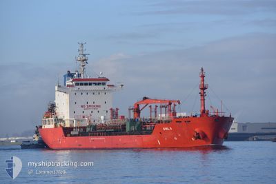
OWL 6
Oil/Chemical Tanker
Current Trip
DO_LRM
| Time Travelled | 34 days |
|---|---|
| Remaining Time | --- |
| Distance Travelled | 1561.33 nm |
| Remaining Distance | --- |
| AVG Speed | 9 Knots |
| MAX Speed | 12.6 Knots |
| AVG Wind | 13.1 knots |
| MAX Wind | 23.5 knots |
| MIN Temp | 21.9°C / 71.42°F |
| MAX Temp | 27.5°C / 81.5°F |
| Draught | 8.9 m |
| Position Received | 6 d ago |
Current Position
| Longitude | --- |
|---|---|
| Latitude | --- |
| Status | Under way using engine |
| Speed | 10.8 Knots |
| Course | 108.2° |
| Area | Caribbean Sea |
| Station | T-AIS |
| Position Received | 6 d ago |
Info
Information
The current position of OWL 6 is in Caribbean Sea with coordinates 18.08131° / -69.06788° as reported on 2025-01-21 19:38 by AIS to our vessel tracker app. The vessel's current speed is 10.8 Knots
The vessel OWL 6 (IMO: 9340350, MMSI: 538007359) is a Oil/Chemical Tanker that was built in 2007 ( 18 years old ). It's sailing under the flag of [MH] Marshall Is.
In this page you can find informations about the vessels current position, last detected port calls, and current voyage information. If the vessels is not in coverage by AIS you will find the latest position.
The current position of OWL 6 is detected by our AIS receivers and we are not responsible for the reliability of the data. The last position was recorded while the vessel was in Coverage by the Ais receivers of our vessel tracking app.
The current draught of OWL 6 as reported by AIS is 8.9 meters
Weather
| Temperature | 26.5°C / 79.7°F |
|---|---|
| Wind Speed | 12 knots |
| Direction | 103° ESE |
| Pressure | 1015.7 hPa |
| Humidity | 76 % |
| Cloud Coverage | 13 % |
Featured Company
Last Port Calls
| Port | Arrival | Departure | Time In Port |
|---|---|---|---|
| 2024-12-23 05:54 | 2024-12-25 01:50 | 1 d | |
| 2024-12-18 01:19 | 2024-12-19 19:42 | 1 d | |
| 2024-12-06 10:43 | 2024-12-08 13:26 | 2 d | |
| 2024-11-17 10:55 | 2024-11-19 11:35 | 2 d | |
| 2024-11-09 17:42 | 2024-11-10 19:14 | 1 d | |
| 2024-11-06 08:15 | 2024-11-08 10:34 | 2 d | |
| 2024-11-02 13:10 | 2024-11-03 11:44 | 22 h |
Most Visited Ports (Last year)
| Port | Arrivals | |
|---|---|---|
| 2 | ||
| 2 | ||
| 2 | ||
| 2 | ||
| 1 | ||
| 1 |
Last Trips
| Origin | Departure | Destination | Arrival | Distance | |
|---|---|---|---|---|---|
| 2024-12-19 14:42 | 2024-12-23 01:54 | 610.97 nm | |||
| 2024-12-08 08:26 | 2024-12-17 20:19 | 1367.35 nm | |||
| 2024-11-19 07:35 | 2024-12-06 05:43 | 1403.56 nm | |||
| 2024-11-10 13:14 | 2024-11-17 06:55 | 1725.85 nm | |||
| 2024-11-08 04:34 | 2024-11-09 11:42 | 6.76 nm | |||
| 2024-11-03 05:44 | 2024-11-06 02:15 | 505.07 nm | |||
| 2024-08-29 15:32 | 2024-11-02 07:10 | 3382.29 nm |
Events
| Time | Event | Details | Position / Dest | Info |
|---|---|---|---|---|
| 2025-01-26 14:26 | START Moving |
17.94860 / -69.43847
DO_LRM
|
Speed: 4.3 kn Course: 70° |
|
| 2025-01-26 00:31 | STOP Moving | 19.93 nm, South of LA ROMANA |
18.08545 / -69.03376
DO_LRM
|
Speed: 0.2 kn Course: 61° |
| 2025-01-25 01:39 | START Moving | 1.52 nm, South of SAN PEDRO DE MACORIS |
18.41758 / -69.30747
DO_LRM
|
Speed: 5.6 kn Course: 192° |
| 2025-01-25 00:53 | STOP Moving | 1.37 nm, South of SAN PEDRO DE MACORIS |
18.41903 / -69.31195
DO_LRM
|
Speed: 0.1 kn Course: 55° |
| 2025-01-25 00:41 | START Moving | 1.39 nm, South of SAN PEDRO DE MACORIS |
18.41831 / -69.31481
DO_LRM
|
Speed: 3.1 kn Course: 74° |
| 2025-01-25 00:22 | STOP Moving | 1.75 nm, South of SAN PEDRO DE MACORIS |
18.41233 / -69.31950
DO_LRM
|
Speed: 0.3 kn Course: 49° |
| 2025-01-24 21:05 | START Moving |
18.03080 / -69.46853
DO_LRM
|
Speed: 4.9 kn Course: 22° |
|
| 2025-01-24 00:41 | STOP Moving |
18.05500 / -69.05360
DO_LRM
|
Speed: 0.3 kn Course: 64° |
|
| 2025-01-21 19:40 | Status Changed | Default Under way using engine |
18.07961 / -69.06239
DO_LRM
|
Speed: 10.8 kn Course: 108.2° |
| 2025-01-21 19:38 | OUT of Coverage |
18.08131 / -69.06788
Caribbean Sea
|
Speed: 10.8 kn Course: 108.2° |