

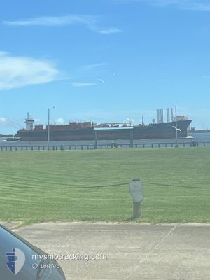
OSG ENDURANCE
Tug

Current Trip
| Time Travelled | 2 days |
|---|---|
| Remaining Time | 9 h, 31 mins |
| Distance Travelled | 757.50 nm |
| Remaining Distance | 142.75 nm |
| AVG Speed | 12.6 Knots |
| MAX Speed | 14.6 Knots |
| AVG Wind | 5.8 knots |
| MAX Wind | 23 knots |
| MIN Temp | 18.7°C / 65.66°F |
| MAX Temp | 27.6°C / 81.68°F |
| Draught | 8.5 m |
| Position Received | 2 h, 37 m ago |
Current Position
| Longitude | --- |
|---|---|
| Latitude | --- |
| Status | Under way using engine |
| Speed | 12.2 Knots |
| Course | 71.1° |
| Area | North Atlantic Ocean |
| Station | T-AIS |
| Position Received | 2 h, 37 m ago |
Information
The current position of OSG ENDURANCE is in North Atlantic Ocean with coordinates 24.41664° / -81.40239° as reported on 2025-03-28 06:31 by AIS to our vessel tracker app. The vessel's current speed is 12.2 Knots and is heading at the port of PORT EVERGLADES. The estimated time of arrival as calculated by MyShipTracking vessel tracking app is 2025-03-28 14:40 LT
The vessel OSG ENDURANCE (IMO: 9441477, MMSI: 367501540) is a Tug It's sailing under the flag of [US] USA.
In this page you can find informations about the vessels current position, last detected port calls, and current voyage information. If the vessels is not in coverage by AIS you will find the latest position.
The current position of OSG ENDURANCE is detected by our AIS receivers and we are not responsible for the reliability of the data. The last position was recorded while the vessel was in Coverage by the Ais receivers of our vessel tracking app.
The current draught of OSG ENDURANCE as reported by AIS is 8.5 meters
Weather
| Temperature | 24.5°C / 76.1°F |
|---|---|
| Wind Speed | 21 knots |
| Direction | 87° E |
| Pressure | 1019.7 hPa |
| Humidity | 62.1 % |
| Cloud Coverage | 70 % |


Featured Company
Last Port Calls
| Port | Arrival | Departure | Time In Port |
|---|---|---|---|
| 2025-03-23 02:10 | 2025-03-25 09:56 | 2 d | |
| 2025-03-22 21:36 | 2025-03-23 00:48 | 3 h | |
| 2025-03-14 22:02 | 2025-03-17 17:58 | 2 d | |
| 2025-03-10 04:32 | 2025-03-12 13:55 | 2 d | |
| 2025-03-07 14:27 | 2025-03-09 15:51 | 2 d | |
| 2025-03-02 21:05 | 2025-03-04 05:34 | 1 d | |
| 2025-02-17 19:35 | 2025-02-20 03:40 | 2 d | |
| 2025-02-12 04:37 | 2025-02-13 19:06 | 1 d | |
| 2025-02-04 02:52 | 2025-02-05 17:27 | 1 d | |
| 2025-01-30 13:35 | 2025-02-01 00:07 | 1 d |
Most Visited Ports (Last year)
| Port | Arrivals | |
|---|---|---|
| 18 | ||
| 10 | ||
| 9 | ||
| 8 | ||
| 8 | ||
| 5 |
Last Trips
| Origin | Departure | Destination | Arrival | Distance | |
|---|---|---|---|---|---|
| 2025-03-23 00:48 | 2025-03-23 02:10 | 1.75 nm | |||
| 2025-03-17 17:58 | 2025-03-22 21:36 | 612.01 nm | |||
| 2025-03-12 13:55 | 2025-03-14 22:02 | 618.90 nm | |||
| 2025-03-09 15:51 | 2025-03-10 04:32 | 95.10 nm | |||
| 2025-03-04 05:34 | 2025-03-07 14:27 | 820.98 nm | |||
| 2025-02-20 03:40 | 2025-03-02 21:05 | 1948.72 nm | |||
| 2025-02-13 19:06 | 2025-02-17 19:35 | 978.95 nm | |||
| 2025-02-05 17:27 | 2025-02-12 04:37 | 981.64 nm | |||
| 2025-02-01 00:07 | 2025-02-04 02:52 | 929.77 nm | |||
| 2025-01-26 07:47 | 2025-01-30 13:35 | 919.98 nm |
Events
| Time | Event | Details | Position / Dest | Info |
|---|---|---|---|---|
| 2025-03-28 06:31 | OUT of Coverage |
24.41664 / -81.40239
North Atlantic Ocean
PORT EVERGLADES
|
Speed: 12.2 kn Course: 71.1° |
|
| 2025-03-28 02:46 | Detected in Sea | United States part of the North Atlantic Ocean |
24.29077 / -82.19087
North Atlantic Ocean
PORT EVERGLADES
|
Speed: 10.9 kn Course: 85.4° |
| 2025-03-28 02:46 | IN Coverage |
24.29077 / -82.19087
North Atlantic Ocean
PORT EVERGLADES
|
Speed: 10.9 kn Course: 85.4° |
|
| 2025-03-27 16:53 | Status Changed | Default Under way using engine |
24.85476 / -83.95577
PORT EVERGLADES
|
Speed: 11.1 kn Course: 128.9° |
| 2025-03-27 16:46 | Status Changed | Under way using engine Default |
24.86657 / -83.97262
PORT EVERGLADES
|
Speed: 11 kn Course: 128° |
| 2025-03-27 16:46 | IN Coverage |
24.86657 / -83.97262
Gulf of Mexico
PORT EVERGLADES
|
Speed: 11.1 kn Course: 128.9° |
|
| 2025-03-27 16:46 | OUT of Coverage |
24.86657 / -83.97262
Gulf of Mexico
PORT EVERGLADES
|
Speed: 11.1 kn Course: 128.9° |
|
| 2025-03-26 15:00 | Status Changed | Default Under way using engine |
27.98665 / -88.37512
PORT EVERGLADES
|
Speed: 11.8 kn Course: 129.5° |
| 2025-03-26 14:55 | Status Changed | Under way using engine Default |
27.99755 / -88.38983
PORT EVERGLADES
|
Speed: 11.7 kn Course: 130° |
| 2025-03-26 14:55 | OUT of Coverage |
27.99755 / -88.38983
Gulf of Mexico
PORT EVERGLADES
|
Speed: 11.8 kn Course: 129.5° |