
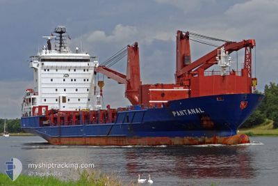
OPTIMAX II
General Cargo
Current Trip
| Trip Time | 8 days |
|---|---|
| Trip Distance | 1081.63 nm |
| AVG Speed | 10.1 Knots |
| MAX Speed | 14.9 Knots |
| Draught | 6.7 m |
| AVG Wind | 11.7 knots |
| MAX Wind | 29 knots |
| MIN Temp | 4.6°C / 40.28°F |
| MAX Temp | 27.8°C / 82.04°F |
| Position Received | 3 h, 23 m ago |
Current Position
| Longitude | --- |
|---|---|
| Latitude | --- |
| Status | Under way using engine |
| Speed | 7.9 Knots |
| Course | 338° |
| Area | Japan Sea |
| Station | T-AIS |
| Position Received | 3 h, 23 m ago |
Info
Information
The current position of OPTIMAX II is in Japan Sea with coordinates 34.97234° / 128.81751° as reported on 2025-03-06 23:23 by AIS to our vessel tracker app. The vessel's current speed is 7.9 Knots and is currently inside the port of MASAN.
The vessel OPTIMAX II (IMO: 9316579, MMSI: 563117200) is a General Cargo that was built in 2004 ( 21 years old ). It's sailing under the flag of [SG] Singapore.
In this page you can find informations about the vessels current position, last detected port calls, and current voyage information. If the vessels is not in coverage by AIS you will find the latest position.
The current position of OPTIMAX II is detected by our AIS receivers and we are not responsible for the reliability of the data. The last position was recorded while the vessel was in Coverage by the Ais receivers of our vessel tracking app.
The current draught of OPTIMAX II as reported by AIS is 6.7 meters
Weather
| Temperature | 6.2°C / 43.16°F |
|---|---|
| Wind Speed | 1 knots |
| Direction | 79° E |
| Pressure | 1029.3 hPa |
| Humidity | 59.8 % |
| Cloud Coverage | 7 % |
Featured Company
Last Trips
| Origin | Departure | Destination | Arrival | Distance | |
|---|---|---|---|---|---|
| 2025-02-26 18:22 | 2025-03-07 10:17 | 1081.63 nm | |||
| 2025-02-15 11:00 | 2025-02-25 06:43 | 1805.11 nm | |||
| 2025-01-31 20:15 | 2025-02-14 22:38 | 3003.81 nm | |||
| 2025-01-08 02:32 | 2025-01-31 10:51 | 3453.63 nm | |||
| 2024-12-22 14:50 | 2025-01-01 07:56 | 2832.18 nm |
Events
| Time | Event | Details | Position / Dest | Info |
|---|---|---|---|---|
| 2025-03-07 01:18 | STOP Moving |
35.18846 / 128.59224
[KR] MASAN
|
Speed: Course: 181° |
|
| 2025-03-07 01:17 | PORT ARRIVAL |
|
35.18846 / 128.59224
[KR] MASAN
|
Speed: 1.4 kn Course: 116° |
| 2025-03-06 23:28 | Status Changed | Default Under way using engine |
34.98542 / 128.81099
HUMEN
|
Speed: 7.9 kn Course: 338° |
| 2025-03-06 23:23 | OUT of Coverage |
34.97234 / 128.81751
Japan Sea
|
Speed: 7.9 kn Course: 338° |
|
| 2025-03-06 23:14 | Status Changed | Under way using engine Default |
34.95464 / 128.82986
HUMEN
|
Speed: 7 kn Course: 317° |
| 2025-03-06 23:10 | Status Changed | Default Under way using engine |
34.94767 / 128.83574
HUMEN
|
Speed: 7.5 kn Course: 300.6° |
| 2025-03-06 23:09 | Status Changed | Under way using engine Default |
34.94711 / 128.83653
HUMEN
|
Speed: 7.8 kn Course: 332° |
| 2025-03-06 22:50 | IN Coverage |
34.94711 / 128.83653
Japan Sea
|
Speed: 7.5 kn Course: 300.6° |
|
| 2025-03-02 10:53 | STOP Moving | 17.52 nm, South West of SHANGHAI |
31.09942 / 121.45952
HUMEN
|
Speed: 0.2 kn Course: 165° |
| 2025-03-01 23:20 | START Moving | 17.6 nm, North East of SHENGSI |
31.00904 / 122.56132
HUMEN
|
Speed: 7.6 kn Course: 268° |