
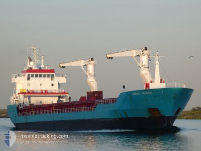
ONEGO TRADER
General Cargo
Current Trip
| Time Travelled | 4 days |
|---|---|
| Remaining Time | --- |
| Distance Travelled | 869.03 nm |
| Remaining Distance | --- |
| AVG Speed | 10.4 Knots |
| MAX Speed | 13.9 Knots |
| AVG Wind | 19.6 knots |
| MAX Wind | 33.8 knots |
| MIN Temp | 0.1°C / 32.18°F |
| MAX Temp | 14.4°C / 57.92°F |
| Draught | 5.3 m |
| Position Received | 19 h, 44 m ago |
Current Position
| Longitude | --- |
|---|---|
| Latitude | --- |
| Status | At anchor |
| Speed | 0.1 Knots |
| Course | 143° |
| Area | English Channel |
| Station | T-AIS |
| Position Received | 19 h, 44 m ago |
Info
Information
The current position of ONEGO TRADER is in English Channel with coordinates 49.51832° / -1.03614° as reported on 2025-12-08 01:26 by AIS to our vessel tracker app. The vessel's current speed is 0.1 Knots and is heading at the port of PASAJES. The estimated time of arrival as calculated by MyShipTracking vessel tracking app is 2025-12-10 01:00 LT
The vessel ONEGO TRADER (IMO: 9238351, MMSI: 255806180) is a General Cargo that was built in 2001 ( 24 years old ). It's sailing under the flag of [PT] Portugal.
In this page you can find informations about the vessels current position, last detected port calls, and current voyage information. If the vessels is not in coverage by AIS you will find the latest position.
The current position of ONEGO TRADER is detected by our AIS receivers and we are not responsible for the reliability of the data. The last position was recorded while the vessel was in Coverage by the Ais receivers of our vessel tracking app.
The current draught of ONEGO TRADER as reported by AIS is 5.3 meters
Weather
| Temperature | 13.4°C / 56.12°F |
|---|---|
| Wind Speed | 18 knots |
| Direction | 202° SSW |
| Pressure | 1012.2 hPa |
| Humidity | 82.5 % |
| Cloud Coverage | 100 % |
Featured Company
Last Port Calls
| Port | Arrival | Departure | Time In Port |
|---|---|---|---|
| 2025-12-03 15:50 | 2025-12-04 10:15 | 18 h | |
| 2025-11-26 20:50 | 2025-11-26 21:35 | 45 m | |
| 2025-11-25 03:47 | 2025-11-26 19:32 | 1 d | |
| 2025-11-25 02:26 | 2025-11-25 02:59 | 32 m | |
| 2025-11-21 19:35 | 2025-11-22 18:50 | 23 h | |
| 2025-11-20 02:23 | 2025-11-21 00:05 | 21 h | |
| 2025-10-28 12:18 | 2025-10-30 18:29 | 2 d | |
| 2025-10-21 08:16 | 2025-10-24 19:49 | 3 d | |
| 2025-10-10 10:28 | 2025-10-14 16:02 | 4 d |
Last Trips
| Origin | Departure | Destination | Arrival | Distance | |
|---|---|---|---|---|---|
| 2025-11-26 21:35 | 2025-12-03 15:50 | 674.92 nm | |||
| 2025-11-26 19:32 | 2025-11-26 20:50 | 5.89 nm | |||
| 2025-11-25 02:59 | 2025-11-25 03:47 | 5.32 nm | |||
| 2025-11-22 18:50 | 2025-11-25 02:26 | 556.29 nm | |||
| 2025-11-21 00:05 | 2025-11-21 19:35 | 141.30 nm | |||
| 2025-10-30 18:29 | 2025-11-20 02:23 | 4928.11 nm | |||
| 2025-10-24 19:49 | 2025-10-28 12:18 | 907.28 nm | |||
| 2025-10-14 16:02 | 2025-10-21 08:16 | 1119.76 nm | |||
| 2025-09-18 16:05 | 2025-10-10 10:28 | 5261.04 nm |
Events
| Time | Event | Details | Position / Dest | Info |
|---|---|---|---|---|
| 2025-12-08 01:37 | Status Changed | Default At anchor |
49.51833 / -1.03500
ESPAS
|
Speed: 0.1 kn Course: 143° |
| 2025-12-08 01:26 | Status Changed | At anchor Default |
49.51832 / -1.03614
ESPAS
|
Speed: Course: 143° |
| 2025-12-08 01:26 | OUT of Coverage |
49.51832 / -1.03614
English Channel
ESPAS
|
Speed: 0.1 kn Course: 253.7° |
|
| 2025-12-08 01:20 | IN Coverage |
49.51832 / -1.03614
English Channel
ESPAS
|
Speed: 0.1 kn Course: 253.7° |
|
| 2025-12-08 00:10 | Status Changed | Default At anchor |
49.51833 / -1.03333
ESPAS
|
Speed: 0.3 kn Course: 219° |
| 2025-12-07 23:59 | Status Changed | At anchor Default |
49.51840 / -1.03407
ESPAS
|
Speed: 0.1 kn Course: 224° |
| 2025-12-07 23:59 | OUT of Coverage |
49.51840 / -1.03407
English Channel
ESPAS
|
Speed: 0.3 kn Course: 301° |
|
| 2025-12-07 23:49 | IN Coverage |
49.51840 / -1.03407
English Channel
ESPAS
|
Speed: 0.3 kn Course: 301° |
|
| 2025-12-07 22:49 | Status Changed | Default At anchor |
49.51667 / -1.03167
ESPAS
|
Speed: 0.1 kn Course: 280° |
| 2025-12-07 22:44 | OUT of Coverage |
49.51705 / -1.03325
English Channel
ESPAS
|
Speed: 0.1 kn Course: 15.7° |