
ONEGO OLZA
General Cargo
Current Trip
| Time Travelled | 9 days |
|---|---|
| Remaining Time | --- |
| Distance Travelled | 2564.03 nm |
| Remaining Distance | --- |
| AVG Speed | 11.7 Knots |
| MAX Speed | 15.1 Knots |
| AVG Wind | 14.1 knots |
| MAX Wind | 23 knots |
| MIN Temp | 5.4°C / 41.72°F |
| MAX Temp | 24.6°C / 76.28°F |
| Draught | 7.7 m |
| Position Received | 5 d ago |
Current Position
| Longitude | --- |
|---|---|
| Latitude | --- |
| Status | Under way using engine |
| Speed | 12.7 Knots |
| Course | 91.3° |
| Area | North Atlantic Ocean |
| Station | T-AIS |
| Position Received | 5 d ago |
Info
Information
The current position of ONEGO OLZA is in North Atlantic Ocean with coordinates 26.09605° / -79.02920° as reported on 2025-01-11 18:15 by AIS to our vessel tracker app. The vessel's current speed is 12.7 Knots
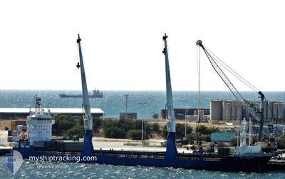
The vessel ONEGO OLZA (IMO: 9511648, MMSI: 305561000) is a General Cargo that was built in 2010 ( 15 years old ). It's sailing under the flag of [AG] Antigua Barbuda.
In this page you can find informations about the vessels current position, last detected port calls, and current voyage information. If the vessels is not in coverage by AIS you will find the latest position.
The current position of ONEGO OLZA is detected by our AIS receivers and we are not responsible for the reliability of the data. The last position was recorded while the vessel was in Coverage by the Ais receivers of our vessel tracking app.
The current draught of ONEGO OLZA as reported by AIS is 7.7 meters
Weather
| Temperature | 19.5°C / 67.1°F |
|---|---|
| Wind Speed | 15 knots |
| Direction | 298° WNW |
| Pressure | 1019.3 hPa |
| Humidity | 67.1 % |
| Cloud Coverage | 43 % |
Featured Company
Last Port Calls
| Port | Arrival | Departure | Time In Port |
|---|---|---|---|
| 2025-01-04 09:20 | 2025-01-07 23:49 | 3 d | |
| 2024-12-27 16:56 | 2025-01-03 00:58 | 6 d | |
| 2024-12-11 12:27 | 2024-12-16 13:03 | 5 d | |
| 2024-11-10 15:38 | 2024-11-12 06:29 | 1 d | |
| 2024-11-06 06:33 | 2024-11-07 14:42 | 1 d | |
| 2024-11-02 16:12 |
Most Visited Ports (Last year)
| Port | Arrivals | |
|---|---|---|
| 2 | ||
| 2 | ||
| 1 | ||
| 1 | ||
| 1 | ||
| 1 |
Last Trips
| Origin | Departure | Destination | Arrival | Distance | |
|---|---|---|---|---|---|
| 2025-01-02 18:58 | 2025-01-04 03:20 | 410.28 nm | |||
| 2024-12-16 09:33 | 2024-12-27 10:56 | 2875.87 nm | |||
| 2024-11-12 07:29 | 2024-12-11 08:57 | 4754.77 nm | |||
| 2024-11-07 15:42 | 2024-11-10 16:38 | 732.26 nm | |||
| 2024-11-02 17:12 | 2024-11-06 07:33 | 241.73 nm |
Events
| Time | Event | Details | Position / Dest | Info |
|---|---|---|---|---|
| 2025-01-11 18:25 | Status Changed | Default Under way using engine |
26.09516 / -78.98869
BEGNE
|
Speed: 12.7 kn Course: 91.3° |
| 2025-01-11 18:15 | Status Changed | Under way using engine Default |
26.09605 / -79.02920
BEGNE
|
Speed: 12.6 kn Course: 92° |
| 2025-01-11 18:15 | OUT of Coverage |
26.09605 / -79.02920
North Atlantic Ocean
BEGNE
|
Speed: 12.7 kn Course: 91.3° |
|
| 2025-01-11 18:04 | Status Changed | Default Under way using engine |
26.09681 / -79.07114
BEGNE
|
Speed: 12.4 kn Course: 90.7° |
| 2025-01-11 13:43 | Detected in Sea | Bahamas part of the North Atlantic Ocean |
25.28628 / -79.39985
North Atlantic Ocean
BEGNE
|
Speed: 13.3 kn Course: 33.8° |
| 2025-01-11 13:43 | Status Changed | Under way using engine Default |
25.28628 / -79.39985
BEGNE
|
Speed: 13.6 kn Course: 37° |
| 2025-01-11 13:43 | IN Coverage |
25.28628 / -79.39985
North Atlantic Ocean
BEGNE
|
Speed: 13.3 kn Course: 33.8° |
|
| 2025-01-08 03:56 | Status Changed | Default Under way using engine |
29.12657 / -93.66151
BEGNE
|
Speed: 12.5 kn Course: 171.8° |
| 2025-01-08 03:48 | OUT of Coverage |
29.15588 / -93.66605
Gulf of Mexico
BEGNE
|
Speed: 12.5 kn Course: 171.8° |
|
| 2025-01-07 23:49 | PORT DEPARTURE |
|
29.81455 / -93.95782
BEGNE
|
Speed: 7.1 kn Course: 163° |