
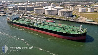
OCEANIA
Tanker
Current Trip
| Time Travelled | 43 days |
|---|---|
| Remaining Time | --- |
| Distance Travelled | 10452.02 nm |
| Remaining Distance | 1840.91 nm |
| AVG Speed | 11.7 Knots |
| MAX Speed | 16.4 Knots |
| AVG Wind | 13.6 knots |
| MAX Wind | 36.2 knots |
| MIN Temp | -3.9°C / 24.98°F |
| MAX Temp | 33.5°C / 92.3°F |
| Draught | 16.2 m |
| Position Received | 7 d ago |
Current Position
| Longitude | 39.44416° |
|---|---|
| Latitude | 18.49095° |
| Status | Under way using engine |
| Speed | 12.4 Knots |
| Course | 164.1° |
| Area | Red Sea |
| Station | T-AIS |
| Position Received | 7 d ago |
Info
Information
The current position of OCEANIA is in Red Sea with coordinates 18.49095° / 39.44416° as reported on 2024-05-06 03:45 by AIS to our vessel tracker app. The vessel's current speed is 12.4 Knots and is heading at the port of SINGAPORE. The estimated time of arrival as calculated by MyShipTracking vessel tracking app is 2024-05-23 12:00 LT
The vessel OCEANIA (IMO: 9905344, MMSI: 636021346) is a Tanker It's sailing under the flag of [LR] Liberia.
In this page you can find informations about the vessels current position, last detected port calls, and current voyage information. If the vessels is not in coverage by AIS you will find the latest position.
The current position of OCEANIA is detected by our AIS receivers and we are not responsible for the reliability of the data. The last position was recorded while the vessel was in Coverage by the Ais receivers of our vessel tracking app.
The current draught of OCEANIA as reported by AIS is 16.2 meters
Weather
| Temperature | 29.7°C / 85.46°F |
|---|---|
| Wind Speed | 5 knots |
| Direction | 285° WNW |
| Pressure | 1006.6 hPa |
| Humidity | 70.3 % |
| Cloud Coverage | 100 % |
Featured Company
Last Port Calls
| Port | Arrival | Departure | Time In Port |
|---|---|---|---|
| 2024-05-03 04:12 | 2024-05-03 12:51 | 8 h | |
| 2024-03-24 17:46 | 2024-03-31 05:36 | 6 d | |
| 2024-03-11 18:37 | 2024-03-12 23:27 | 1 d |
Most Visited Ports (Last year)
| Port | Arrivals | |
|---|---|---|
| 4 | ||
| 1 | ||
| 1 | ||
| 1 | ||
| 1 | ||
| 1 |
Last Trips
| Origin | Departure | Destination | Arrival | Distance | |
|---|---|---|---|---|---|
| 2024-03-31 06:36 | 2024-05-03 06:12 | 7175.40 nm | |||
| 2024-03-13 02:27 | 2024-03-24 17:46 | 3220.70 nm |
Events
| Time | Event | Details | Position / Dest | Info |
|---|---|---|---|---|
| 2024-05-06 03:51 | Status Changed | Default Under way using engine |
18.46820 / 39.45100
SINGAPORE
|
Speed: 12.4 kn Course: 164.1° |
| 2024-05-06 03:45 | OUT of Coverage |
18.49095 / 39.44416
Red Sea
SINGAPORE
|
Speed: 12.4 kn Course: 164.1° |
|
| 2024-05-06 03:22 | Status Changed | Under way using engine Default |
18.56667 / 39.42104
SINGAPORE
|
Speed: 12.4 kn Course: 164° |
| 2024-05-06 03:14 | IN Coverage |
18.56667 / 39.42104
Red Sea
SINGAPORE
|
Speed: 12.4 kn Course: 163.8° |
|
| 2024-05-06 00:29 | Status Changed | Default Under way using engine |
19.13022 / 39.19551
SINGAPORE
|
Speed: 12.4 kn Course: 155.4° |
| 2024-05-06 00:28 | OUT of Coverage |
19.13490 / 39.19324
Red Sea
SINGAPORE
|
Speed: 12.4 kn Course: 155.4° |
|
| 2024-05-06 00:27 | Status Changed | Under way using engine Default |
19.13587 / 39.19275
SINGAPORE
|
Speed: 12.4 kn Course: 156° |
| 2024-05-05 23:37 | Status Changed | Default Under way using engine |
19.29486 / 39.11561
SINGAPORE
|
Speed: 12.3 kn Course: 155° |
| 2024-05-05 22:47 | Change Sea Area | Sudanese part of the Red Sea Saudi Arabian part of the Red Sea |
19.45100 / 39.04091
Red Sea
SINGAPORE
|
Speed: 12.2 kn Course: 155.9° |
| 2024-05-05 22:45 | Status Changed | Under way using engine Default |
19.45617 / 39.03845
SINGAPORE
|
Speed: 12.3 kn Course: 156° |