
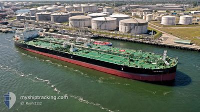
OCEANIA
Tanker
Current Trip
SG SIN PEBGC
| Time Travelled | 58 days |
|---|---|
| Remaining Time | --- |
| Distance Travelled | 13802.70 nm |
| Remaining Distance | --- |
| AVG Speed | 11.7 Knots |
| MAX Speed | 16.4 Knots |
| AVG Wind | 12.6 knots |
| MAX Wind | 36.2 knots |
| MIN Temp | -3.9°C / 24.98°F |
| MAX Temp | 33.5°C / 92.3°F |
| Dybgang | 9.5 m |
| Position Modtaget | 1 m siden |
Current Position
| Longitude | 104.26957° |
|---|---|
| Latitude | 1.30363° |
| Status | Under way using engine |
| Fart | 6.2 Knots |
| Kurs | 261.2° |
| Område | Singapore Strait |
| Station | T-AIS |
| Position Modtaget | 1 m siden |
Info
Information
The current position of OCEANIA is in Singapore Strait with coordinates 1.30363° / 104.26957° as reported on 2024-05-28 19:08 by AIS to our vessel tracker app. The vessel's current speed is 6.2 Knots
The vessel OCEANIA (IMO: 9905344, MMSI: 636021346) is a Tanker It's sailing under the flag of [LR] Liberia.
In this page you can find informations about the vessels current position, last detected port calls, and current voyage information. If the vessels is not in coverage by AIS you will find the latest position.
The current position of OCEANIA is detected by our AIS receivers and we are not responsible for the reliability of the data. The last position was recorded while the vessel was in Coverage by the Ais receivers of our vessel tracking app.
The current draught of OCEANIA as reported by AIS is 9.5 meters
Weather
| Temperature | 28.8°C / 83.84°F |
|---|---|
| Wind Speed | 10 knots |
| Direction | 145° SE |
| Pressure | 1006.8 hPa |
| Humidity | 86.9 % |
| Cloud Coverage | 100 % |
Featured Company
Last Port Calls
| Port | Arrival | Departure | Time In Port |
|---|---|---|---|
| 2024-05-03 04:12 | 2024-05-03 12:51 | 8 h | |
| 2024-03-24 17:46 | 2024-03-31 05:36 | 6 d | |
| 2024-03-11 18:37 | 2024-03-12 23:27 | 1 d |
Most Visited Ports (Last year)
| Port | Arrivals | |
|---|---|---|
| 4 | ||
| 1 | ||
| 1 | ||
| 1 | ||
| 1 |
Last Trips
| Origin | Departure | Destination | Arrival | Distance | |
|---|---|---|---|---|---|
| 2024-03-31 06:36 | 2024-05-03 06:12 | 7175.40 nm | |||
| 2024-03-13 02:27 | 2024-03-24 17:46 | 3220.70 nm |
Events
| Tid | Hændelsen | Detaljer | Position / Dest | Info |
|---|---|---|---|---|
| 2024-05-28 18:53 | Dybgangen er ændret | 9.5 16.2 |
1.30760 / 104.29812
SG SIN PEBGC
|
Fart: 7.5 kn Kurs: 260.7° |
| 2024-05-28 18:53 | Destination er ændret | SG SIN PEBGC SINGAPORE FOR ORDERS |
1.30760 / 104.29812
SG SIN PEBGC
|
Fart: 7.5 kn Kurs: 260.7° |
| 2024-05-28 18:53 | ETA er ændret | 2024/05/29 06:00 2024/05/23 12:00 |
1.30760 / 104.29812
SG SIN PEBGC
|
Fart: 7.5 kn Kurs: 260.7° |
| 2024-05-28 18:35 | Ændre havområde | Malaysian part of the Singapore Strait Malaysian part of the South China Sea |
1.32126 / 104.33263
Singapore Strait
|
Fart: 6.3 kn Kurs: 233° |
| 2024-05-28 18:03 | Status er ændret | Under way using engine Default |
1.36094 / 104.37383
SINGAPORE FOR ORDERS
|
Fart: 6.5 kn Kurs: 228° |
| 2024-05-28 17:58 | Indenfor Dækning |
1.35883 / 104.37170
South China Sea
|
Fart: 6.5 kn Kurs: 225.5° |
|
| 2024-05-28 14:11 | START Sejllads |
1.81292 / 104.69153
SINGAPORE FOR ORDERS
|
Fart: 3.6 kn Kurs: 235° |
|
| 2024-05-27 16:04 | STOP Sejllads |
1.81710 / 104.69170
SINGAPORE FOR ORDERS
|
Fart: 0.3 kn Kurs: 156° |
|
| 2024-05-25 08:53 | START Sejllads | 5.81 nm, North East of MUARA |
5.09711 / 115.12882
SINGAPORE FOR ORDERS
|
Fart: 3.3 kn Kurs: 300° |
| 2024-05-24 02:38 | STOP Sejllads | 5.59 nm, North East of MUARA |
5.08529 / 115.13666
SINGAPORE FOR ORDERS
|
Fart: 0.1 kn Kurs: 283° |