

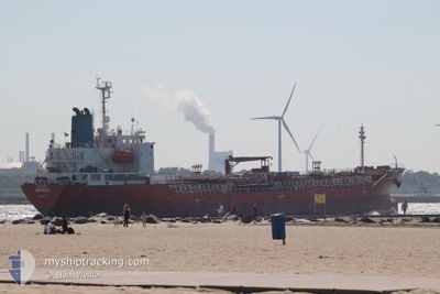
NQ VICTORIA
Oil/Chemical Tanker

Current Trip
| Time Travelled | 13 h, 31 mins |
|---|---|
| Remaining Time | 14 h, 31 mins |
| Distance Travelled | 154.92 nm |
| Remaining Distance | 178.40 nm |
| AVG Speed | 11.7 Knots |
| MAX Speed | 12.7 Knots |
| AVG Wind | 16.4 knots |
| MAX Wind | 21 knots |
| MIN Temp | 14.8°C / 58.64°F |
| MAX Temp | 16.6°C / 61.88°F |
| Draught | 7 m |
| Position Received | 17 m ago |
Current Position
| Longitude | --- |
|---|---|
| Latitude | --- |
| Status | Under way using engine |
| Speed | 11.9 Knots |
| Course | 22° |
| Area | North Atlantic Ocean |
| Station | T-AIS |
| Position Received | 17 m ago |
Information
The current position of NQ VICTORIA is in North Atlantic Ocean with coordinates 34.44972° / -8.41902° as reported on 2025-03-28 14:56 by AIS to our vessel tracker app. The vessel's current speed is 11.9 Knots and is heading at the port of HUELVA. The estimated time of arrival as calculated by MyShipTracking vessel tracking app is 2025-03-29 06:44 LT
The vessel NQ VICTORIA (IMO: 9344174, MMSI: 256442000) is a Oil/Chemical Tanker that was built in 2006 ( 19 years old ). It's sailing under the flag of [MT] Malta.
In this page you can find informations about the vessels current position, last detected port calls, and current voyage information. If the vessels is not in coverage by AIS you will find the latest position.
The current position of NQ VICTORIA is detected by our AIS receivers and we are not responsible for the reliability of the data. The last position was recorded while the vessel was in Coverage by the Ais receivers of our vessel tracking app.
The current draught of NQ VICTORIA as reported by AIS is 7 meters
Weather
| Temperature | 16.6°C / 61.88°F |
|---|---|
| Wind Speed | 13 knots |
| Direction | 46° NE |
| Pressure | 1017.4 hPa |
| Humidity | 66.1 % |
| Cloud Coverage | --- |


Featured Company
Last Port Calls
| Port | Arrival | Departure | Time In Port |
|---|---|---|---|
| 2025-03-27 01:15 | 2025-03-28 01:42 | 1 d | |
| 2025-03-19 16:37 | 2025-03-21 08:00 | 1 d | |
| 2025-03-14 13:19 | 2025-03-15 22:44 | 1 d | |
| 2025-03-11 08:38 | 2025-03-11 08:46 | 7 m | |
| 2025-03-08 10:58 | 2025-03-09 11:27 | 1 d | |
| 2025-03-07 07:51 | 2025-03-07 21:25 | 13 h | |
| 2025-03-05 17:15 | 2025-03-06 12:52 | 19 h | |
| 2025-03-05 05:14 | 2025-03-05 11:27 | 6 h | |
| 2025-02-28 12:46 | 2025-03-02 00:28 | 1 d | |
| 2025-02-22 11:15 | 2025-02-23 18:31 | 1 d |
Most Visited Ports (Last year)
| Port | Arrivals | |
|---|---|---|
| 10 | ||
| 9 | ||
| 4 | ||
| 4 | ||
| 3 | ||
| 3 |
Last Trips
| Origin | Departure | Destination | Arrival | Distance | |
|---|---|---|---|---|---|
| 2025-03-21 08:00 | 2025-03-27 01:15 | 295.45 nm | |||
| 2025-03-15 22:44 | 2025-03-19 16:37 | 731.31 nm | |||
| 2025-03-11 08:46 | 2025-03-14 13:19 | 14.45 nm | |||
| 2025-03-09 11:27 | 2025-03-11 08:38 | 528.46 nm | |||
| 2025-03-07 21:25 | 2025-03-08 10:58 | 141.18 nm | |||
| 2025-03-06 12:52 | 2025-03-07 07:51 | 170.73 nm | |||
| 2025-03-05 11:27 | 2025-03-05 17:15 | 4.03 nm | |||
| 2025-03-02 00:28 | 2025-03-05 05:14 | 643.70 nm | |||
| 2025-02-23 18:31 | 2025-02-28 12:46 | 1253.19 nm | |||
| 2025-02-19 21:21 | 2025-02-22 11:15 | 524.09 nm |
Events
| Time | Event | Details | Position / Dest | Info |
|---|---|---|---|---|
| 2025-03-28 15:01 | Status Changed | Default Under way using engine |
34.46723 / -8.40998
ESHUV
|
Speed: 11.9 kn Course: 22° |
| 2025-03-28 14:33 | Status Changed | Under way using engine Default |
34.38198 / -8.45635
ESHUV
|
Speed: 12.1 kn Course: 27° |
| 2025-03-28 14:28 | Status Changed | Default Under way using engine |
34.36408 / -8.46602
ESHUV
|
Speed: 12.1 kn Course: 19° |
| 2025-03-28 14:25 | Status Changed | Under way using engine Default |
34.35637 / -8.47040
ESHUV
|
Speed: 12.2 kn Course: 23° |
| 2025-03-28 14:16 | Status Changed | Default Under way using engine |
34.32746 / -8.48550
ESHUV
|
Speed: 12.2 kn Course: 25° |
| 2025-03-28 14:00 | Draught Changed | 7 5.4 |
34.27917 / -8.51075
ESHUV
|
Speed: 12.3 kn Course: 31° |
| 2025-03-28 14:00 | Destination Changed | ESHUV MASFI |
34.27917 / -8.51075
ESHUV
|
Speed: 12.3 kn Course: 31° |
| 2025-03-28 14:00 | ETA Changed | 2025/03/29 07:00 2025/03/22 07:00 |
34.27917 / -8.51075
ESHUV
|
Speed: 12.3 kn Course: 31° |
| 2025-03-28 13:55 | Status Changed | Under way using engine Default |
34.26340 / -8.52080
MASFI
|
Speed: 12.4 kn Course: 30° |
| 2025-03-28 12:46 | OUT of Coverage |
34.05628 / -8.65255
North Atlantic Ocean
|
Speed: 12 kn Course: 28° |