

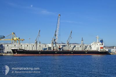
NOUR STAR
Bulk Carrier

Current Trip
| Time Travelled | 6 days |
|---|---|
| Remaining Time | --- |
| Distance Travelled | 404.99 nm |
| Remaining Distance | --- |
| AVG Speed | 12 Knots |
| MAX Speed | 12.8 Knots |
| AVG Wind | 9.8 knots |
| MAX Wind | 16.3 knots |
| MIN Temp | 8.7°C / 47.66°F |
| MAX Temp | 12.1°C / 53.78°F |
| Draught | 6.4 m |
| Position Received | 5 d ago |
Current Position
| Longitude | --- |
|---|---|
| Latitude | --- |
| Status | Under way using engine |
| Speed | 12.1 Knots |
| Course | 64.8° |
| Area | Black Sea |
| Station | T-AIS |
| Position Received | 5 d ago |
Information
The current position of NOUR STAR is in Black Sea with coordinates 42.39599° / 32.12966° as reported on 2025-03-24 15:11 by AIS to our vessel tracker app. The vessel's current speed is 12.1 Knots
The vessel NOUR STAR (IMO: 9296315, MMSI: 371570000) is a Bulk Carrier that was built in 2005 ( 20 years old ). It's sailing under the flag of [PA] Panama.
In this page you can find informations about the vessels current position, last detected port calls, and current voyage information. If the vessels is not in coverage by AIS you will find the latest position.
The current position of NOUR STAR is detected by our AIS receivers and we are not responsible for the reliability of the data. The last position was recorded while the vessel was in Coverage by the Ais receivers of our vessel tracking app.
The current draught of NOUR STAR as reported by AIS is 6.4 meters
Weather
| Temperature | 9.9°C / 49.82°F |
|---|---|
| Wind Speed | 16 knots |
| Direction | 166° SSE |
| Pressure | 1021.7 hPa |
| Humidity | 81.9 % |
| Cloud Coverage | 100 % |


Featured Company
Last Port Calls
| Port | Arrival | Departure | Time In Port |
|---|---|---|---|
| 2025-03-24 01:10 | 2025-03-24 02:38 | 1 h | |
| 2025-03-07 06:29 | 2025-03-11 23:06 | 4 d | |
| 2025-03-03 23:47 | 2025-03-04 11:37 | 11 h | |
| 2025-02-12 14:41 | 2025-02-13 04:22 | 13 h | |
| 2025-01-22 23:37 | 2025-01-25 14:51 | 2 d | |
| 2025-01-20 10:30 | 2025-01-22 22:28 | 2 d | |
| 2025-01-09 07:57 | 2025-01-09 08:01 | 4 m | |
| 2025-01-05 00:32 | 2025-01-05 00:50 | 17 m | |
| 2025-01-02 10:30 | 2025-01-02 14:54 | 4 h |
Most Visited Ports (Last year)
| Port | Arrivals | |
|---|---|---|
| 8 | ||
| 4 | ||
| 2 | ||
| 2 | ||
| 1 | ||
| 1 |
Last Trips
| Origin | Departure | Destination | Arrival | Distance | |
|---|---|---|---|---|---|
| 2025-03-12 01:06 | 2025-03-24 04:10 | 876.12 nm | |||
| 2025-03-04 13:37 | 2025-03-07 08:29 | 16.20 nm | |||
| 2025-02-13 07:22 | 2025-03-04 01:47 | 1223.06 nm | |||
| 2025-01-25 16:51 | 2025-02-12 17:41 | 1236.38 nm | |||
| 2025-01-23 00:28 | 2025-01-23 01:37 | 0.78 nm | |||
| 2025-01-09 11:01 | 2025-01-20 12:30 | 1210.21 nm | |||
| 2025-01-05 03:50 | 2025-01-09 10:57 | 482.21 nm | |||
| 2025-01-02 17:54 | 2025-01-05 03:32 | 375.21 nm | |||
| 2024-12-23 21:42 | 2025-01-02 13:30 | 1085.58 nm |
Events
| Time | Event | Details | Position / Dest | Info |
|---|---|---|---|---|
| 2025-03-24 15:11 | Status Changed | Default Under way using engine |
42.39696 / 32.13245
RU TAM
|
Speed: 12.1 kn Course: 64.8° |
| 2025-03-24 15:11 | OUT of Coverage |
42.39599 / 32.12966
Black Sea
RU TAM
|
Speed: 12.1 kn Course: 64.8° |
|
| 2025-03-24 11:46 | Destination Changed | RU TAM ISTANBUL |
42.08448 / 31.28486
RU TAM
|
Speed: 12.5 kn Course: 63.1° |
| 2025-03-24 11:46 | ETA Changed | 2025/03/25 14:00 2026/02/21 11:00 |
42.08448 / 31.28486
RU TAM
|
Speed: 12.5 kn Course: 63.1° |
| 2025-03-24 11:35 | Status Changed | Under way using engine Default |
42.06800 / 31.24023
ISTANBUL
|
Speed: 12.4 kn Course: 64° |
| 2025-03-24 11:21 | IN Coverage |
42.06800 / 31.24023
Black Sea
|
Speed: 12.5 kn Course: 63.7° |
|
| 2025-03-24 04:27 | Status Changed | Default Under way using engine |
41.40541 / 29.50415
ISTANBUL
|
Speed: 12.1 kn Course: 60.8° |
| 2025-03-24 04:15 | OUT of Coverage |
41.38859 / 29.45933
Black Sea
|
Speed: 12.1 kn Course: 60.8° |
|
| 2025-03-24 02:53 | Change Sea Area | Turkish part of the Black Sea Turkish part of the Sea of Marmara |
41.23186 / 29.15201
Black Sea
|
Speed: 11.6 kn Course: 47.3° |
| 2025-03-24 02:38 | PORT DEPARTURE |
|
41.20418 / 29.11594
ISTANBUL
|
Speed: 7.6 kn Course: 43° |