

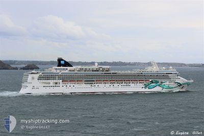
NORWEGIAN JADE
Passengers Ship

Current Trip
VG TOV > DO AMBER CO
| Time Travelled | 19 h, 21 mins |
|---|---|
| Remaining Time | --- |
| Distance Travelled | 362.62 nm |
| Remaining Distance | --- |
| AVG Speed | 17.4 Knots |
| MAX Speed | 21.8 Knots |
| AVG Wind | 15.6 knots |
| MAX Wind | 19.1 knots |
| MIN Temp | 21.8°C / 71.24°F |
| MAX Temp | 26.1°C / 78.98°F |
| Draught | 8.7 m |
| Position Received | 8 h, 21 m ago |
Current Position
| Longitude | --- |
|---|---|
| Latitude | --- |
| Status | Under way using engine |
| Speed | 21.2 Knots |
| Course | 285.6° |
| Area | North Atlantic Ocean |
| Station | T-AIS |
| Position Received | 8 h, 21 m ago |
Information
The current position of NORWEGIAN JADE is in North Atlantic Ocean with coordinates 19.28055° / -68.21024° as reported on 2025-02-18 04:58 by AIS to our vessel tracker app. The vessel's current speed is 21.2 Knots
The vessel NORWEGIAN JADE (IMO: 9304057, MMSI: 308416000) is a Passengers Ship that was built in 2006 ( 19 years old ). It's sailing under the flag of [BS] Bahamas.
In this page you can find informations about the vessels current position, last detected port calls, and current voyage information. If the vessels is not in coverage by AIS you will find the latest position.
The current position of NORWEGIAN JADE is detected by our AIS receivers and we are not responsible for the reliability of the data. The last position was recorded while the vessel was in Coverage by the Ais receivers of our vessel tracking app.
The current draught of NORWEGIAN JADE as reported by AIS is 8.7 meters
Weather
| Temperature | 24.6°C / 76.28°F |
|---|---|
| Wind Speed | 12 knots |
| Direction | 119° ESE |
| Pressure | 1017.1 hPa |
| Humidity | 74.7 % |
| Cloud Coverage | 100 % |


Featured Company
Last Port Calls
| Port | Arrival | Departure | Time In Port |
|---|---|---|---|
| 2025-02-17 09:36 | 2025-02-17 17:59 | 8 h | |
| 2025-02-16 10:29 | 2025-02-16 21:01 | 10 h | |
| 2025-02-14 10:07 | 2025-02-14 23:55 | 13 h | |
| 2025-02-11 14:10 | 2025-02-12 00:03 | 9 h | |
| 2025-02-07 12:18 | 2025-02-07 22:49 | 10 h | |
| 2025-02-06 12:40 | 2025-02-07 00:02 | 11 h | |
| 2025-02-05 11:00 | 2025-02-05 21:11 | 10 h | |
| 2025-02-03 13:08 | 2025-02-03 22:08 | 8 h | |
| 2025-02-01 11:07 | 2025-02-01 21:00 | 9 h | |
| 2025-01-30 15:09 | 2025-01-31 00:06 | 8 h |
Most Visited Ports (Last year)
| Port | Arrivals | |
|---|---|---|
| 21 | ||
| 16 | ||
| 15 | ||
| 14 | ||
| 13 | ||
| 10 |
Last Trips
| Origin | Departure | Destination | Arrival | Distance | |
|---|---|---|---|---|---|
| 2025-02-16 17:01 | 2025-02-17 05:36 | 151.52 nm | |||
| 2025-02-14 19:55 | 2025-02-16 06:29 | 503.59 nm | |||
| 2025-02-11 19:03 | 2025-02-14 06:07 | 518.28 nm | |||
| 2025-02-07 16:49 | 2025-02-11 09:10 | 585.88 nm | |||
| 2025-02-06 19:02 | 2025-02-07 06:18 | 202.92 nm | |||
| 2025-02-05 16:11 | 2025-02-06 07:40 | 284.48 nm | |||
| 2025-02-03 17:08 | 2025-02-05 06:00 | 572.13 nm | |||
| 2025-02-01 16:00 | 2025-02-03 08:08 | 590.26 nm | |||
| 2025-01-30 19:06 | 2025-02-01 06:07 | 380.68 nm | |||
| 2025-01-29 17:34 | 2025-01-30 10:09 | 333.92 nm |
Events
| Time | Event | Details | Position / Dest | Info |
|---|---|---|---|---|
| 2025-02-18 05:02 | Status Changed | Default Under way using engine |
19.28760 / -68.23601
VG TOV > DO AMBER CO
|
Speed: 21.2 kn Course: 285.6° |
| 2025-02-18 04:58 | OUT of Coverage |
19.28055 / -68.21024
North Atlantic Ocean
VG TOV > DO AMBER CO
|
Speed: 21.2 kn Course: 285.6° |
|
| 2025-02-18 04:47 | Detected in Sea | Dominican Republic part of the North Atlantic Ocean |
19.26254 / -68.14391
North Atlantic Ocean
VG TOV > DO AMBER CO
|
Speed: 21.2 kn Course: 284.5° |
| 2025-02-18 04:47 | Status Changed | Under way using engine Default |
19.26254 / -68.14391
VG TOV > DO AMBER CO
|
Speed: 21.1 kn Course: 285° |
| 2025-02-18 04:40 | IN Coverage |
19.26254 / -68.14391
North Atlantic Ocean
VG TOV > DO AMBER CO
|
Speed: 21.2 kn Course: 284.5° |
|
| 2025-02-17 22:45 | Status Changed | Default Under way using engine |
18.73702 / -66.00732
VG TOV > DO AMBER CO
|
Speed: 20.9 kn Course: 283.8° |
| 2025-02-17 22:38 | Status Changed | Under way using engine Default |
18.72765 / -65.96797
VG TOV > DO AMBER CO
|
Speed: 20.9 kn Course: 284° |
| 2025-02-17 22:38 | OUT of Coverage |
18.72765 / -65.96797
North Atlantic Ocean
VG TOV > DO AMBER CO
|
Speed: 20.9 kn Course: 283.8° |
|
| 2025-02-17 22:27 | Status Changed | Default Under way using engine |
18.71158 / -65.90086
VG TOV > DO AMBER CO
|
Speed: 20.8 kn Course: 284.6° |
| 2025-02-17 21:43 | Change Sea Area | Puerto Rican part of the North Atlantic Ocean Puerto Rican part of the Caribbean Sea |
18.64746 / -65.64338
North Atlantic Ocean
VG TOV > DO AMBER CO
|
Speed: 20.9 kn Course: 284° |