
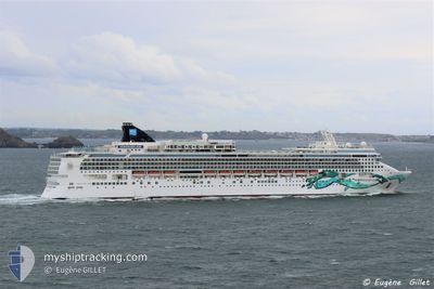
NORWEGIAN JADE
Passenger
Current Trip
| Time Travelled | 3 h, 31 mins |
|---|---|
| Remaining Time | 13 h, 23 mins |
| Distance Travelled | 49.42 nm |
| Remaining Distance | 266.36 nm |
| AVG Speed | 15 Noeuds |
| MAX Speed | 19.9 Noeuds |
| AVG Wind | 4.6 knots |
| MAX Wind | 5.7 knots |
| MIN Temp | 16°C / 60.8°F |
| MAX Temp | 17.4°C / 63.32°F |
| Tirant d eau | 8 m |
| Position reçue | 29 m depuis |
Current Position
| Longitude | --- |
|---|---|
| Latitude | --- |
| Etat | Under way using engine |
| Vitesse | 20 Noeuds |
| Parcours | 186.6° |
| Zone | Gulf of Mexico |
| Station | T-AIS |
| Position reçue | 29 m depuis |
Info
Information
The current position of NORWEGIAN JADE is in Gulf of Mexico with coordinates 27.34592° / -83.06170° as reported on 2025-01-30 01:35 by AIS to our vessel tracker app. The vessel's current speed is 20 Noeuds and is heading at the port of KEY WEST. The estimated time of arrival as calculated by MyShipTracking vessel tracking app is 2025-01-30 15:28 LT
The vessel NORWEGIAN JADE (MMSI: 308416000) is a Passenger It's sailing under the flag of [BS] Bahamas.
In this page you can find informations about the vessels current position, last detected port calls, and current voyage information. If the vessels is not in coverage by AIS you will find the latest position.
The current position of NORWEGIAN JADE is detected by our AIS receivers and we are not responsible for the reliability of the data. The last position was recorded while the vessel was in Coverage by the Ais receivers of our vessel tracking app.
The current draught of NORWEGIAN JADE as reported by AIS is 8 meters
Weather
| Temperature | 17.7°C / 63.86°F |
|---|---|
| Wind Speed | 2 knots |
| Direction | 20° NNE |
| Pressure | 1021.7 hPa |
| Humidity | 87.5 % |
| Cloud Coverage | 49 % |
Featured Company
Last Port Calls
| Port | Arrival | Departure | Time In Port |
|---|---|---|---|
| 2025-01-29 06:24 | 2025-01-29 22:34 | 16 h | |
| 2025-01-27 15:15 | 2025-01-28 00:45 | 9 h | |
| 2025-01-25 13:50 | 2025-01-26 00:38 | 10 h | |
| 2025-01-23 11:25 | 2025-01-23 21:02 | 9 h | |
| 2025-01-21 13:09 | 2025-01-21 22:58 | 9 h | |
| 2025-01-17 12:34 | 2025-01-17 22:49 | 10 h | |
| 2025-01-16 12:31 | 2025-01-16 23:23 | 10 h | |
| 2025-01-15 12:12 | 2025-01-15 21:30 | 9 h | |
| 2025-01-11 13:08 | 2025-01-11 23:10 | 10 h | |
| 2025-01-10 10:44 | 2025-01-10 19:32 | 8 h |
Most Visited Ports (Last year)
| Port | Arrivals | |
|---|---|---|
| 21 | ||
| 16 | ||
| 16 | ||
| 14 | ||
| 13 | ||
| 10 |
Last Trips
| Origin | Departure | Destination | Arrival | Distance | |
|---|---|---|---|---|---|
| 2025-01-27 19:45 | 2025-01-29 01:24 | 514.72 nm | |||
| 2025-01-25 18:38 | 2025-01-27 10:15 | 481.50 nm | |||
| 2025-01-23 16:02 | 2025-01-25 07:50 | 581.05 nm | |||
| 2025-01-21 17:58 | 2025-01-23 06:25 | 602.03 nm | |||
| 2025-01-17 16:49 | 2025-01-21 08:09 | 580.94 nm | |||
| 2025-01-16 18:23 | 2025-01-17 06:34 | 204.64 nm | |||
| 2025-01-15 16:30 | 2025-01-16 07:31 | 286.87 nm | |||
| 2025-01-11 19:10 | 2025-01-15 07:12 | 985.28 nm | |||
| 2025-01-10 15:32 | 2025-01-11 09:08 | 342.81 nm | |||
| 2025-01-09 17:19 | 2025-01-10 06:44 | 131.85 nm |
Events
| Heure | Evenement | Détails | Position/ Destination | Info |
|---|---|---|---|---|
| 2025-01-30 01:41 | Etat Changé | Default Under way using engine |
27.31543 / -83.06564
US TPA> US EYW
|
Vitesse: 20 kn Parcours: 186.6° |
| 2025-01-29 23:50 | Tirant d'eau modifié | 8 8.7 |
27.60908 / -82.70051
US TPA> US EYW
|
Vitesse: 16 kn Parcours: 261° |
| 2025-01-29 23:38 | Tirant d'eau modifié | 8.7 8 |
27.62605 / -82.64321
US TPA> US EYW
|
Vitesse: 16.2 kn Parcours: 242.2° |
| 2025-01-29 23:38 | Changement d'ETA | 2025/01/30 14:30 |
27.62605 / -82.64321
US TPA> US EYW
|
Vitesse: 16.2 kn Parcours: 242.2° |
| 2025-01-29 23:14 | Tirant d'eau modifié | 8 8.7 |
27.69603 / -82.55570
US TPA> US EYW
|
Vitesse: 15.6 kn Parcours: 222.3° |
| 2025-01-29 23:08 | Changement de destination | US TPA> US EYW MX CZM > US TPA |
27.71761 / -82.53978
US TPA> US EYW
|
Vitesse: 15.8 kn Parcours: 212.2° |
| 2025-01-29 23:08 | Changement d'ETA | 2025/01/30 14:30 2025/01/29 04:30 |
27.71761 / -82.53978
US TPA> US EYW
|
Vitesse: 15.8 kn Parcours: 212.2° |
| 2025-01-29 22:34 | PORT DE DEPART |
|
27.80832 / -82.45544
MX CZM > US TPA
|
Vitesse: 10.9 kn Parcours: 230° |
| 2025-01-29 21:33 | Démarrage |
27.93877 / -82.44493
[US] TAMPA
|
Vitesse: 3.2 kn Parcours: 197° |
|
| 2025-01-29 21:17 | Etat Changé | Under way using engine Moored |
27.94215 / -82.44746
[US] TAMPA
|
Vitesse: Parcours: 253° |