
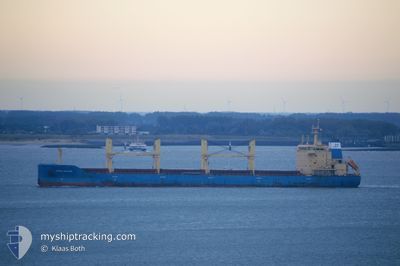
NORDIC MALMOE
Bulk Carrier
Current Trip
| Trip Time | 5 days |
|---|---|
| Trip Distance | 816.26 nm |
| AVG Speed | 9 Knots |
| MAX Speed | 12.2 Knots |
| Draught | 10.2 m |
| AVG Wind | 11.4 knots |
| MAX Wind | 23.5 knots |
| MIN Temp | 19.8°C / 67.64°F |
| MAX Temp | 31.7°C / 89.06°F |
| Position Received | 13 d ago |
Current Position
| Longitude | -93.22657° |
|---|---|
| Latitude | 29.30929° |
| Status | Under way using engine |
| Speed | 11.1 Knots |
| Course | 181.7° |
| Area | Gulf of Mexico |
| Station | T-AIS |
| Position Received | 13 d ago |
Info
Information
The current position of NORDIC MALMOE is in Gulf of Mexico with coordinates 29.30929° / -93.22657° as reported on 2024-05-11 12:33 by AIS to our vessel tracker app. The vessel's current speed is 11.1 Knots and is currently inside the port of VERACRUZ.
The vessel NORDIC MALMOE (IMO: 9602679, MMSI: 636092675) is a Bulk Carrier that was built in 2012 ( 12 years old ). It's sailing under the flag of [LR] Liberia.
In this page you can find informations about the vessels current position, last detected port calls, and current voyage information. If the vessels is not in coverage by AIS you will find the latest position.
The current position of NORDIC MALMOE is detected by our AIS receivers and we are not responsible for the reliability of the data. The last position was recorded while the vessel was in Coverage by the Ais receivers of our vessel tracking app.
The current draught of NORDIC MALMOE as reported by AIS is 10.2 meters
Weather
| Temperature | 35.6°C / 96.08°F |
|---|---|
| Wind Speed | 11 knots |
| Direction | 81° E |
| Pressure | 1004 hPa |
| Humidity | 49.8 % |
| Cloud Coverage | 25 % |
Featured Company
Last Port Calls
| Port | Arrival | Departure | Time In Port |
|---|---|---|---|
| 2024-05-16 18:16 | |||
| 2024-04-28 19:14 | 2024-05-11 00:21 | 12 d | |
| 2024-04-25 00:47 | 2024-04-25 05:59 | 5 h | |
| 2024-04-18 06:46 | 2024-04-19 09:27 | 1 d | |
| 2024-04-09 14:18 | 2024-04-16 11:40 | 6 d | |
| 2024-03-22 20:36 |
Last Trips
| Origin | Departure | Destination | Arrival | Distance | |
|---|---|---|---|---|---|
| 2024-05-11 00:21 | 2024-05-16 18:16 | 816.26 nm | |||
| 2024-04-25 05:59 | 2024-04-28 19:14 | 510.39 nm | |||
| 2024-04-19 09:27 | 2024-04-25 00:47 | 1420.44 nm | |||
| 2024-04-16 11:40 | 2024-04-18 06:46 | 402.77 nm | |||
| 2024-03-22 20:36 | 2024-04-09 14:18 | 3848.83 nm |
Events
| Time | Event | Details | Position / Dest | Info |
|---|---|---|---|---|
| 2024-05-16 23:28 | STOP Moving |
19.20500 / -96.13500
[MX] VERACRUZ
|
Speed: Course: -1° |
|
| 2024-05-16 23:16 | PORT ARRIVAL |
|
19.20500 / -96.13167
[MX] VERACRUZ
|
Speed: 8 kn Course: 278° |
| 2024-05-16 21:19 | START Moving | 9.93 nm, North East of VERACRUZ |
19.34435 / -96.03397
VERACRUZ
|
Speed: 3.6 kn Course: 131° |
| 2024-05-16 21:04 | STOP Moving | 9.97 nm, North East of VERACRUZ |
19.34667 / -96.03667
VERACRUZ
|
Speed: Course: -1° |
| 2024-05-16 19:26 | START Moving | 17.84 nm, North of VERACRUZ |
19.48627 / -96.02723
VERACRUZ
|
Speed: 3.1 kn Course: 185° |
| 2024-05-16 16:28 | STOP Moving | 15.9 nm, North of VERACRUZ |
19.45167 / -96.02666
VERACRUZ
|
Speed: Course: -1° |
| 2024-05-16 14:31 | START Moving | 21.02 nm, North of VERACRUZ |
19.54178 / -96.02670
VERACRUZ
|
Speed: 3.2 kn Course: 336° |
| 2024-05-15 16:41 | STOP Moving | 15.64 nm, North of VERACRUZ |
19.45667 / -96.05833
VERACRUZ
|
Speed: Course: -1° |
| 2024-05-15 15:05 | START Moving | 17.33 nm, North of VERACRUZ |
19.49000 / -96.08334
VERACRUZ
|
Speed: 4 kn Course: -1° |
| 2024-05-15 08:02 | STOP Moving | 16.47 nm, North of VERACRUZ |
19.45833 / -96.01667
VERACRUZ
|
Speed: Course: -1° |