
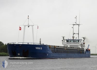
NINA B
General Cargo
Current Trip
GB GUW
| Time Travelled | 2 days |
|---|---|
| Remaining Time | --- |
| Distance Travelled | 469.86 nm |
| Remaining Distance | --- |
| AVG Speed | 7.8 Knots |
| MAX Speed | 9 Knots |
| AVG Wind | 10.1 knots |
| MAX Wind | 16.9 knots |
| MIN Temp | -6.3°C / 20.66°F |
| MAX Temp | 4.3°C / 39.74°F |
| Draught | 3 m |
| Position Received | Now |
Current Position
| Longitude | --- |
|---|---|
| Latitude | --- |
| Status | Under way using engine |
| Speed | 2 Knots |
| Course | 171° |
| Area | North Sea |
| Station | T-AIS |
| Position Received | Now |
Info
Information
The current position of NINA B is in North Sea with coordinates 53.53655° / 0.55129° as reported on 2025-02-16 12:34 by AIS to our vessel tracker app. The vessel's current speed is 2 Knots
The vessel NINA B (IMO: 9213703, MMSI: 209982000) is a General Cargo that was built in 2000 ( 25 years old ). It's sailing under the flag of [CY] Cyprus.
In this page you can find informations about the vessels current position, last detected port calls, and current voyage information. If the vessels is not in coverage by AIS you will find the latest position.
The current position of NINA B is detected by our AIS receivers and we are not responsible for the reliability of the data. The last position was recorded while the vessel was in Coverage by the Ais receivers of our vessel tracking app.
The current draught of NINA B as reported by AIS is 3 meters
Weather
| Temperature | 3.9°C / 39.02°F |
|---|---|
| Wind Speed | 16 knots |
| Direction | 120° ESE |
| Pressure | 1023.5 hPa |
| Humidity | 66.3 % |
| Cloud Coverage | 99 % |
Featured Company
Last Port Calls
| Port | Arrival | Departure | Time In Port |
|---|---|---|---|
| 2025-02-12 22:55 | 2025-02-13 23:12 | 1 d | |
| 2025-02-11 05:49 | 2025-02-11 07:18 | 1 h | |
| 2025-02-07 20:47 | 2025-02-08 13:14 | 16 h | |
| 2025-02-04 09:12 | 2025-02-05 16:38 | 1 d | |
| 2025-01-31 15:21 | 2025-02-01 15:29 | 1 d | |
| 2025-01-28 17:18 | 2025-01-29 14:50 | 21 h | |
| 2025-01-25 04:36 | 2025-01-25 22:45 | 18 h | |
| 2025-01-20 19:15 | 2025-01-21 15:08 | 19 h | |
| 2025-01-18 05:45 | 2025-01-20 13:19 | 2 d | |
| 2025-01-16 11:15 | 2025-01-16 19:34 | 8 h |
Last Trips
| Origin | Departure | Destination | Arrival | Distance | |
|---|---|---|---|---|---|
| 2025-02-11 08:18 | 2025-02-12 23:55 | 163.85 nm | |||
| 2025-02-08 14:14 | 2025-02-11 06:49 | 412.78 nm | |||
| 2025-02-05 17:38 | 2025-02-07 21:47 | 388.97 nm | |||
| 2025-02-01 17:29 | 2025-02-04 10:12 | 497.78 nm | |||
| 2025-01-29 15:50 | 2025-01-31 17:21 | 411.20 nm | |||
| 2025-01-25 23:45 | 2025-01-28 18:18 | 514.44 nm | |||
| 2025-01-21 16:08 | 2025-01-25 05:36 | 507.90 nm | |||
| 2025-01-20 14:19 | 2025-01-20 20:15 | 44.82 nm | |||
| 2025-01-16 20:34 | 2025-01-18 06:45 | 233.49 nm | |||
| 2025-01-15 19:37 | 2025-01-16 12:15 | 121.87 nm |
Events
| Time | Event | Details | Position / Dest | Info |
|---|---|---|---|---|
| 2025-02-16 11:02 | Status Changed | Under way using engine Default |
53.59592 / .55799
GB GUW
|
Speed: 3.2 kn Course: 187° |
| 2025-02-16 11:02 | IN Coverage |
53.59435 / .55735
North Sea
GB GUW
|
Speed: 2.8 kn Course: 194.2° |
|
| 2025-02-16 08:11 | Status Changed | Default Under way using engine |
53.75909 / .89701
GB GUW
|
Speed: 8.2 kn Course: 221.2° |
| 2025-02-16 08:05 | Status Changed | Under way using engine Default |
53.76944 / .91276
GB GUW
|
Speed: 7.8 kn Course: 236° |
| 2025-02-16 08:05 | OUT of Coverage |
53.76944 / .91276
North Sea
GB GUW
|
Speed: 8.2 kn Course: 221.2° |
|
| 2025-02-16 07:42 | Status Changed | Default Under way using engine |
53.80774 / .97645
GB GUW
|
Speed: 8.1 kn Course: 231.7° |
| 2025-02-16 03:39 | ETA Changed | 2025/02/16 13:00 2025/02/16 12:00 |
54.17446 / 1.67254
GB GUW
|
Speed: 7.7 kn Course: 224.1° |
| 2025-02-16 02:51 | Status Changed | Under way using engine Default |
54.24678 / 1.80186
GB GUW
|
Speed: 8.1 kn Course: 231° |
| 2025-02-16 02:38 | Status Changed | Default Under way using engine |
54.26618 / 1.83768
GB GUW
|
Speed: 7.9 kn Course: 228.7° |
| 2025-02-16 02:32 | Detected in Sea | United Kingdom part of the North Sea |
54.27572 / 1.85520
North Sea
GB GUW
|
Speed: 7.9 kn Course: 228.7° |