
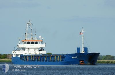
NIKLAS
General Cargo
Current Trip
| Time Travelled | 1 day |
|---|---|
| Remaining Time | --- |
| Distance Travelled | 304.17 nm |
| Remaining Distance | --- |
| AVG Speed | 7.8 Knots |
| MAX Speed | 11.6 Knots |
| AVG Wind | 12.9 knots |
| MAX Wind | 23.8 knots |
| MIN Temp | 8.5°C / 47.3°F |
| MAX Temp | 23.5°C / 74.3°F |
| Draught | 3.4 m |
| Position Received | 2 m ago |
Current Position
| Longitude | 10.04640° |
|---|---|
| Latitude | 57.05635° |
| Status | Moored |
| Speed | |
| Course | 307° |
| Area | Kattegat |
| Station | T-AIS |
| Position Received | 2 m ago |
Info
Information
The current position of NIKLAS is in Kattegat with coordinates 57.05635° / 10.04640° as reported on 2024-05-02 10:41 by AIS to our vessel tracker app. The vessel's current speed is 0 Knots
The vessel NIKLAS (IMO: 9582855, MMSI: 304030000) is a General Cargo that was built in 2010 ( 14 years old ). It's sailing under the flag of [AG] Antigua Barbuda.
In this page you can find informations about the vessels current position, last detected port calls, and current voyage information. If the vessels is not in coverage by AIS you will find the latest position.
The current position of NIKLAS is detected by our AIS receivers and we are not responsible for the reliability of the data. The last position was recorded while the vessel was in Coverage by the Ais receivers of our vessel tracking app.
The current draught of NIKLAS as reported by AIS is 3.4 meters
Weather
| Temperature | 14.3°C / 57.74°F |
|---|---|
| Wind Speed | 12 knots |
| Direction | 78° ENE |
| Pressure | 1013.8 hPa |
| Humidity | 69.3 % |
| Cloud Coverage | 100 % |
Featured Company
Last Port Calls
| Port | Arrival | Departure | Time In Port |
|---|---|---|---|
| 2024-04-26 19:16 | 2024-04-30 14:08 | 3 d | |
| 2024-04-23 22:08 | 2024-04-25 16:37 | 1 d | |
| 2024-04-21 08:25 | 2024-04-23 18:32 | 2 d | |
| 2024-04-20 07:16 | |||
| 2024-04-16 07:51 | 2024-04-17 18:03 | 1 d | |
| 2024-04-11 20:05 | 2024-04-13 17:45 | 1 d | |
| 2024-04-06 06:59 | 2024-04-09 22:44 | 3 d | |
| 2024-03-29 00:47 | 2024-03-31 11:33 | 2 d | |
| 2024-03-27 22:18 | 2024-03-28 15:04 | 16 h | |
| 2024-03-23 15:00 | 2024-03-27 15:23 | 4 d |
Most Visited Ports (Last year)
| Port | Arrivals | |
|---|---|---|
| 4 | ||
| 4 | ||
| 4 | ||
| 4 | ||
| 4 | ||
| 3 |
Last Trips
| Origin | Departure | Destination | Arrival | Distance | |
|---|---|---|---|---|---|
| 2024-04-25 18:37 | 2024-04-26 21:16 | 201.46 nm | |||
| 2024-04-23 20:32 | 2024-04-24 00:08 | 33.75 nm | |||
| 2024-04-20 09:16 | 2024-04-21 10:25 | 254.51 nm | |||
| 2024-04-13 19:45 | 2024-04-16 09:51 | 498.05 nm | |||
| 2024-04-10 00:44 | 2024-04-11 22:05 | 365.80 nm | |||
| 2024-03-31 13:33 | 2024-04-06 08:59 | 535.66 nm | |||
| 2024-03-28 16:04 | 2024-03-29 01:47 | 89.24 nm | |||
| 2024-03-27 16:23 | 2024-03-27 23:18 | 78.08 nm | |||
| 2024-03-22 08:46 | 2024-03-23 16:00 | 290.24 nm | |||
| 2024-03-15 15:40 | 2024-03-17 23:27 | 411.92 nm |
Events
| Time | Event | Details | Position / Dest | Info |
|---|---|---|---|---|
| 2024-05-02 06:02 | Status Changed | Moored Under way using engine |
57.05634 / 10.04639
DKAAL
|
Speed: Course: 307° |
| 2024-05-02 05:59 | STOP Moving | 2.84 nm, East of AALBORG |
57.05635 / 10.04646
DKAAL
|
Speed: 0.3 kn Course: 306° |
| 2024-05-01 08:59 | Change Sea Area | Danish part of the Kattegat Danish part of the Baltic Sea |
54.74619 / 10.88169
Kattegat
DKAAL
|
Speed: 8.4 kn Course: 359° |
| 2024-05-01 07:02 | Change Sea Area | Danish part of the Baltic Sea German part of the Baltic Sea |
54.56085 / 10.58487
Baltic Sea
DKAAL
|
Speed: 8.2 kn Course: 61.8° |
| 2024-05-01 05:23 | Change Sea Area | German part of the Baltic Sea German part of the North Sea |
54.45857 / 10.27167
Baltic Sea
DKAAL
|
Speed: 7.9 kn Course: 38.8° |
| 2024-05-01 04:34 | ETA Changed | 2024/05/02 07:00 2024/05/02 06:00 |
54.36592 / 10.17222
DKAAL
|
Speed: 7.8 kn Course: 46.1° |
| 2024-05-01 04:27 | START Moving | 1.33 nm, South West of STICKENHΟRN SPORT |
54.36497 / 10.14553
DKAAL
|
Speed: 4.3 kn Course: 103° |
| 2024-05-01 04:01 | STOP Moving | 1.38 nm, South West of STICKENHΟRN SPORT |
54.36536 / 10.14227
DKAAL
|
Speed: 0.3 kn Course: 104° |
| 2024-04-30 22:14 | Status Changed | Under way using engine Default |
54.09800 / 9.32849
DKAAL
|
Speed: 6.8 kn Course: 17° |
| 2024-04-30 22:06 | Status Changed | Default Under way using engine |
54.08387 / 9.32146
DKAAL
|
Speed: 6.9 kn Course: 14.5° |