
NICOLAS DELMAS
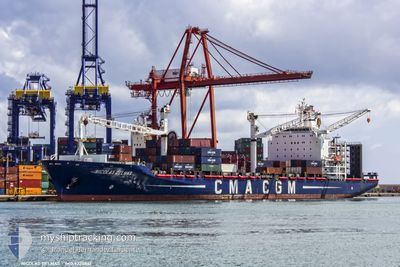
Container Ship
Current Trip
| Time Travelled | 2 days |
|---|---|
| Remaining Time | -5 mins |
| Distance Travelled | 603.05 nm |
| Remaining Distance | 20.18 nm |
| AVG Speed | 10.1 Knots |
| MAX Speed | 17.2 Knots |
| AVG Wind | 9.1 knots |
| MAX Wind | 19 knots |
| MIN Temp | 18.9°C / 66.02°F |
| MAX Temp | 23.1°C / 73.58°F |
| Draught | 7.9 m |
| Position Received | 2 h, 32 m ago |
Current Position
| Longitude | 14.46030° |
|---|---|
| Latitude | 35.61458° |
| Status | Under way using engine |
| Speed | 8.9 Knots |
| Course | 116.4° |
| Area | Mediterranean Sea - Eastern Basin |
| Station | T-AIS |
| Position Received | 2 h, 32 m ago |
Info
Information
The current position of NICOLAS DELMAS is in Mediterranean Sea - Eastern Basin with coordinates 35.61458° / 14.46030° as reported on 2024-06-05 12:38 by AIS to our vessel tracker app. The vessel's current speed is 8.9 Knots and is heading at the port of VALLETTA. The estimated time of arrival as calculated by MyShipTracking vessel tracking app is 2024-06-05 15:06 LT
The vessel NICOLAS DELMAS (IMO: 9220861, MMSI: 311326000) is a Container Ship that was built in 2002 ( 22 years old ). It's sailing under the flag of [BS] Bahamas.
In this page you can find informations about the vessels current position, last detected port calls, and current voyage information. If the vessels is not in coverage by AIS you will find the latest position.
The current position of NICOLAS DELMAS is detected by our AIS receivers and we are not responsible for the reliability of the data. The last position was recorded while the vessel was in Coverage by the Ais receivers of our vessel tracking app.
The current draught of NICOLAS DELMAS as reported by AIS is 7.9 meters
Weather
| Temperature | 22.2°C / 71.96°F |
|---|---|
| Wind Speed | 18 knots |
| Direction | 24° NNE |
| Pressure | 1012.2 hPa |
| Humidity | 83 % |
| Cloud Coverage | 99 % |
Featured Company
Last Port Calls
| Port | Arrival | Departure | Time In Port |
|---|---|---|---|
| 2024-05-26 15:27 | 2024-06-03 00:19 | 7 d | |
| 2024-05-10 20:14 | 2024-05-12 07:44 | 1 d | |
| 2024-05-06 18:00 | 2024-05-07 09:43 | 15 h | |
| 2024-05-05 04:35 | 2024-05-06 01:57 | 21 h | |
| 2024-04-28 09:56 | |||
| 2024-04-08 19:17 | 2024-04-09 22:52 | 1 d | |
| 2024-04-02 20:26 |
Most Visited Ports (Last year)
| Port | Arrivals | |
|---|---|---|
| 14 | ||
| 9 | ||
| 8 | ||
| 8 | ||
| 7 | ||
| 6 |
Last Trips
| Origin | Departure | Destination | Arrival | Distance | |
|---|---|---|---|---|---|
| 2024-05-12 09:44 | 2024-05-26 16:27 | 834.22 nm | |||
| 2024-05-07 11:43 | 2024-05-10 22:14 | 944.51 nm | |||
| 2024-05-06 03:57 | 2024-05-06 20:00 | 170.03 nm | |||
| 2024-04-28 10:56 | 2024-05-05 06:35 | 1433.73 nm | |||
| 2024-04-02 22:26 | 2024-04-08 21:17 | 901.55 nm |
Events
| Time | Event | Details | Position / Dest | Info |
|---|---|---|---|---|
| 2024-06-05 12:43 | Status Changed | Default Under way using engine |
35.60883 / 14.47480
MTMLA
|
Speed: 8.9 kn Course: 116.4° |
| 2024-06-05 12:38 | Status Changed | Under way using engine Default |
35.61458 / 14.46030
MTMLA
|
Speed: 8.8 kn Course: 117° |
| 2024-06-05 12:38 | OUT of Coverage |
35.61458 / 14.46030
Mediterranean Sea - Eastern Basin
MTMLA
|
Speed: 8.9 kn Course: 116.4° |
|
| 2024-06-05 12:28 | Status Changed | Default Under way using engine |
35.62568 / 14.43244
MTMLA
|
Speed: 8.6 kn Course: 115.9° |
| 2024-06-05 11:57 | Status Changed | Under way using engine Default |
35.65753 / 14.35017
MTMLA
|
Speed: 8.5 kn Course: 116° |
| 2024-06-05 11:51 | Status Changed | Default Under way using engine |
35.66334 / 14.33522
MTMLA
|
Speed: 8.4 kn Course: 116.8° |
| 2024-06-05 11:45 | Status Changed | Under way using engine Default |
35.67010 / 14.31828
MTMLA
|
Speed: 8.2 kn Course: 117° |
| 2024-06-05 11:40 | Status Changed | Default Under way using engine |
35.67545 / 14.30510
MTMLA
|
Speed: 8.2 kn Course: 116.3° |
| 2024-06-05 11:37 | Detected in Sea | Maltese part of the Mediterranean Sea - Eastern Basin |
35.67806 / 14.29883
Mediterranean Sea - Eastern Basin
MTMLA
|
Speed: 8.2 kn Course: 116.3° |
| 2024-06-05 11:37 | Status Changed | Under way using engine Default |
35.67806 / 14.29883
MTMLA
|
Speed: 8.1 kn Course: 115° |