
NICOLAS DELMAS
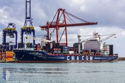
Container Ship
Current Trip
| Time Travelled | 3 days |
|---|---|
| Remaining Time | --- |
| Distance Travelled | 689.08 nm |
| Remaining Distance | --- |
| AVG Speed | 16 Noeuds |
| MAX Speed | 18.4 Noeuds |
| AVG Wind | 9.4 knots |
| MAX Wind | 20.9 knots |
| MIN Temp | 18.1°C / 64.58°F |
| MAX Temp | 20.5°C / 68.9°F |
| Tirant d eau | 9.1 m |
| Position reçue | 1 d depuis |
Current Position
| Longitude | 3.16414° |
|---|---|
| Latitude | 37.13570° |
| Etat | Under way using engine |
| Vitesse | 1.2 Noeuds |
| Parcours | 347° |
| Zone | Mediterranean Sea - Western Basin |
| Station | T-AIS |
| Position reçue | 1 d depuis |
Info
Information
The current position of NICOLAS DELMAS is in Mediterranean Sea - Western Basin with coordinates 37.13570° / 3.16414° as reported on 2024-05-14 19:15 by AIS to our vessel tracker app. The vessel's current speed is 1.2 Noeuds
The vessel NICOLAS DELMAS (IMO: 9220861, MMSI: 311326000) is a Container Ship that was built in 2002 ( 22 Age ). It's sailing under the flag of [BS] Bahamas.
In this page you can find informations about the vessels current position, last detected port calls, and current voyage information. If the vessels is not in coverage by AIS you will find the latest position.
The current position of NICOLAS DELMAS is detected by our AIS receivers and we are not responsible for the reliability of the data. The last position was recorded while the vessel was in Coverage by the Ais receivers of our vessel tracking app.
The current draught of NICOLAS DELMAS as reported by AIS is 9.1 meters
Weather
| Temperature | 18.4°C / 65.12°F |
|---|---|
| Wind Speed | 15 knots |
| Direction | 271° W |
| Pressure | 1009 hPa |
| Humidity | 69.9 % |
| Cloud Coverage | 5 % |
Featured Company
Last Port Calls
| Port | Arrival | Departure | Time In Port |
|---|---|---|---|
| 2024-05-10 20:14 | 2024-05-12 07:44 | 1 d | |
| 2024-05-06 18:00 | 2024-05-07 09:43 | 15 h | |
| 2024-05-05 04:35 | 2024-05-06 01:57 | 21 h | |
| 2024-04-28 09:56 | |||
| 2024-04-08 19:17 | 2024-04-09 22:52 | 1 d | |
| 2024-03-31 22:23 | 2024-04-02 20:26 | 1 d | |
| 2024-03-26 08:53 | 2024-03-27 10:13 | 1 d | |
| 2024-03-13 16:45 | 2024-03-21 15:56 | 7 d | |
| 2024-03-06 04:33 |
Most Visited Ports (Last year)
| Port | Arrivals | |
|---|---|---|
| 15 | ||
| 11 | ||
| 10 | ||
| 9 | ||
| 7 | ||
| 7 |
Last Trips
| Origin | Departure | Destination | Arrival | Distance | |
|---|---|---|---|---|---|
| 2024-05-07 11:43 | 2024-05-10 22:14 | 944.51 nm | |||
| 2024-05-06 03:57 | 2024-05-06 20:00 | 170.03 nm | |||
| 2024-04-28 10:56 | 2024-05-05 06:35 | 1433.73 nm | |||
| 2024-04-02 22:26 | 2024-04-08 21:17 | 901.55 nm | |||
| 2024-03-27 12:13 | 2024-04-01 00:23 | 185.93 nm | |||
| 2024-03-21 16:56 | 2024-03-26 10:53 | 1526.71 nm | |||
| 2024-03-06 05:33 | 2024-03-13 17:45 | 808.98 nm |
Events
| Heure | Evenement | Détails | Position/ Destination | Info |
|---|---|---|---|---|
| 2024-05-15 10:12 | Démarrage | 18.04 nm, North West of TAGNANT DJENET |
37.14301 / 3.55119
DZALG
|
Vitesse: 3.4 kn Parcours: 354° |
| 2024-05-15 03:13 | Arret | 20.54 nm, North of EL MARSA TAMANFOUSST |
37.13988 / 3.32646
DZALG
|
Vitesse: 0.3 kn Parcours: 333° |
| 2024-05-14 19:21 | Etat Changé | Default Under way using engine |
37.13582 / 3.16623
DZALG
|
Vitesse: 1.2 kn Parcours: 347° |
| 2024-05-14 19:15 | Etat Changé | Under way using engine Default |
37.13570 / 3.16414
DZALG
|
Vitesse: 1.2 kn Parcours: 343° |
| 2024-05-14 19:15 | Hors de la zone couverte |
37.13570 / 3.16414
Mediterranean Sea - Western Basin
|
Vitesse: 1.2 kn Parcours: 80.8° |
|
| 2024-05-14 19:04 | Etat Changé | Default Under way using engine |
37.13571 / 3.15965
DZALG
|
Vitesse: 1.4 kn Parcours: 351° |
| 2024-05-14 18:58 | Etat Changé | Under way using engine Default |
37.13555 / 3.15677
DZALG
|
Vitesse: 0.5 kn Parcours: 355° |
| 2024-05-14 18:56 | Dans la zone couverte |
37.13555 / 3.15677
Mediterranean Sea - Western Basin
|
Vitesse: 1.4 kn Parcours: 81.9° |
|
| 2024-05-14 12:24 | Démarrage | 19.64 nm, North West of TAGNANT DJENET |
37.17149 / 3.54801
DZALG
|
Vitesse: 4.9 kn Parcours: 260° |
| 2024-05-14 05:00 | Hors de la zone couverte |
37.14523 / 3.47804
Mediterranean Sea - Western Basin
|
Vitesse: 1 kn Parcours: 67.6° |