

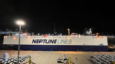
NEPTUNE THALASSA
Vehicles Carrier

Current Trip
| Time Travelled | 4 h, 29 mins |
|---|---|
| Remaining Time | 23 mins |
| Distance Travelled | 60.82 nm |
| Remaining Distance | 8.02 nm |
| AVG Speed | 14.1 Knots |
| MAX Speed | 16.8 Knots |
| AVG Wind | 14.2 knots |
| MAX Wind | 15.9 knots |
| MIN Temp | 1.2°C / 34.16°F |
| MAX Temp | 4.1°C / 39.38°F |
| Draught | 8.5 m |
| Position Received | Now |
Current Position
| Longitude | --- |
|---|---|
| Latitude | --- |
| Status | Under way using engine |
| Speed | 12 Knots |
| Course | 97.5° |
| Area | Sea of Marmara |
| Station | T-AIS |
| Position Received | Now |
Information
The current position of NEPTUNE THALASSA is in Sea of Marmara with coordinates 40.43480° / 28.96436° as reported on 2025-02-20 13:44 by AIS to our vessel tracker app. The vessel's current speed is 12 Knots and is heading at the port of GEMLIK. The estimated time of arrival as calculated by MyShipTracking vessel tracking app is 2025-02-20 14:08 LT
The vessel NEPTUNE THALASSA (IMO: 9668506, MMSI: 241859000) is a Vehicles Carrier that was built in 2014 ( 11 years old ). It's sailing under the flag of [GR] Greece.
In this page you can find informations about the vessels current position, last detected port calls, and current voyage information. If the vessels is not in coverage by AIS you will find the latest position.
The current position of NEPTUNE THALASSA is detected by our AIS receivers and we are not responsible for the reliability of the data. The last position was recorded while the vessel was in Coverage by the Ais receivers of our vessel tracking app.
The current draught of NEPTUNE THALASSA as reported by AIS is 8.5 meters
Weather
| Temperature | 1.3°C / 34.34°F |
|---|---|
| Wind Speed | 11 knots |
| Direction | 26° NNE |
| Pressure | 1030.6 hPa |
| Humidity | 62.8 % |
| Cloud Coverage | 93 % |


Featured Company
Last Port Calls
| Port | Arrival | Departure | Time In Port |
|---|---|---|---|
| 2025-02-19 20:43 | 2025-02-20 09:16 | 12 h | |
| 2025-02-18 00:23 | 2025-02-19 01:02 | 1 d | |
| 2025-02-17 11:24 | 2025-02-17 23:09 | 11 h | |
| 2025-02-12 18:05 | 2025-02-14 05:38 | 1 d | |
| 2025-02-11 06:23 | 2025-02-12 12:04 | 1 d | |
| 2025-02-06 17:35 | 2025-02-07 07:46 | 14 h | |
| 2025-02-05 18:03 | 2025-02-06 16:55 | 22 h | |
| 2025-02-04 23:56 | 2025-02-05 16:53 | 16 h | |
| 2025-01-31 06:17 | 2025-02-01 17:09 | 1 d | |
| 2025-01-27 12:02 | 2025-01-28 02:09 | 14 h |
Most Visited Ports (Last year)
| Port | Arrivals | |
|---|---|---|
| 8 | ||
| 8 | ||
| 7 | ||
| 7 | ||
| 7 | ||
| 6 |
Last Trips
| Origin | Departure | Destination | Arrival | Distance | |
|---|---|---|---|---|---|
| 2025-02-19 04:02 | 2025-02-19 23:43 | 15.97 nm | |||
| 2025-02-18 02:09 | 2025-02-18 03:23 | 13.46 nm | |||
| 2025-02-14 06:38 | 2025-02-17 14:24 | 1202.34 nm | |||
| 2025-02-12 13:04 | 2025-02-12 19:05 | 71.12 nm | |||
| 2025-02-07 10:46 | 2025-02-11 07:23 | 1208.03 nm | |||
| 2025-02-06 19:55 | 2025-02-06 20:35 | 4.56 nm | |||
| 2025-02-05 19:53 | 2025-02-05 21:03 | 13.44 nm | |||
| 2025-02-01 18:09 | 2025-02-05 02:56 | 1211.16 nm | |||
| 2025-01-28 05:09 | 2025-01-31 07:17 | 1199.09 nm | |||
| 2025-01-27 14:39 | 2025-01-27 15:02 | 2.51 nm |
Events
| Time | Event | Details | Position / Dest | Info |
|---|---|---|---|---|
| 2025-02-20 13:24 | Status Changed | Under way using engine Default |
40.44623 / 28.87871
TRGEM
|
Speed: 11.8 kn Course: 104° |
| 2025-02-20 13:01 | Status Changed | Default Under way using engine |
40.47398 / 28.78118
TRGEM
|
Speed: 12.6 kn Course: 112.3° |
| 2025-02-20 11:39 | ETA Changed | 2025/02/20 14:00 2025/02/20 16:00 |
40.66548 / 29.02829
TRGEM
|
Speed: 16.3 kn Course: 258.9° |
| 2025-02-20 09:53 | ETA Changed | 2025/02/20 16:00 2025/02/19 00:00 |
40.75301 / 29.55241
TRGEM
|
Speed: 11 kn Course: 279.2° |
| 2025-02-20 09:16 | PORT DEPARTURE |
|
40.75549 / 29.73875
TRGEM
|
Speed: 8.8 kn Course: 249° |
| 2025-02-20 09:15 | START Moving |
40.75712 / 29.74374
[TR] KORFEZ
|
Speed: 4.8 kn Course: 240° |
|
| 2025-02-20 09:12 | Status Changed | Under way using engine Moored |
40.75829 / 29.74575
[TR] KORFEZ
|
Speed: 0.5 kn Course: 242° |
| 2025-02-20 09:10 | Destination Changed | TRGEM TRYAR |
40.75854 / 29.74571
[TR] KORFEZ
|
Speed: Course: 245° |
| 2025-02-20 09:09 | Draught Changed | 8.5 7.6 |
40.75854 / 29.74571
[TR] KORFEZ
|
Speed: Course: 245° |
| 2025-02-20 03:26 | Status Changed | Moored Default |
40.75852 / 29.74576
[TR] KORFEZ
|
Speed: Course: 245° |