
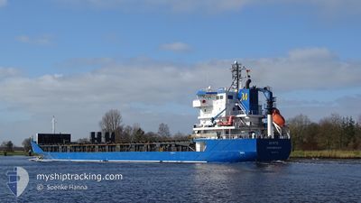
MYRTE
General Cargo
Current Trip
| Time Travelled | 10 days |
|---|---|
| Remaining Time | 2 days |
| Distance Travelled | 2958.82 nm |
| Remaining Distance | 831.55 nm |
| AVG Speed | 11.9 Knots |
| MAX Speed | 15.1 Knots |
| AVG Wind | 7.9 knots |
| MAX Wind | 21 knots |
| MIN Temp | -5.3°C / 22.46°F |
| MAX Temp | 16.3°C / 61.34°F |
| Draught | 7.2 m |
| Position Received | 10 h, 39 m ago |
Current Position
| Longitude | --- |
|---|---|
| Latitude | --- |
| Status | Under way using engine |
| Speed | 13 Knots |
| Course | 87° |
| Area | Alboran Sea |
| Station | T-AIS |
| Position Received | 10 h, 39 m ago |
Info
Information
The current position of MYRTE is in Alboran Sea with coordinates 36.06787° / -4.74248° as reported on 2025-03-16 20:04 by AIS to our vessel tracker app. The vessel's current speed is 13 Knots and is heading at the port of GENOVA. The estimated time of arrival as calculated by MyShipTracking vessel tracking app is 2025-03-19 10:53 LT
The vessel MYRTE (IMO: 9364136, MMSI: 246110000) is a General Cargo that was built in 2008 ( 17 years old ). It's sailing under the flag of [NL] Netherlands.
In this page you can find informations about the vessels current position, last detected port calls, and current voyage information. If the vessels is not in coverage by AIS you will find the latest position.
The current position of MYRTE is detected by our AIS receivers and we are not responsible for the reliability of the data. The last position was recorded while the vessel was in Coverage by the Ais receivers of our vessel tracking app.
The current draught of MYRTE as reported by AIS is 7.2 meters
Weather
| Temperature | 15.5°C / 59.9°F |
|---|---|
| Wind Speed | 9 knots |
| Direction | 208° SSW |
| Pressure | 1015.2 hPa |
| Humidity | 80.7 % |
| Cloud Coverage | 53 % |
Featured Company
Last Port Calls
| Port | Arrival | Departure | Time In Port |
|---|---|---|---|
| 2025-03-05 10:45 | 2025-03-06 10:10 | 23 h | |
| 2025-03-02 20:49 | 2025-03-05 08:17 | 2 d | |
| 2025-02-21 12:16 | 2025-02-25 22:14 | 4 d | |
| 2025-02-21 01:58 | 2025-02-21 03:30 | 1 h | |
| 2025-02-16 09:51 | 2025-02-21 00:08 | 4 d | |
| 2025-02-16 08:25 | 2025-02-16 08:39 | 13 m | |
| 2025-02-05 11:17 | 2025-02-05 16:17 | 4 h | |
| 2025-01-31 00:42 | 2025-02-02 02:34 | 2 d | |
| 2025-01-21 15:54 | 2025-01-24 16:53 | 3 d | |
| 2025-01-18 08:29 | 2025-01-19 06:59 | 22 h |
Most Visited Ports (Last year)
| Port | Arrivals | |
|---|---|---|
| 3 | ||
| 3 | ||
| 3 | ||
| 3 | ||
| 2 | ||
| 2 |
Last Trips
| Origin | Departure | Destination | Arrival | Distance | |
|---|---|---|---|---|---|
| 2025-03-05 08:17 | 2025-03-05 10:45 | 19.22 nm | |||
| 2025-02-25 22:14 | 2025-03-02 20:49 | 1474.65 nm | |||
| 2025-02-21 03:30 | 2025-02-21 12:16 | 103.07 nm | |||
| 2025-02-21 00:08 | 2025-02-21 01:58 | 9.60 nm | |||
| 2025-02-16 08:39 | 2025-02-16 09:51 | 7.34 nm | |||
| 2025-02-05 16:17 | 2025-02-16 08:25 | 2377.41 nm | |||
| 2025-02-02 02:34 | 2025-02-05 11:17 | 1007.20 nm | |||
| 2025-01-24 16:53 | 2025-01-31 00:42 | 816.14 nm | |||
| 2025-01-19 06:59 | 2025-01-21 15:54 | 76.79 nm | |||
| 2025-01-16 23:21 | 2025-01-18 08:29 | 320.06 nm |
Events
| Time | Event | Details | Position / Dest | Info |
|---|---|---|---|---|
| 2025-03-16 20:08 | Status Changed | Default Under way using engine |
36.06867 / -4.72633
GENOA
|
Speed: 13 kn Course: 87° |
| 2025-03-16 20:04 | OUT of Coverage |
36.06787 / -4.74248
Alboran Sea
GENOA
|
Speed: 13 kn Course: 87° |
|
| 2025-03-16 19:21 | Status Changed | Under way using engine Default |
36.04900 / -4.93067
GENOA
|
Speed: 12.5 kn Course: 83° |
| 2025-03-16 18:59 | Status Changed | Default Under way using engine |
36.03517 / -5.02483
GENOA
|
Speed: 12.2 kn Course: 73° |
| 2025-03-16 18:50 | Change Sea Area | Spanish part of the Alboran Sea Spanish part of the Strait of Gibraltar |
36.02664 / -5.05972
Alboran Sea
GENOA
|
Speed: 12.2 kn Course: 73° |
| 2025-03-16 18:50 | Status Changed | Under way using engine Default |
36.02664 / -5.05972
GENOA
|
Speed: 13.1 kn Course: 80° |
| 2025-03-16 18:32 | IN Coverage |
36.02664 / -5.05972
Alboran Sea
GENOA
|
Speed: 12.2 kn Course: 73° |
|
| 2025-03-16 17:51 | Status Changed | Default Under way using engine |
35.99500 / -5.33267
GENOA
|
Speed: 14 kn Course: 75° |
| 2025-03-16 17:46 | Change Sea Area | Spanish part of the Strait of Gibraltar Moroccan part of the Strait of Gibraltar |
35.99083 / -5.35283
Strait of Gibraltar
GENOA
|
Speed: 14 kn Course: 75° |
| 2025-03-16 17:46 | OUT of Coverage |
35.99083 / -5.35283
Strait of Gibraltar
GENOA
|
Speed: 14 kn Course: 75° |