

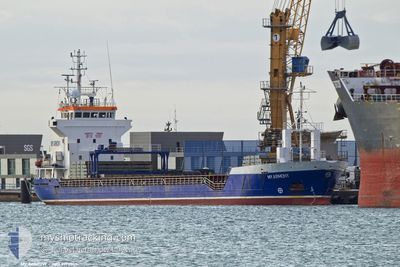
MY ARMONY
General Cargo

Current Trip
| Time Travelled | 4 days |
|---|---|
| Remaining Time | 5 days |
| Distance Travelled | 500.16 nm |
| Remaining Distance | 1694.94 nm |
| AVG Speed | 8.5 Knots |
| MAX Speed | 12.7 Knots |
| AVG Wind | 14.1 knots |
| MAX Wind | 25 knots |
| MIN Temp | 1.9°C / 35.42°F |
| MAX Temp | 15.4°C / 59.72°F |
| Draught | 6.1 m |
| Position Received | 1 d ago |
Current Position
| Longitude | --- |
|---|---|
| Latitude | --- |
| Status | Under way using engine |
| Speed | 10.7 Knots |
| Course | 209.3° |
| Area | Aegean Sea |
| Station | T-AIS |
| Position Received | 1 d ago |
Information
The current position of MY ARMONY is in Aegean Sea with coordinates 37.72752° / 24.21161° as reported on 2025-03-20 12:09 by AIS to our vessel tracker app. The vessel's current speed is 10.7 Knots and is heading at the port of SETUBAL. The estimated time of arrival as calculated by MyShipTracking vessel tracking app is 2025-03-27 14:28 LT
The vessel MY ARMONY (IMO: 9190365, MMSI: 314490000) is a General Cargo that was built in 1999 ( 26 years old ). It's sailing under the flag of [BB] Barbados.
In this page you can find informations about the vessels current position, last detected port calls, and current voyage information. If the vessels is not in coverage by AIS you will find the latest position.
The current position of MY ARMONY is detected by our AIS receivers and we are not responsible for the reliability of the data. The last position was recorded while the vessel was in Coverage by the Ais receivers of our vessel tracking app.
The current draught of MY ARMONY as reported by AIS is 6.1 meters
Weather
| Temperature | 14.2°C / 57.56°F |
|---|---|
| Wind Speed | 12 knots |
| Direction | 201° SSW |
| Pressure | 1022.6 hPa |
| Humidity | 65.8 % |
| Cloud Coverage | 93 % |


Featured Company
Last Port Calls
| Port | Arrival | Departure | Time In Port |
|---|---|---|---|
| 2025-03-13 13:59 | 2025-03-17 09:46 | 3 d | |
| 2025-03-07 09:16 | 2025-03-11 14:17 | 4 d | |
| 2025-02-24 23:19 | 2025-02-26 21:21 | 1 d | |
| 2025-02-18 20:34 | 2025-02-20 20:59 | 2 d | |
| 2025-02-08 10:33 | 2025-02-10 14:22 | 2 d | |
| 2025-01-31 09:09 | 2025-02-05 11:15 | 5 d | |
| 2025-01-19 13:43 | 2025-01-21 19:59 | 2 d | |
| 2025-01-10 15:47 | 2025-01-12 20:00 | 2 d | |
| 2025-01-09 19:20 | 2025-01-10 13:38 | 18 h | |
| 2025-01-03 20:20 | 2025-01-08 21:14 | 5 d |
Last Trips
| Origin | Departure | Destination | Arrival | Distance | |
|---|---|---|---|---|---|
| 2025-03-11 14:17 | 2025-03-13 13:59 | 247.93 nm | |||
| 2025-02-26 21:21 | 2025-03-07 09:16 | 1810.06 nm | |||
| 2025-02-20 20:59 | 2025-02-24 23:19 | 36.47 nm | |||
| 2025-02-10 14:22 | 2025-02-18 20:34 | 1247.40 nm | |||
| 2025-02-05 11:15 | 2025-02-08 10:33 | 78.93 nm | |||
| 2025-01-21 19:59 | 2025-01-31 09:09 | 2366.13 nm | |||
| 2025-01-12 20:00 | 2025-01-19 13:43 | 683.38 nm | |||
| 2025-01-08 21:14 | 2025-01-10 15:47 | 251.17 nm | |||
| 2025-01-08 21:14 | 2025-01-09 19:20 | 231.57 nm | |||
| 2024-12-30 04:46 | 2025-01-03 20:20 | 1108.95 nm |
Events
| Time | Event | Details | Position / Dest | Info |
|---|---|---|---|---|
| 2025-03-20 12:12 | Status Changed | Default Under way using engine |
37.72097 / 24.20693
PT SET
|
Speed: 10.7 kn Course: 209.3° |
| 2025-03-20 12:09 | OUT of Coverage |
37.72752 / 24.21161
Aegean Sea
PT SET
|
Speed: 10.7 kn Course: 209.3° |
|
| 2025-03-20 10:59 | Status Changed | Under way using engine Default |
37.85279 / 24.41362
PT SET
|
Speed: 10.4 kn Course: 239° |
| 2025-03-20 10:55 | Status Changed | Default Under way using engine |
37.85858 / 24.42580
PT SET
|
Speed: 10.5 kn Course: 239.1° |
| 2025-03-20 10:50 | Status Changed | Under way using engine Default |
37.86589 / 24.44102
PT SET
|
Speed: 10.7 kn Course: 235° |
| 2025-03-20 10:33 | Status Changed | Default Under way using engine |
37.89278 / 24.49554
PT SET
|
Speed: 10.9 kn Course: 236.5° |
| 2025-03-20 05:11 | Status Changed | Under way using engine Default |
38.69583 / 25.04050
PT SET
|
Speed: 9.9 kn Course: 205° |
| 2025-03-20 05:11 | IN Coverage |
38.69004 / 25.03685
Aegean Sea
PT SET
|
Speed: 10 kn Course: 207.4° |
|
| 2025-03-19 23:36 | Status Changed | Default Under way using engine |
39.55069 / 25.58322
PT SET
|
Speed: 10.2 kn Course: 205.6° |
| 2025-03-19 23:32 | OUT of Coverage |
39.56053 / 25.58932
Aegean Sea
PT SET
|
Speed: 10.2 kn Course: 205.6° |