

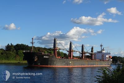
MV BOBIC
Bulk Carrier

Current Trip
| Time Travelled | 11 days |
|---|---|
| Remaining Time | --- |
| Distance Travelled | 3045.69 nm |
| Remaining Distance | --- |
| AVG Speed | 11.7 Knots |
| MAX Speed | 13.7 Knots |
| AVG Wind | 9.4 knots |
| MAX Wind | 21.8 knots |
| MIN Temp | 22.8°C / 73.04°F |
| MAX Temp | 29.4°C / 84.92°F |
| Draught | 9.7 m |
| Position Received | 7 m ago |
Current Position
| Longitude | --- |
|---|---|
| Latitude | --- |
| Status | At anchor |
| Speed | |
| Course | 264° |
| Area | Malacca Strait |
| Station | T-AIS |
| Position Received | 7 m ago |
Information
The current position of MV BOBIC is in Malacca Strait with coordinates -20.14745° / 57.45660° as reported on 2025-03-25 06:25 by AIS to our vessel tracker app. The vessel's current speed is 0 Knots
The vessel MV BOBIC (IMO: 9317781, MMSI: 538006462) is a Bulk Carrier that was built in 2006 ( 19 years old ). It's sailing under the flag of [MH] Marshall Is.
In this page you can find informations about the vessels current position, last detected port calls, and current voyage information. If the vessels is not in coverage by AIS you will find the latest position.
The current position of MV BOBIC is detected by our AIS receivers and we are not responsible for the reliability of the data. The last position was recorded while the vessel was in Coverage by the Ais receivers of our vessel tracking app.
The current draught of MV BOBIC as reported by AIS is 9.7 meters
Weather
| Temperature | 28°C / 82.4°F |
|---|---|
| Wind Speed | 2 knots |
| Direction | 116° ESE |
| Pressure | 1013.7 hPa |
| Humidity | 62.6 % |
| Cloud Coverage | 100 % |


Featured Company
Events
| Time | Event | Details | Position / Dest | Info |
|---|---|---|---|---|
| 2025-03-25 06:16 | Status Changed | At anchor Default |
-20.14738 / 57.45655
MU PLU
|
Speed: Course: 266° |
| 2025-03-25 06:04 | Status Changed | Default At anchor |
-20.14750 / 57.45665
MU PLU
|
Speed: 0.1 kn Course: 296° |
| 2025-03-25 05:40 | Status Changed | At anchor Default |
-20.14842 / 57.45623
MU PLU
|
Speed: 0.1 kn Course: 305° |
| 2025-03-25 05:22 | Status Changed | Default At anchor |
-20.14881 / 57.45553
MU PLU
|
Speed: 0.3 kn Course: 348° |
| 2025-03-25 04:46 | Status Changed | At anchor Default |
-20.14900 / 57.45413
MU PLU
|
Speed: 0.1 kn Course: 3° |
| 2025-03-25 04:43 | Status Changed | Default At anchor |
-20.14898 / 57.45425
MU PLU
|
Speed: Course: 2° |
| 2025-03-25 03:36 | Draught Changed | 9.7 9.8 |
-20.14870 / 57.45453
MU PLU
|
Speed: 0.1 kn Course: 1° |
| 2025-03-25 03:36 | Destination Changed | MU PLU MY PKG |
-20.14870 / 57.45453
MU PLU
|
Speed: 0.1 kn Course: 1° |
| 2025-03-25 03:36 | ETA Changed | 2025/03/24 12:00 2025/02/15 04:00 |
-20.14870 / 57.45453
MU PLU
|
Speed: 0.1 kn Course: 1° |
| 2025-03-25 03:34 | Status Changed | At anchor Default |
-20.14870 / 57.45453
MY PKG
|
Speed: 0.1 kn Course: 6° |