
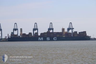
MSC TESSA
Cargo A
Current Trip
| Time Travelled | 10 h, 31 mins |
|---|---|
| Remaining Time | --- |
| Distance Travelled | 151.51 nm |
| Remaining Distance | --- |
| AVG Speed | 13.2 Knots |
| MAX Speed | 16.9 Knots |
| AVG Wind | 21 knots |
| MAX Wind | 33.9 knots |
| MIN Temp | 22.7°C / 72.86°F |
| MAX Temp | 24.7°C / 76.46°F |
| Draught | 13.5 m |
| Position Received | 1 m ago |
Current Position
| Longitude | -7.87362° |
|---|---|
| Latitude | 34.52353° |
| Status | Under way using engine |
| Speed | 14.2 Knots |
| Course | 222.9° |
| Area | North Atlantic Ocean |
| Station | T-AIS |
| Position Received | 1 m ago |
Info
Information
The current position of MSC TESSA is in North Atlantic Ocean with coordinates 34.52353° / -7.87362° as reported on 2024-09-15 01:53 by AIS to our vessel tracker app. The vessel's current speed is 14.2 Knots and is heading at the port of SINGAPORE. The estimated time of arrival as calculated by MyShipTracking vessel tracking app is 2024-10-15 21:30 LT
The vessel MSC TESSA (IMO: 9930038, MMSI: 636022102) is a Cargo A It's sailing under the flag of [LR] Liberia.
In this page you can find informations about the vessels current position, last detected port calls, and current voyage information. If the vessels is not in coverage by AIS you will find the latest position.
The current position of MSC TESSA is detected by our AIS receivers and we are not responsible for the reliability of the data. The last position was recorded while the vessel was in Coverage by the Ais receivers of our vessel tracking app.
The current draught of MSC TESSA as reported by AIS is 13.5 meters
Weather
| Temperature | 23.6°C / 74.48°F |
|---|---|
| Wind Speed | 5 knots |
| Direction | 316° NW |
| Pressure | 1013.5 hPa |
| Humidity | 81.2 % |
| Cloud Coverage | --- |
Featured Company
Last Port Calls
| Port | Arrival | Departure | Time In Port |
|---|---|---|---|
| 2024-09-13 16:56 | 2024-09-14 15:24 | 22 h | |
| 2024-09-02 22:40 | 2024-09-06 14:13 | 3 d | |
| 2024-08-23 16:30 | 2024-08-25 06:22 | 1 d | |
| 2024-08-22 02:48 | 2024-08-23 02:28 | 23 h | |
| 2024-08-18 23:15 | 2024-08-19 22:20 | 23 h | |
| 2024-08-13 02:54 | 2024-08-15 17:02 | 2 d | |
| 2024-07-14 11:14 | 2024-07-16 03:25 | 1 d | |
| 2024-07-09 15:37 | 2024-07-10 14:58 | 23 h |
Most Visited Ports (Last year)
| Port | Arrivals | |
|---|---|---|
| 7 | ||
| 4 | ||
| 4 | ||
| 3 | ||
| 3 | ||
| 2 |
Last Trips
| Origin | Departure | Destination | Arrival | Distance | |
|---|---|---|---|---|---|
| 2024-09-06 16:13 | 2024-09-13 17:56 | 1463.72 nm | |||
| 2024-08-25 08:22 | 2024-09-03 00:40 | 608.37 nm | |||
| 2024-08-23 04:28 | 2024-08-23 18:30 | 149.37 nm | |||
| 2024-08-20 00:20 | 2024-08-22 04:48 | 340.44 nm | |||
| 2024-08-15 18:02 | 2024-08-19 01:15 | 983.17 nm | |||
| 2024-07-16 11:25 | 2024-08-13 03:54 | 10932.74 nm | |||
| 2024-07-10 22:58 | 2024-07-14 19:14 | 1489.87 nm | |||
| 2024-06-24 19:52 | 2024-07-09 23:37 | 3500.41 nm |
Events
| Time | Event | Details | Position / Dest | Info |
|---|---|---|---|---|
| 2024-09-14 19:34 | Change Sea Area | Moroccan part of the North Atlantic Ocean Moroccan part of the Strait of Gibraltar |
35.62741 / -6.62021
North Atlantic Ocean
|
Speed: 14.3 kn Course: 227.3° |
| 2024-09-14 19:33 | Status Changed | Under way using engine Default |
35.63089 / -6.61562
SGSIN PWBGA
|
Speed: 14.3 kn Course: 227° |
| 2024-09-14 19:31 | IN Coverage |
35.62741 / -6.62021
North Atlantic Ocean
|
Speed: 14.3 kn Course: 227.3° |
|
| 2024-09-14 16:47 | Status Changed | Default Under way using engine |
35.92729 / -5.80812
SGSIN PWBGA
|
Speed: 15.5 kn Course: 255.2° |
| 2024-09-14 16:36 | Change Sea Area | Moroccan part of the Strait of Gibraltar Spanish part of the Strait of Gibraltar |
35.94140 / -5.75038
Strait of Gibraltar
|
Speed: 15.5 kn Course: 255.2° |
| 2024-09-14 16:36 | OUT of Coverage |
35.94140 / -5.75038
Strait of Gibraltar
|
Speed: 15.5 kn Course: 255.2° |
|
| 2024-09-14 16:31 | Status Changed | Under way using engine Default |
35.94571 / -5.72726
SGSIN PWBGA
|
Speed: 15.2 kn Course: 259° |
| 2024-09-14 16:31 | Status Changed | Default Under way using engine |
35.94594 / -5.72572
SGSIN PWBGA
|
Speed: 15.1 kn Course: 268.2° |
| 2024-09-14 15:52 | Change Sea Area | Spanish part of the Strait of Gibraltar Moroccan part of the Strait of Gibraltar |
35.95629 / -5.53866
Strait of Gibraltar
|
Speed: 12.2 kn Course: 266.1° |
| 2024-09-14 15:24 | PORT DEPARTURE |
|
35.90209 / -5.49220
SGSIN PWBGA
|
Speed: 6.3 kn Course: 10° |