
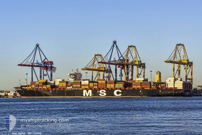
MSC SASHA
Cargo A
Current Trip
| Time Travelled | 5 days |
|---|---|
| Remaining Time | --- |
| Distance Travelled | 2442.36 nm |
| Remaining Distance | --- |
| AVG Speed | 17.9 Knots |
| MAX Speed | 20.3 Knots |
| AVG Wind | 11 knots |
| MAX Wind | 17 knots |
| MIN Temp | 19.8°C / 67.64°F |
| MAX Temp | 27.9°C / 82.22°F |
| Draught | 13.6 m |
| Position Received | 4 d ago |
Current Position
| Longitude | --- |
|---|---|
| Latitude | --- |
| Status | Under way using engine |
| Speed | 17.4 Knots |
| Course | 54.7° |
| Area | Caribbean Sea |
| Station | T-AIS |
| Position Received | 4 d ago |
Info
Information
The current position of MSC SASHA is in Caribbean Sea with coordinates 13.61248° / -74.37376° as reported on 2026-01-05 19:41 by AIS to our vessel tracker app. The vessel's current speed is 17.4 Knots and is heading at the port of THAMES.
The vessel MSC SASHA (IMO: 9720500, MMSI: 255805897) is a Cargo A It's sailing under the flag of [PT] Portugal.
In this page you can find informations about the vessels current position, last detected port calls, and current voyage information. If the vessels is not in coverage by AIS you will find the latest position.
The current position of MSC SASHA is detected by our AIS receivers and we are not responsible for the reliability of the data. The last position was recorded while the vessel was in Coverage by the Ais receivers of our vessel tracking app.
The current draught of MSC SASHA as reported by AIS is 13.6 meters
Weather
| Temperature | 19.9°C / 67.82°F |
|---|---|
| Wind Speed | 10 knots |
| Direction | 329° NNW |
| Pressure | 1021.2 hPa |
| Humidity | 79.8 % |
| Cloud Coverage | 78 % |
Featured Company
Last Port Calls
| Port | Arrival | Departure | Time In Port |
|---|---|---|---|
| 2026-01-03 12:23 | 2026-01-04 15:21 | 1 d | |
| 2026-01-01 02:46 | 2026-01-03 07:08 | 2 d | |
| 2025-12-30 03:55 | 2025-12-31 05:55 | 1 d | |
| 2025-12-27 06:09 | 2025-12-27 17:45 | 11 h | |
| 2025-12-24 23:55 | 2025-12-25 09:07 | 9 h | |
| 2025-12-20 07:43 | 2025-12-21 11:19 | 1 d | |
| 2025-12-17 22:59 | 2025-12-19 13:35 | 1 d | |
| 2025-12-16 00:02 | 2025-12-17 01:34 | 1 d | |
| 2025-12-11 13:22 | 2025-12-12 07:26 | 18 h | |
| 2025-12-07 17:11 | 2025-12-08 08:51 | 15 h |
Last Trips
| Origin | Departure | Destination | Arrival | Distance | |
|---|---|---|---|---|---|
| 2026-01-03 07:08 | 2026-01-03 12:23 | 24.61 nm | |||
| 2025-12-31 05:55 | 2026-01-01 02:46 | 67.81 nm | |||
| 2025-12-27 17:45 | 2025-12-30 03:55 | 868.61 nm | |||
| 2025-12-25 09:07 | 2025-12-27 06:09 | 513.22 nm | |||
| 2025-12-21 11:19 | 2025-12-24 23:55 | 1322.73 nm | |||
| 2025-12-19 13:35 | 2025-12-20 07:43 | 271.04 nm | |||
| 2025-12-17 01:34 | 2025-12-17 22:59 | 265.12 nm | |||
| 2025-12-12 07:26 | 2025-12-16 00:02 | 1486.50 nm | |||
| 2025-12-08 08:51 | 2025-12-11 13:22 | 1355.53 nm | |||
| 2025-12-07 06:39 | 2025-12-07 17:11 | 36.97 nm |
Events
| Time | Event | Details | Position / Dest | Info |
|---|---|---|---|---|
| 2026-01-05 19:47 | Status Changed | Default Under way using engine |
13.62828 / -74.35162
GBLGP
|
Speed: 17.4 kn Course: 54.7° |
| 2026-01-05 19:41 | OUT of Coverage |
13.61248 / -74.37376
Caribbean Sea
|
Speed: 17.4 kn Course: 54.7° |
|
| 2026-01-05 19:40 | Status Changed | Under way using engine Default |
13.60969 / -74.37779
GBLGP
|
Speed: 17.4 kn Course: 55° |
| 2026-01-05 19:35 | Status Changed | Default Under way using engine |
13.59355 / -74.40101
GBLGP
|
Speed: 17.4 kn Course: 54.8° |
| 2026-01-05 19:27 | Status Changed | Under way using engine Default |
13.57295 / -74.43072
GBLGP
|
Speed: 17.4 kn Course: 55° |
| 2026-01-05 19:27 | Status Changed | Default Under way using engine |
13.57069 / -74.43404
GBLGP
|
Speed: 17.4 kn Course: 54.5° |
| 2026-01-05 17:37 | Change Sea Area | Colombian part of the Caribbean Sea Panamanian part of the Caribbean Sea |
13.24438 / -74.88359
Caribbean Sea
|
Speed: 18.2 kn Course: 55.1° |
| 2026-01-05 17:37 | Status Changed | Under way using engine Default |
13.24438 / -74.88359
GBLGP
|
Speed: 18.1 kn Course: 55° |
| 2026-01-05 17:31 | IN Coverage |
13.24438 / -74.88359
Caribbean Sea
|
Speed: 18.2 kn Course: 55.1° |
|
| 2026-01-04 22:42 | OUT of Coverage |
9.77039 / -79.57476
Caribbean Sea
|
Speed: 19.9 kn Course: 53° |