
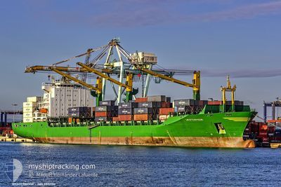
MSC SAMU
Container Ship
Current Trip
| Trip Time | 3 days |
|---|---|
| Trip Distance | 147.21 nm |
| AVG Speed | 11.4 Knots |
| MAX Speed | 14.6 Knots |
| Draught | 11.1 m |
| AVG Wind | 9.7 knots |
| MAX Wind | 15 knots |
| MIN Temp | 26.2°C / 79.16°F |
| MAX Temp | 28.7°C / 83.66°F |
| Position Received | 15 d ago |
Current Position
| Longitude | --- |
|---|---|
| Latitude | --- |
| Status | Under way using engine |
| Speed | 14.6 Knots |
| Course | 340.7° |
| Area | South Atlantic Ocean |
| Station | T-AIS |
| Position Received | 15 d ago |
Info
Information
The current position of MSC SAMU is in South Atlantic Ocean with coordinates -27.80900° / 15.32367° as reported on 2025-11-27 14:33 by AIS to our vessel tracker app. The vessel's current speed is 14.6 Knots and is currently inside the port of LOME.
The vessel MSC SAMU (IMO: 9222106, MMSI: 636020700) is a Container Ship that was built in 2001 ( 24 years old ). It's sailing under the flag of [LR] Liberia.
In this page you can find informations about the vessels current position, last detected port calls, and current voyage information. If the vessels is not in coverage by AIS you will find the latest position.
The current position of MSC SAMU is detected by our AIS receivers and we are not responsible for the reliability of the data. The last position was recorded while the vessel was in Coverage by the Ais receivers of our vessel tracking app.
The current draught of MSC SAMU as reported by AIS is 11.1 meters
Weather
| Temperature | 32.2°C / 89.96°F |
|---|---|
| Wind Speed | 9 knots |
| Direction | 162° SSE |
| Pressure | 1007.5 hPa |
| Humidity | 48.6 % |
| Cloud Coverage | 79 % |
Featured Company
Last Port Calls
| Port | Arrival | Departure | Time In Port |
|---|---|---|---|
| 2025-12-12 04:09 | |||
| 2025-12-06 08:07 | 2025-12-08 13:17 | 2 d | |
| 2025-12-01 00:16 | 2025-12-02 08:40 | 1 d | |
| 2025-11-14 07:48 | 2025-11-26 10:33 | 12 d | |
| 2025-11-09 02:06 | 2025-11-12 02:43 | 3 d | |
| 2025-11-03 08:52 | 2025-11-06 20:06 | 3 d | |
| 2025-10-31 05:59 | 2025-11-02 03:03 | 1 d | |
| 2025-10-23 07:55 | 2025-10-24 22:27 | 1 d | |
| 2025-10-20 19:11 | 2025-10-21 18:31 | 23 h | |
| 2025-10-18 21:15 | 2025-10-20 06:19 | 1 d |
Last Trips
| Origin | Departure | Destination | Arrival | Distance | |
|---|---|---|---|---|---|
| 2025-12-08 14:17 | 2025-12-12 04:09 | 147.21 nm | |||
| 2025-12-02 09:40 | 2025-12-06 09:07 | 1261.71 nm | |||
| 2025-11-26 12:33 | 2025-12-01 01:16 | 1611.87 nm | |||
| 2025-11-12 04:43 | 2025-11-14 09:48 | 815.04 nm | |||
| 2025-11-06 22:06 | 2025-11-09 04:06 | 67.31 nm | |||
| 2025-11-02 05:03 | 2025-11-03 10:52 | 404.73 nm | |||
| 2025-10-25 00:27 | 2025-10-31 07:59 | 1153.03 nm | |||
| 2025-10-21 19:31 | 2025-10-23 09:55 | 530.70 nm | |||
| 2025-10-20 07:19 | 2025-10-20 20:11 | 219.12 nm | |||
| 2025-10-18 09:03 | 2025-10-18 22:15 | 238.73 nm |
Events
| Time | Event | Details | Position / Dest | Info |
|---|---|---|---|---|
| 2025-12-12 04:31 | STOP Moving |
6.13633 / 1.27517
[TG] LOME
|
Speed: 0.2 kn Course: 90° |
|
| 2025-12-12 04:09 | PORT ARRIVAL |
|
6.13633 / 1.28700
[TG] LOME
|
Speed: 7.8 kn Course: 272° |
| 2025-12-12 03:45 | START Moving | 2.51 nm, South East of LOME |
6.11633 / 1.32333
AOLAD
|
Speed: 5.1 kn Course: 321° |
| 2025-12-12 03:29 | STOP Moving | 2.71 nm, South East of LOME |
6.11233 / 1.32467
AOLAD
|
Speed: 0.3 kn Course: 357° |
| 2025-12-12 03:01 | START Moving | 3.31 nm, South East of LOME |
6.10267 / 1.33017
AOLAD
|
Speed: 5.5 kn Course: 320° |
| 2025-12-12 02:37 | STOP Moving | 3.57 nm, South East of LOME |
6.09750 / 1.33150
AOLAD
|
Speed: 0.3 kn Course: 336° |
| 2025-12-12 01:41 | START Moving | 5.24 nm, South East of LOME |
6.05767 / 1.32350
AOLAD
|
Speed: 4.9 kn Course: 70° |
| 2025-12-09 00:02 | STOP Moving | 5.51 nm, South East of LOME |
6.05400 / 1.32617
AOLAD
|
Speed: 0.1 kn Course: -1° |
| 2025-12-08 13:17 | PORT DEPARTURE |
|
6.38267 / 3.40600
AOLAD
|
Speed: 11.4 kn Course: -1° |
| 2025-12-08 12:25 | START Moving |
6.42917 / 3.33650
[NG] LAGOS
|
Speed: 4.1 kn Course: -1° |