
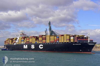
MSC MADELEINE
Container Ship
Current Trip
| Time Travelled | 1 day |
|---|---|
| Remaining Time | 2 days |
| Distance Travelled | 746.73 nm |
| Remaining Distance | 986.42 nm |
| AVG Speed | 18.3 Knots |
| MAX Speed | 19.7 Knots |
| AVG Wind | 10.1 knots |
| MAX Wind | 16.9 knots |
| MIN Temp | 16.9°C / 62.42°F |
| MAX Temp | 22.6°C / 72.68°F |
| Draught | 12.7 m |
| Position Received | 33 m ago |
Current Position
| Longitude | 14.92804° |
|---|---|
| Latitude | 36.42106° |
| Status | Under way using engine |
| Speed | 18.1 Knots |
| Course | 92.4° |
| Area | Mediterranean Sea - Eastern Basin |
| Station | T-AIS |
| Position Received | 33 m ago |
Info
Information
The current position of MSC MADELEINE is in Mediterranean Sea - Eastern Basin with coordinates 36.42106° / 14.92804° as reported on 2024-05-06 03:59 by AIS to our vessel tracker app. The vessel's current speed is 18.1 Knots and is heading at the port of MERSIN. The estimated time of arrival as calculated by MyShipTracking vessel tracking app is 2024-05-08 10:14 LT
The vessel MSC MADELEINE (IMO: 9305702, MMSI: 353728000) is a Container Ship that was built in 2006 ( 18 years old ). It's sailing under the flag of [PA] Panama.
In this page you can find informations about the vessels current position, last detected port calls, and current voyage information. If the vessels is not in coverage by AIS you will find the latest position.
The current position of MSC MADELEINE is detected by our AIS receivers and we are not responsible for the reliability of the data. The last position was recorded while the vessel was in Coverage by the Ais receivers of our vessel tracking app.
The current draught of MSC MADELEINE as reported by AIS is 12.7 meters
Weather
| Temperature | 17°C / 62.6°F |
|---|---|
| Wind Speed | 8 knots |
| Direction | 233° SW |
| Pressure | 1017.1 hPa |
| Humidity | 79.8 % |
| Cloud Coverage | 10 % |
Featured Company
Last Port Calls
| Port | Arrival | Departure | Time In Port |
|---|---|---|---|
| 2024-05-03 10:40 | 2024-05-04 11:09 | 1 d | |
| 2024-04-27 13:27 | 2024-04-29 01:52 | 1 d | |
| 2024-04-26 00:34 | 2024-04-26 22:11 | 21 h | |
| 2024-04-24 08:50 | 2024-04-25 03:42 | 18 h | |
| 2024-04-17 09:12 | 2024-04-18 08:40 | 23 h | |
| 2024-04-11 19:22 | 2024-04-14 02:07 | 2 d | |
| 2024-04-06 16:28 | 2024-04-08 00:05 | 1 d | |
| 2024-04-05 13:41 | 2024-04-06 11:03 | 21 h | |
| 2024-04-01 20:35 | 2024-04-03 04:35 | 1 d | |
| 2024-03-29 09:33 | 2024-03-30 23:31 | 1 d |
Most Visited Ports (Last year)
| Port | Arrivals | |
|---|---|---|
| 11 | ||
| 7 | ||
| 6 | ||
| 6 | ||
| 5 | ||
| 4 |
Last Trips
| Origin | Departure | Destination | Arrival | Distance | |
|---|---|---|---|---|---|
| 2024-04-29 03:52 | 2024-05-03 12:40 | 1882.43 nm | |||
| 2024-04-27 00:11 | 2024-04-27 15:27 | 132.07 nm | |||
| 2024-04-25 04:42 | 2024-04-26 02:34 | 163.87 nm | |||
| 2024-04-18 10:40 | 2024-04-24 09:50 | 2367.57 nm | |||
| 2024-04-14 04:07 | 2024-04-17 11:12 | 1315.64 nm | |||
| 2024-04-08 03:05 | 2024-04-11 21:22 | 481.15 nm | |||
| 2024-04-06 14:03 | 2024-04-06 19:28 | 88.19 nm | |||
| 2024-04-03 06:35 | 2024-04-05 16:41 | 1037.02 nm | |||
| 2024-03-31 00:31 | 2024-04-01 22:35 | 764.38 nm | |||
| 2024-03-25 00:15 | 2024-03-29 10:33 | 1844.80 nm |
Events
| Time | Event | Details | Position / Dest | Info |
|---|---|---|---|---|
| 2024-05-06 04:02 | Status Changed | Default Under way using engine |
36.42043 / 14.94624
TRMER
|
Speed: 18.1 kn Course: 92.4° |
| 2024-05-06 03:59 | Status Changed | Under way using engine Default |
36.42106 / 14.92804
TRMER
|
Speed: 18.1 kn Course: 92° |
| 2024-05-06 03:09 | Status Changed | Default Under way using engine |
36.44004 / 14.60992
TRMER
|
Speed: 18.3 kn Course: 96.4° |
| 2024-05-06 02:13 | Status Changed | Under way using engine Default |
36.48056 / 14.26072
TRMER
|
Speed: 18 kn Course: 107° |
| 2024-05-06 01:54 | Status Changed | Default Under way using engine |
36.50799 / 14.14934
TRMER
|
Speed: 18.1 kn Course: 106.9° |
| 2024-05-06 01:39 | Status Changed | Under way using engine Default |
36.52914 / 14.06339
TRMER
|
Speed: 18.1 kn Course: 107° |
| 2024-05-06 01:26 | IN Coverage |
36.52914 / 14.06339
Mediterranean Sea - Eastern Basin
TRMER
|
Speed: 18.1 kn Course: 107° |
|
| 2024-05-06 00:37 | Status Changed | Default Under way using engine |
36.63069 / 13.69100
TRMER
|
Speed: 18.1 kn Course: 108.5° |
| 2024-05-06 00:30 | OUT of Coverage |
36.64099 / 13.65352
Mediterranean Sea - Eastern Basin
TRMER
|
Speed: 18.1 kn Course: 108.5° |
|
| 2024-05-06 00:16 | Status Changed | Under way using engine Default |
36.66514 / 13.56582
TRMER
|
Speed: 17.9 kn Course: 109° |