
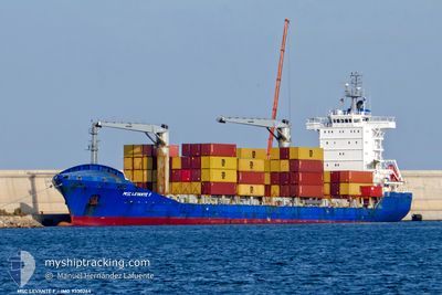
MSC LEVANTE F
Container Ship
Current Trip
| Time Travelled | 3 days |
|---|---|
| Remaining Time | --- |
| Distance Travelled | 325.33 nm |
| Remaining Distance | --- |
| AVG Speed | 9.5 Knots |
| MAX Speed | 9.5 Knots |
| AVG Wind | 7.7 knots |
| MAX Wind | 16 knots |
| MIN Temp | 15.3°C / 59.54°F |
| MAX Temp | 22.8°C / 73.04°F |
| Draught | 6.4 m |
| Position Received | 2 d ago |
Current Position
| Longitude | 35.85275° |
|---|---|
| Latitude | 36.49706° |
| Status | Under way using engine |
| Speed | 8.8 Knots |
| Course | 50.2° |
| Area | Mediterranean Sea - Eastern Basin |
| Station | T-AIS |
| Position Received | 2 d ago |
Info
Information
The current position of MSC LEVANTE F is in Mediterranean Sea - Eastern Basin with coordinates 36.49706° / 35.85275° as reported on 2024-05-01 19:50 by AIS to our vessel tracker app. The vessel's current speed is 8.8 Knots
The vessel MSC LEVANTE F (IMO: 9330264, MMSI: 352898711) is a Container Ship that was built in 2006 ( 18 years old ). It's sailing under the flag of [PA] Panama.
In this page you can find informations about the vessels current position, last detected port calls, and current voyage information. If the vessels is not in coverage by AIS you will find the latest position.
The current position of MSC LEVANTE F is detected by our AIS receivers and we are not responsible for the reliability of the data. The last position was recorded while the vessel was in Coverage by the Ais receivers of our vessel tracking app.
The current draught of MSC LEVANTE F as reported by AIS is 6.4 meters
Weather
| Temperature | 20.8°C / 69.44°F |
|---|---|
| Wind Speed | 9 knots |
| Direction | 227° SW |
| Pressure | 1005 hPa |
| Humidity | 80.8 % |
| Cloud Coverage | 4 % |
Featured Company
Last Port Calls
| Port | Arrival | Departure | Time In Port |
|---|---|---|---|
| 2024-04-30 05:28 | 2024-04-30 15:40 | 10 h | |
| 2024-04-25 18:31 | 2024-04-27 01:29 | 1 d | |
| 2024-04-20 11:04 | |||
| 2024-04-16 04:08 | 2024-04-16 12:08 | 7 h | |
| 2024-04-12 17:49 | 2024-04-13 01:15 | 7 h | |
| 2024-04-07 16:57 | 2024-04-08 20:01 | 1 d | |
| 2024-04-01 01:50 | 2024-04-03 09:55 | 2 d | |
| 2024-03-24 08:58 | 2024-03-26 05:09 | 1 d | |
| 2024-03-15 03:19 | 2024-03-16 01:57 | 22 h | |
| 2024-03-12 18:19 | 2024-03-13 23:59 | 1 d |
Last Trips
| Origin | Departure | Destination | Arrival | Distance | |
|---|---|---|---|---|---|
| 2024-04-27 03:29 | 2024-04-30 08:28 | 665.28 nm | |||
| 2024-04-20 13:04 | 2024-04-25 20:31 | 399.76 nm | |||
| 2024-04-13 04:15 | 2024-04-16 06:08 | 773.46 nm | |||
| 2024-04-08 23:01 | 2024-04-12 20:49 | 831.91 nm | |||
| 2024-04-03 11:55 | 2024-04-07 19:57 | 888.08 nm | |||
| 2024-03-26 06:09 | 2024-04-01 03:50 | 627.30 nm | |||
| 2024-03-14 00:59 | 2024-03-15 04:19 | 208.11 nm | |||
| 2024-03-11 16:02 | 2024-03-12 19:19 | 104.64 nm |
Events
| Time | Event | Details | Position / Dest | Info |
|---|---|---|---|---|
| 2024-05-03 20:52 | START Moving | 8.25 nm, North West of ISKENDERUN |
36.68602 / 36.03187
TRISK
|
Speed: 4 kn Course: 333° |
| 2024-05-02 16:25 | STOP Moving | 6.21 nm, North of ISKENDERUN |
36.71333 / 36.15500
TRISK
|
Speed: Course: -1° |
| 2024-05-02 15:19 | START Moving | 4.38 nm, North of ISKENDERUN |
36.67899 / 36.14189
TRISK
|
Speed: 4.8 kn Course: 34° |
| 2024-05-02 13:49 | STOP Moving | 4.79 nm, North of ISKENDERUN |
36.68836 / 36.15036
TRISK
|
Speed: 0.2 kn Course: 245° |
| 2024-05-02 11:51 | START Moving | 5.82 nm, North of ISKENDERUN |
36.70777 / 36.16479
TRISK
|
Speed: 3.3 kn Course: 209° |
| 2024-05-01 22:36 | STOP Moving | 6.13 nm, North of ISKENDERUN |
36.71180 / 36.15348
TRISK
|
Speed: 0.2 kn Course: 309° |
| 2024-05-01 19:55 | Status Changed | Default Under way using engine |
36.50500 / 35.86333
TRISK
|
Speed: 8.8 kn Course: 50.2° |
| 2024-05-01 19:50 | OUT of Coverage |
36.49706 / 35.85275
Mediterranean Sea - Eastern Basin
TRISK
|
Speed: 8.8 kn Course: 50.2° |
|
| 2024-05-01 17:20 | IN Coverage |
36.33299 / 35.44838
Mediterranean Sea - Eastern Basin
TRISK
|
Speed: 10 kn Course: 71.1° |
|
| 2024-05-01 14:55 | OUT of Coverage |
36.21921 / 34.96902
Mediterranean Sea - Eastern Basin
TRISK
|
Speed: 10.3 kn Course: 71.2° |