
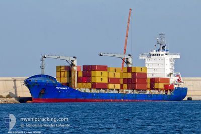
MSC LEVANTE F
Container Ship
Current Trip
| Time Travelled | 5 days |
|---|---|
| Remaining Time | --- |
| Distance Travelled | 601.06 nm |
| Remaining Distance | --- |
| AVG Speed | 8.9 Knots |
| MAX Speed | 11.1 Knots |
| AVG Wind | 11.9 knots |
| MAX Wind | 18 knots |
| MIN Temp | 6°C / 42.8°F |
| MAX Temp | 8.7°C / 47.66°F |
| Dybgang | 7.5 m |
| Position Modtaget | 5 d siden |
Current Position
| Longitude | --- |
|---|---|
| Latitude | --- |
| Status | Under way using engine |
| Fart | 10.4 Knots |
| Kurs | 322.2° |
| Område | Black Sea |
| Station | T-AIS |
| Position Modtaget | 5 d siden |
Info
Information
The current position of MSC LEVANTE F is in Black Sea with coordinates 41.68496° / 41.62792° as reported on 2025-01-15 02:52 by AIS to our vessel tracker app. The vessel's current speed is 10.4 Knots
The vessel MSC LEVANTE F (IMO: 9330264, MMSI: 352898711) is a Container Ship that was built in 2006 ( 19 år gamle ). It's sailing under the flag of [PA] Panama.
In this page you can find informations about the vessels current position, last detected port calls, and current voyage information. If the vessels is not in coverage by AIS you will find the latest position.
The current position of MSC LEVANTE F is detected by our AIS receivers and we are not responsible for the reliability of the data. The last position was recorded while the vessel was in Coverage by the Ais receivers of our vessel tracking app.
The current draught of MSC LEVANTE F as reported by AIS is 7.5 meters
Weather
| Temperature | 8.1°C / 46.58°F |
|---|---|
| Wind Speed | 7 knots |
| Direction | 73° ENE |
| Pressure | 1026.7 hPa |
| Humidity | 68.3 % |
| Cloud Coverage | 1 % |
Featured Company
Last Port Calls
| Port | Arrival | Departure | Time In Port |
|---|---|---|---|
| 2025-01-14 06:56 | 2025-01-15 02:42 | 19 h | |
| 2025-01-07 22:47 | 2025-01-09 08:07 | 1 d | |
| 2024-12-29 18:16 | 2024-12-30 23:32 | 1 d | |
| 2024-12-20 08:38 | 2024-12-21 04:40 | 20 h | |
| 2024-12-13 20:32 | 2024-12-14 21:22 | 1 d | |
| 2024-12-03 06:47 | 2024-12-04 10:46 | 1 d | |
| 2024-11-24 22:49 | 2024-11-25 20:18 | 21 h | |
| 2024-11-19 05:40 | 2024-11-19 22:08 | 16 h | |
| 2024-11-15 19:24 | 2024-11-16 09:58 | 14 h | |
| 2024-11-03 22:36 | 2024-11-04 16:52 | 18 h |
Last Trips
| Origin | Departure | Destination | Arrival | Distance | |
|---|---|---|---|---|---|
| 2025-01-09 11:07 | 2025-01-14 10:56 | 761.26 nm | |||
| 2024-12-31 02:32 | 2025-01-08 01:47 | 754.43 nm | |||
| 2024-12-21 08:40 | 2024-12-29 21:16 | 1026.10 nm | |||
| 2024-12-15 00:22 | 2024-12-20 12:38 | 770.11 nm | |||
| 2024-12-04 13:46 | 2024-12-13 23:32 | 761.27 nm | |||
| 2024-11-25 23:18 | 2024-12-03 09:47 | 733.62 nm | |||
| 2024-11-20 02:08 | 2024-11-25 01:49 | 719.94 nm | |||
| 2024-11-16 11:58 | 2024-11-19 09:40 | 587.11 nm | |||
| 2024-11-04 19:52 | 2024-11-15 21:24 | 348.83 nm | |||
| 2024-10-31 04:53 | 2024-11-04 01:36 | 722.31 nm |
Events
| Tid | Hændelsen | Detaljer | Position / Dest | Info |
|---|---|---|---|---|
| 2025-01-15 02:57 | Status er ændret | Default Under way using engine |
41.69648 / 41.61610
UA ODS
|
Fart: 10.4 kn Kurs: 322.2° |
| 2025-01-15 02:52 | Udenfor Dækning |
41.68496 / 41.62792
Black Sea
UA ODS
|
Fart: 10.4 kn Kurs: 322.2° |
|
| 2025-01-15 02:47 | ETA er ændret | 2025/01/18 06:00 2025/01/18 04:00 |
41.67405 / 41.63596
UA ODS
|
Fart: 10.5 kn Kurs: 335.2° |
| 2025-01-15 02:42 | Afsejlet fra sidste havn |
|
41.65989 / 41.64484
UA ODS
|
Fart: 8.5 kn Kurs: 335° |
| 2025-01-15 02:35 | START Sejllads |
41.65022 / 41.64740
[GE] BATUMI
|
Fart: 3.1 kn Kurs: 350° |
|
| 2025-01-15 02:14 | Status er ændret | Under way using engine Moored |
41.64940 / 41.65575
[GE] BATUMI
|
Fart: Kurs: 153° |
| 2025-01-15 02:04 | Status er ændret | Moored Default |
41.64937 / 41.65572
[GE] BATUMI
|
Fart: Kurs: 153° |
| 2025-01-15 01:55 | Status er ændret | Default Moored |
41.64939 / 41.65577
[GE] BATUMI
|
Fart: Kurs: 153° |
| 2025-01-15 01:37 | Status er ændret | Moored Default |
41.64937 / 41.65573
[GE] BATUMI
|
Fart: Kurs: 153° |
| 2025-01-15 01:31 | Status er ændret | Default Moored |
41.64934 / 41.65578
[GE] BATUMI
|
Fart: Kurs: 152° |