
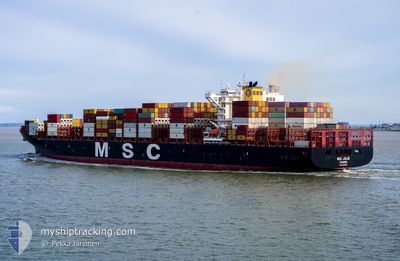
MSC JULIE
Cargo A
Current Trip
| Time Travelled | 12 days |
|---|---|
| Remaining Time | --- |
| Distance Travelled | 4375.37 nm |
| Remaining Distance | --- |
| AVG Speed | 15.8 Knots |
| MAX Speed | 20.1 Knots |
| AVG Wind | 12.3 knots |
| MAX Wind | 38 knots |
| MIN Temp | 19.2°C / 66.56°F |
| MAX Temp | 28.5°C / 83.3°F |
| Draught | 12.8 m |
| Position Received | 3 m ago |
Current Position
| Longitude | --- |
|---|---|
| Latitude | --- |
| Status | At anchor |
| Speed | |
| Course | 214° |
| Area | Persian Gulf |
| Station | T-AIS |
| Position Received | 3 m ago |
Info
Information
The current position of MSC JULIE is in Persian Gulf with coordinates 24.97041° / 54.43479° as reported on 2026-01-03 11:23 by AIS to our vessel tracker app. The vessel's current speed is 0 Knots
The vessel MSC JULIE (IMO: 9704996, MMSI: 255806498) is a Cargo A It's sailing under the flag of [PT] Portugal.
In this page you can find informations about the vessels current position, last detected port calls, and current voyage information. If the vessels is not in coverage by AIS you will find the latest position.
The current position of MSC JULIE is detected by our AIS receivers and we are not responsible for the reliability of the data. The last position was recorded while the vessel was in Coverage by the Ais receivers of our vessel tracking app.
The current draught of MSC JULIE as reported by AIS is 12.8 meters
Weather
| Temperature | 22.7°C / 72.86°F |
|---|---|
| Wind Speed | 7 knots |
| Direction | 308° NW |
| Pressure | 1017.9 hPa |
| Humidity | 56.7 % |
| Cloud Coverage | --- |
Featured Company
Last Port Calls
| Port | Arrival | Departure | Time In Port |
|---|---|---|---|
| 2025-12-20 05:17 | 2025-12-22 07:46 | 2 d | |
| 2025-12-12 09:36 | 2025-12-16 06:53 | 3 d | |
| 2025-11-24 08:48 | 2025-11-24 08:55 | 7 m | |
| 2025-11-15 11:57 | 2025-11-16 14:33 | 1 d | |
| 2025-11-14 00:13 | 2025-11-14 22:01 | 21 h | |
| 2025-11-04 19:49 | 2025-11-06 07:13 | 1 d | |
| 2025-11-01 20:29 | 2025-11-02 19:21 | 22 h |
Most Visited Ports (Last year)
| Port | Arrivals | |
|---|---|---|
| 3 | ||
| 2 | ||
| 2 | ||
| 2 | ||
| 2 | ||
| 2 |
Last Trips
| Origin | Departure | Destination | Arrival | Distance | |
|---|---|---|---|---|---|
| 2025-12-16 08:53 | 2025-12-20 07:17 | 1213.32 nm | |||
| 2025-11-24 05:55 | 2025-12-12 11:36 | 3238.69 nm | |||
| 2025-11-16 11:33 | 2025-11-24 05:48 | 543.22 nm | |||
| 2025-11-14 19:01 | 2025-11-15 08:57 | 112.82 nm | |||
| 2025-11-06 04:13 | 2025-11-13 21:13 | 1065.57 nm | |||
| 2025-11-02 16:21 | 2025-11-04 16:49 | 822.04 nm | |||
| 2025-10-31 12:29 | 2025-11-01 17:29 | 128.94 nm |
Events
| Time | Event | Details | Position / Dest | Info |
|---|---|---|---|---|
| 2026-01-03 11:23 | Status Changed | At anchor Default |
24.97041 / 54.43479
AEAUH
|
Speed: Course: 214° |
| 2026-01-03 11:20 | Status Changed | Default At anchor |
24.97041 / 54.43481
AEAUH
|
Speed: Course: 213° |
| 2026-01-03 10:32 | Status Changed | At anchor Default |
24.97059 / 54.43398
AEAUH
|
Speed: 0.1 kn Course: 197° |
| 2026-01-03 10:29 | Status Changed | Default At anchor |
24.97058 / 54.43383
AEAUH
|
Speed: 0.1 kn Course: 194° |
| 2026-01-03 10:26 | Status Changed | At anchor Default |
24.97062 / 54.43376
AEAUH
|
Speed: 0.1 kn Course: 192° |
| 2026-01-03 10:23 | Status Changed | Default At anchor |
24.97067 / 54.43368
AEAUH
|
Speed: 0.1 kn Course: 189° |
| 2026-01-03 10:20 | Status Changed | At anchor Default |
24.97071 / 54.43357
AEAUH
|
Speed: 0.1 kn Course: 185° |
| 2026-01-03 10:17 | Status Changed | Default At anchor |
24.97080 / 54.43346
AEAUH
|
Speed: 0.1 kn Course: 179° |
| 2026-01-03 09:56 | Status Changed | At anchor Default |
24.97021 / 54.43249
AEAUH
|
Speed: 0.2 kn Course: 144° |
| 2026-01-03 09:41 | Status Changed | Default At anchor |
24.96942 / 54.43159
AEAUH
|
Speed: 0.2 kn Course: 94° |