
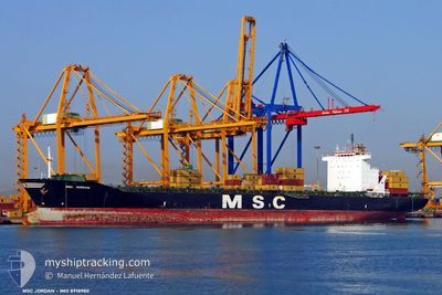
MSC JORDAN III
Container Ship
Current Trip
| Time Travelled | 1 day |
|---|---|
| Remaining Time | --- |
| Distance Travelled | 537.53 nm |
| Remaining Distance | 2.62 nm |
| AVG Speed | 13.7 Knots |
| MAX Speed | 16 Knots |
| AVG Wind | 12.8 knots |
| MAX Wind | 19 knots |
| MIN Temp | 13.7°C / 56.66°F |
| MAX Temp | 18.8°C / 65.84°F |
| Draught | 11.8 m |
| Position Received | 2 m ago |
Current Position
| Longitude | -15.40052° |
|---|---|
| Latitude | 28.11366° |
| Status | Under way using engine |
| Speed | 7.2 Knots |
| Course | 281.3° |
| Area | North Atlantic Ocean |
| Station | T-AIS |
| Position Received | 2 m ago |
Info
Information
The current position of MSC JORDAN III is in North Atlantic Ocean with coordinates 28.11366° / -15.40052° as reported on 2024-04-29 06:32 by AIS to our vessel tracker app. The vessel's current speed is 7.2 Knots and is heading at the port of LAS PALMAS. The estimated time of arrival as calculated by MyShipTracking vessel tracking app is 2024-04-29 07:00 LT
The vessel MSC JORDAN III (IMO: 8918980, MMSI: 355194000) is a Container Ship that was built in 1993 ( 31 years old ). It's sailing under the flag of [PA] Panama.
In this page you can find informations about the vessels current position, last detected port calls, and current voyage information. If the vessels is not in coverage by AIS you will find the latest position.
The current position of MSC JORDAN III is detected by our AIS receivers and we are not responsible for the reliability of the data. The last position was recorded while the vessel was in Coverage by the Ais receivers of our vessel tracking app.
The current draught of MSC JORDAN III as reported by AIS is 11.8 meters
Weather
| Temperature | 13.7°C / 56.66°F |
|---|---|
| Wind Speed | 13 knots |
| Direction | 3° N |
| Pressure | 1021.7 hPa |
| Humidity | 67.8 % |
| Cloud Coverage | 44 % |
Featured Company
Last Port Calls
| Port | Arrival | Departure | Time In Port |
|---|---|---|---|
| 2024-04-26 01:46 | 2024-04-27 18:23 | 1 d | |
| 2024-04-19 01:11 | 2024-04-19 20:32 | 19 h | |
| 2024-04-17 03:23 | 2024-04-18 06:11 | 1 d | |
| 2024-04-14 23:23 | 2024-04-16 15:53 | 1 d | |
| 2024-04-10 06:09 | |||
| 2024-04-06 13:52 | 2024-04-07 11:04 | 21 h | |
| 2024-03-31 00:46 | 2024-04-01 04:46 | 1 d | |
| 2024-03-29 13:39 | 2024-03-30 12:35 | 22 h | |
| 2024-03-25 17:59 | 2024-03-27 10:43 | 1 d | |
| 2024-03-23 08:31 | 2024-03-24 05:10 | 20 h |
Last Trips
| Origin | Departure | Destination | Arrival | Distance | |
|---|---|---|---|---|---|
| 2024-04-19 22:32 | 2024-04-26 02:46 | 1360.66 nm | |||
| 2024-04-18 08:11 | 2024-04-19 03:11 | 262.85 nm | |||
| 2024-04-16 17:53 | 2024-04-17 05:23 | 128.31 nm | |||
| 2024-04-10 06:09 | 2024-04-15 01:23 | 1626.04 nm | |||
| 2024-04-01 04:46 | 2024-04-06 14:52 | 1854.79 nm | |||
| 2024-03-30 12:35 | 2024-03-31 00:46 | 166.67 nm | |||
| 2024-03-27 10:43 | 2024-03-29 13:39 | 774.08 nm | |||
| 2024-03-24 05:10 | 2024-03-25 17:59 | 486.42 nm | |||
| 2024-03-18 15:13 | 2024-03-23 08:31 | 863.71 nm | |||
| 2024-03-15 17:39 | 2024-03-17 10:28 | 536.81 nm |
Events
| Time | Event | Details | Position / Dest | Info |
|---|---|---|---|---|
| 2024-04-29 03:35 | ETA Changed | 2024/04/29 07:00 2024/04/29 06:30 |
28.50741 / -14.91935
MACAS>>ESLPA
|
Speed: 15.2 kn Course: 223.6° |
| 2024-04-29 01:44 | Change Sea Area | Spanish (Canary Islands) part of the North Atlantic Ocean Moroccan part of the North Atlantic Ocean |
28.84607 / -14.54864
North Atlantic Ocean
MACAS>>ESLPA
|
Speed: 15.4 kn Course: 222° |
| 2024-04-29 01:42 | Status Changed | Under way using engine Default |
28.85254 / -14.54234
MACAS>>ESLPA
|
Speed: 15.4 kn Course: 219° |
| 2024-04-29 01:34 | IN Coverage |
28.84607 / -14.54864
North Atlantic Ocean
MACAS>>ESLPA
|
Speed: 15.4 kn Course: 222° |
|
| 2024-04-27 19:59 | Status Changed | Default Under way using engine |
33.67955 / -7.86389
MACAS>>ESLPA
|
Speed: 15 kn Course: 255.4° |
| 2024-04-27 19:57 | OUT of Coverage |
33.68270 / -7.85117
North Atlantic Ocean
MACAS>>ESLPA
|
Speed: 15 kn Course: 255.4° |
|
| 2024-04-27 18:23 | PORT DEPARTURE |
|
33.61904 / -7.58397
MACAS>>ESLPA
|
Speed: 8.2 kn Course: 68° |
| 2024-04-27 18:19 | Draught Changed | 11.8 11.4 |
33.61604 / -7.59332
[MA] CASABLANCA
|
Speed: 6 kn Course: 69° |
| 2024-04-27 18:19 | Destination Changed | MACAS>>ESLPA FRLEH>>MACAS |
33.61604 / -7.59332
[MA] CASABLANCA
|
Speed: 6 kn Course: 69° |
| 2024-04-27 18:19 | ETA Changed | 2024/04/29 06:30 2024/04/23 05:15 |
33.61604 / -7.59332
[MA] CASABLANCA
|
Speed: 6 kn Course: 69° |