
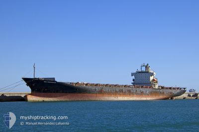
MSC GRENADA III
Container Ship
Current Trip
| Time Travelled | 7 days |
|---|---|
| Remaining Time | 23 h, 44 mins |
| Distance Travelled | 1821.04 nm |
| Remaining Distance | 65.37 nm |
| AVG Speed | 9 Knots |
| MAX Speed | 16.2 Knots |
| AVG Wind | 14 knots |
| MAX Wind | 32 knots |
| MIN Temp | 16.2°C / 61.16°F |
| MAX Temp | 22.5°C / 72.5°F |
| Draught | 9.9 m |
| Position Received | 5 m ago |
Current Position
| Longitude | 2.37771° |
|---|---|
| Latitude | 52.01631° |
| Status | Under way using engine |
| Speed | 2 Knots |
| Course | 336° |
| Area | North Sea |
| Station | T-AIS |
| Position Received | 5 m ago |
Info
Information
The current position of MSC GRENADA III is in North Sea with coordinates 52.01631° / 2.37771° as reported on 2024-09-21 16:55 by AIS to our vessel tracker app. The vessel's current speed is 2 Knots and is heading at the port of ROTTERDAM. The estimated time of arrival as calculated by MyShipTracking vessel tracking app is 2024-09-22 16:45 LT
The vessel MSC GRENADA III (IMO: 9275373, MMSI: 636017191) is a Container Ship that was built in 2003 ( 21 years old ). It's sailing under the flag of [LR] Liberia.
In this page you can find informations about the vessels current position, last detected port calls, and current voyage information. If the vessels is not in coverage by AIS you will find the latest position.
The current position of MSC GRENADA III is detected by our AIS receivers and we are not responsible for the reliability of the data. The last position was recorded while the vessel was in Coverage by the Ais receivers of our vessel tracking app.
The current draught of MSC GRENADA III as reported by AIS is 9.9 meters
Weather
| Temperature | 19.3°C / 66.74°F |
|---|---|
| Wind Speed | 9 knots |
| Direction | 74° ENE |
| Pressure | 1017.4 hPa |
| Humidity | 77.4 % |
| Cloud Coverage | 11 % |
Featured Company
Last Port Calls
| Port | Arrival | Departure | Time In Port |
|---|---|---|---|
| 2024-09-12 23:22 | 2024-09-14 05:55 | 1 d | |
| 2024-08-25 06:00 | 2024-08-31 03:12 | 5 d | |
| 2024-08-13 07:42 | 2024-08-17 12:17 | 4 d | |
| 2024-08-07 10:51 | 2024-08-09 03:07 | 1 d | |
| 2024-07-22 18:47 | 2024-08-06 05:40 | 14 d | |
| 2024-07-01 10:54 | 2024-07-04 12:07 | 3 d |
Last Trips
| Origin | Departure | Destination | Arrival | Distance | |
|---|---|---|---|---|---|
| 2024-08-31 05:12 | 2024-09-13 00:22 | 4884.37 nm | |||
| 2024-08-17 14:17 | 2024-08-25 08:00 | 1699.98 nm | |||
| 2024-08-09 05:07 | 2024-08-13 09:42 | 499.21 nm | |||
| 2024-08-06 07:40 | 2024-08-07 12:51 | 346.23 nm | |||
| 2024-07-04 14:07 | 2024-07-22 20:47 | 2361.01 nm | |||
| 2024-06-26 00:08 | 2024-07-01 12:54 | 531.27 nm |
Events
| Time | Event | Details | Position / Dest | Info |
|---|---|---|---|---|
| 2024-09-21 15:51 | ETA Changed | 2024/09/22 15:00 2024/09/22 10:00 |
51.98072 / 2.36809
NLRTM
|
Speed: 1.9 kn Course: 338° |
| 2024-09-21 13:44 | STOP Moving |
51.94935 / 2.35677
NLRTM
|
Speed: 0.3 kn Course: 341° |
|
| 2024-09-21 09:41 | START Moving |
51.93828 / 2.32034
NLRTM
|
Speed: 3.1 kn Course: 184° |
|
| 2024-09-21 06:51 | STOP Moving |
51.97597 / 2.38855
NLRTM
|
Speed: 0.3 kn Course: 118° |
|
| 2024-09-21 05:33 | START Moving |
52.04462 / 2.36559
NLRTM
|
Speed: 3.1 kn Course: 359° |
|
| 2024-09-21 01:28 | STOP Moving |
51.94042 / 2.35043
NLRTM
|
Speed: 0.3 kn Course: 342° |
|
| 2024-09-21 00:42 | Status Changed | Under way using engine Default |
51.94859 / 2.36164
NLRTM
|
Speed: 1.6 kn Course: 337° |
| 2024-09-21 00:37 | Status Changed | Default Under way using engine |
51.95020 / 2.36389
NLRTM
|
Speed: 1.6 kn Course: 337° |
| 2024-09-21 00:19 | Status Changed | Under way using engine Default |
51.95823 / 2.37192
NLRTM
|
Speed: 2.1 kn Course: 338° |
| 2024-09-21 00:17 | Status Changed | Default Under way using engine |
51.95904 / 2.37288
NLRTM
|
Speed: 2.1 kn Course: 339° |