

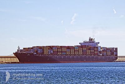
MSC DARIEN
Container Ship

Current Trip
| Time Travelled | 1 day |
|---|---|
| Remaining Time | 11 h, 59 mins |
| Distance Travelled | 476.99 nm |
| Remaining Distance | 194.70 nm |
| AVG Speed | 16 Knots |
| MAX Speed | 19.2 Knots |
| AVG Wind | 6.3 knots |
| MAX Wind | 14 knots |
| MIN Temp | 16.3°C / 61.34°F |
| MAX Temp | 18.7°C / 65.66°F |
| Draught | 13.7 m |
| Position Received | 3 m ago |
Current Position
| Longitude | --- |
|---|---|
| Latitude | --- |
| Status | Under way using engine |
| Speed | 19.2 Knots |
| Course | 126° |
| Area | Mediterranean Sea - Eastern Basin |
| Station | T-AIS |
| Position Received | 3 m ago |
Information
The current position of MSC DARIEN is in Mediterranean Sea - Eastern Basin with coordinates 34.21003° / 31.56408° as reported on 2025-03-26 21:02 by AIS to our vessel tracker app. The vessel's current speed is 19.2 Knots and is heading at the port of HAIFA. The estimated time of arrival as calculated by MyShipTracking vessel tracking app is 2025-03-27 11:05 LT
The vessel MSC DARIEN (IMO: 9243394, MMSI: 255803780) is a Container Ship that was built in 2003 ( 22 years old ). It's sailing under the flag of [PT] Portugal.
In this page you can find informations about the vessels current position, last detected port calls, and current voyage information. If the vessels is not in coverage by AIS you will find the latest position.
The current position of MSC DARIEN is detected by our AIS receivers and we are not responsible for the reliability of the data. The last position was recorded while the vessel was in Coverage by the Ais receivers of our vessel tracking app.
The current draught of MSC DARIEN as reported by AIS is 13.7 meters
Weather
| Temperature | 18.3°C / 64.94°F |
|---|---|
| Wind Speed | 8 knots |
| Direction | 59° ENE |
| Pressure | 1014 hPa |
| Humidity | 61.3 % |
| Cloud Coverage | 100 % |


Featured Company
Last Port Calls
| Port | Arrival | Departure | Time In Port |
|---|---|---|---|
| 2025-03-24 11:31 | 2025-03-25 17:51 | 1 d | |
| 2025-03-22 23:42 | 2025-03-23 23:58 | 1 d | |
| 2025-03-20 17:40 | 2025-03-22 02:53 | 1 d | |
| 2025-03-15 02:15 | 2025-03-16 10:19 | 1 d | |
| 2025-03-07 01:00 | 2025-03-11 20:33 | 4 d | |
| 2025-02-27 22:55 | 2025-02-28 20:55 | 22 h | |
| 2025-02-26 08:45 | 2025-02-27 00:01 | 15 h | |
| 2025-02-24 18:05 | 2025-02-25 19:40 | 1 d | |
| 2025-02-23 08:41 | 2025-02-23 17:49 | 9 h | |
| 2025-02-20 13:57 | 2025-02-21 14:25 | 1 d |
Most Visited Ports (Last year)
| Port | Arrivals | |
|---|---|---|
| 4 | ||
| 4 | ||
| 4 | ||
| 4 | ||
| 3 | ||
| 3 |
Last Trips
| Origin | Departure | Destination | Arrival | Distance | |
|---|---|---|---|---|---|
| 2025-03-23 23:58 | 2025-03-24 11:31 | 197.11 nm | |||
| 2025-03-22 02:53 | 2025-03-22 23:42 | 214.22 nm | |||
| 2025-03-16 10:19 | 2025-03-20 17:40 | 1511.64 nm | |||
| 2025-03-11 20:33 | 2025-03-15 02:15 | 852.91 nm | |||
| 2025-02-28 20:55 | 2025-03-07 01:00 | 2295.66 nm | |||
| 2025-02-27 00:01 | 2025-02-27 22:55 | 178.53 nm | |||
| 2025-02-25 19:40 | 2025-02-26 08:45 | 163.80 nm | |||
| 2025-02-21 14:25 | 2025-02-24 18:05 | 569.97 nm | |||
| 2025-02-21 14:25 | 2025-02-23 08:41 | 305.77 nm | |||
| 2025-02-19 06:31 | 2025-02-20 13:57 | 536.02 nm |
Events
| Time | Event | Details | Position / Dest | Info |
|---|---|---|---|---|
| 2025-03-26 20:43 | Status Changed | Under way using engine Default |
34.23728 / 31.46707
ILHFA
|
Speed: 16 kn Course: 109° |
| 2025-03-26 20:42 | Status Changed | Default Under way using engine |
34.23875 / 31.46192
ILHFA
|
Speed: 16 kn Course: 109° |
| 2025-03-26 19:37 | Status Changed | Under way using engine Default |
34.37747 / 31.16795
ILHFA
|
Speed: 15.7 kn Course: 115° |
| 2025-03-26 18:54 | Status Changed | Default Under way using engine |
34.46086 / 30.96373
ILHFA
|
Speed: 15.8 kn Course: 116° |
| 2025-03-26 17:43 | Status Changed | Under way using engine Default |
34.59960 / 30.62857
ILHFA
|
Speed: 15.8 kn Course: 116° |
| 2025-03-26 17:42 | Status Changed | Default Under way using engine |
34.60309 / 30.61998
ILHFA
|
Speed: 15.8 kn Course: 116° |
| 2025-03-26 17:35 | Status Changed | Under way using engine Default |
34.61593 / 30.58833
ILHFA
|
Speed: 15.8 kn Course: 116° |
| 2025-03-26 17:29 | Status Changed | Default Under way using engine |
34.62717 / 30.55987
ILHFA
|
Speed: 15 kn Course: 115° |
| 2025-03-26 17:11 | Detected in Sea | Cypriote part of the Mediterranean Sea - Eastern Basin |
34.66080 / 30.47530
Mediterranean Sea - Eastern Basin
ILHFA
|
Speed: 15.5 kn Course: 117° |
| 2025-03-26 16:11 | Change Sea Area | Turkish part of the Mediterranean Sea - Eastern Basin Greek part of the Mediterranean Sea - Eastern Basin |
34.78453 / 30.18790
Mediterranean Sea - Eastern Basin
ILHFA
|
Speed: 16.3 kn Course: 117° |