
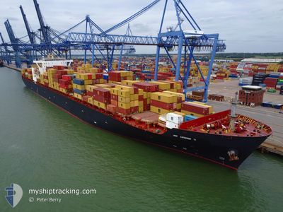
MSC CATHERINE VI
Container Ship
Current Trip
JPNGO OFF
| Time Travelled | 5 h, 32 mins |
|---|---|
| Remaining Time | --- |
| Distance Travelled | 72.30 nm |
| Remaining Distance | --- |
| AVG Speed | 13.9 Knots |
| MAX Speed | 19.5 Knots |
| AVG Wind | 25.1 knots |
| MAX Wind | 29 knots |
| MIN Temp | 6.6°C / 43.88°F |
| MAX Temp | 8.7°C / 47.66°F |
| Draught | 11.9 m |
| Position Received | 5 h, 41 m ago |
Current Position
| Longitude | --- |
|---|---|
| Latitude | --- |
| Status | Moored |
| Speed | 8.5 Knots |
| Course | 166° |
| Area | Philippine Sea |
| Station | T-AIS |
| Position Received | 5 h, 41 m ago |
Info
Information
The current position of MSC CATHERINE VI is in Philippine Sea with coordinates 35.01837° / 136.83481° as reported on 2026-01-05 15:06 by AIS to our vessel tracker app. The vessel's current speed is 8.5 Knots
The vessel MSC CATHERINE VI (IMO: 9229300, MMSI: 636017173) is a Container Ship that was built in 2001 ( 25 years old ). It's sailing under the flag of [LR] Liberia.
In this page you can find informations about the vessels current position, last detected port calls, and current voyage information. If the vessels is not in coverage by AIS you will find the latest position.
The current position of MSC CATHERINE VI is detected by our AIS receivers and we are not responsible for the reliability of the data. The last position was recorded while the vessel was in Coverage by the Ais receivers of our vessel tracking app.
The current draught of MSC CATHERINE VI as reported by AIS is 11.9 meters
Weather
| Temperature | 7.2°C / 44.96°F |
|---|---|
| Wind Speed | 27 knots |
| Direction | 311° NW |
| Pressure | 1013.8 hPa |
| Humidity | 60 % |
| Cloud Coverage | --- |
Featured Company
Last Port Calls
| Port | Arrival | Departure | Time In Port |
|---|---|---|---|
| 2026-01-03 22:15 | 2026-01-05 15:16 | 1 d | |
| 2026-01-01 21:56 | 2026-01-02 07:56 | 10 h | |
| 2025-12-28 13:36 | 2025-12-29 07:56 | 18 h | |
| 2025-12-13 06:32 | 2025-12-15 11:01 | 2 d | |
| 2025-11-26 00:50 | 2025-12-01 09:04 | 5 d | |
| 2025-11-14 09:39 | 2025-11-16 05:47 | 1 d | |
| 2025-11-06 01:57 | 2025-11-07 08:52 | 1 d |
Most Visited Ports (Last year)
| Port | Arrivals | |
|---|---|---|
| 6 | ||
| 2 | ||
| 2 | ||
| 2 | ||
| 2 | ||
| 2 |
Last Trips
| Origin | Departure | Destination | Arrival | Distance | |
|---|---|---|---|---|---|
| 2026-01-02 16:56 | 2026-01-04 07:15 | 12.64 nm | |||
| 2025-12-29 16:56 | 2026-01-02 06:56 | 758.34 nm | |||
| 2025-12-15 19:01 | 2025-12-28 22:36 | 2690.29 nm | |||
| 2025-12-01 11:04 | 2025-12-13 14:32 | 4888.63 nm | |||
| 2025-11-16 07:47 | 2025-11-26 02:50 | 1030.68 nm | |||
| 2025-11-07 12:52 | 2025-11-14 11:39 | 1940.26 nm | |||
| 2025-10-26 19:26 | 2025-11-06 05:57 | 3356.57 nm |
Events
| Time | Event | Details | Position / Dest | Info |
|---|---|---|---|---|
| 2026-01-05 15:16 | PORT DEPARTURE |
|
34.98982 / 136.81705
JPNGO OFF
|
Speed: 11.4 kn Course: 216° |
| 2026-01-05 15:12 | Status Changed | Default Moored |
35.00191 / 136.82704
[JP] NAGOYA
|
Speed: 8.5 kn Course: 166° |
| 2026-01-05 15:06 | OUT of Coverage |
35.01837 / 136.83481
Philippine Sea
|
Speed: 8.5 kn Course: 157.8° |
|
| 2026-01-05 15:06 | Status Changed | Moored Default |
35.01870 / 136.83465
[JP] NAGOYA
|
Speed: 7.4 kn Course: 151° |
| 2026-01-05 15:05 | IN Coverage |
35.01837 / 136.83481
Philippine Sea
[JP] NAGOYA
|
Speed: 8.5 kn Course: 157.8° |
|
| 2026-01-05 15:01 | START Moving |
35.02387 / 136.82581
[JP] NAGOYA
|
Speed: 5 kn Course: 103° |
|
| 2026-01-03 22:59 | STOP Moving |
35.02631 / 136.82079
[JP] NAGOYA
|
Speed: 0.2 kn Course: 258° |
|
| 2026-01-03 22:37 | Status Changed | Default At anchor |
35.02316 / 136.83186
[JP] NAGOYA
|
Speed: 5.8 kn Course: 353° |
| 2026-01-03 22:30 | OUT of Coverage |
35.01598 / 136.83780
Philippine Sea
[JP] NAGOYA
|
Speed: 5.8 kn Course: 2.1° |
|
| 2026-01-03 22:15 | PORT ARRIVAL |
|
34.99244 / 136.82074
[JP] NAGOYA
|
Speed: 8.1 kn Course: 31.9° |