
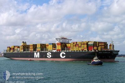
MSC CAMILLE
Container Ship
Current Trip
| Time Travelled | 1 day |
|---|---|
| Remaining Time | 17 h, 48 mins |
| Distance Travelled | 746.22 nm |
| Remaining Distance | 326.27 nm |
| AVG Speed | 17.1 Knots |
| MAX Speed | 19.2 Knots |
| AVG Wind | 15.6 knots |
| MAX Wind | 26 knots |
| MIN Temp | 17.5°C / 63.5°F |
| MAX Temp | 21.8°C / 71.24°F |
| Draught | 11.7 m |
| Position Received | 7 h, 52 m ago |
Current Position
| Longitude | 23.42875° |
|---|---|
| Latitude | 36.07733° |
| Status | Under way using engine |
| Speed | 17.2 Knots |
| Course | 260.4° |
| Area | Aegean Sea |
| Station | T-AIS |
| Position Received | 7 h, 52 m ago |
Info
Information
The current position of MSC CAMILLE is in Aegean Sea with coordinates 36.07733° / 23.42875° as reported on 2024-05-12 15:39 by AIS to our vessel tracker app. The vessel's current speed is 17.2 Knots and is heading at the port of GIOIA TAURO. The estimated time of arrival as calculated by MyShipTracking vessel tracking app is 2024-05-13 17:20 LT
The vessel MSC CAMILLE (IMO: 9404651, MMSI: 354625000) is a Container Ship that was built in 2009 ( 15 years old ). It's sailing under the flag of [PA] Panama.
In this page you can find informations about the vessels current position, last detected port calls, and current voyage information. If the vessels is not in coverage by AIS you will find the latest position.
The current position of MSC CAMILLE is detected by our AIS receivers and we are not responsible for the reliability of the data. The last position was recorded while the vessel was in Coverage by the Ais receivers of our vessel tracking app.
The current draught of MSC CAMILLE as reported by AIS is 11.7 meters
Weather
| Temperature | 19.2°C / 66.56°F |
|---|---|
| Wind Speed | 9 knots |
| Direction | 317° NW |
| Pressure | 1017.7 hPa |
| Humidity | 75.6 % |
| Cloud Coverage | --- |
Featured Company
Last Port Calls
| Port | Arrival | Departure | Time In Port |
|---|---|---|---|
| 2024-05-08 01:46 | 2024-05-11 02:42 | 3 d | |
| 2024-05-01 01:52 | 2024-05-02 10:28 | 1 d | |
| 2024-04-28 02:01 | 2024-04-28 13:23 | 11 h | |
| 2024-04-25 19:34 | 2024-04-27 20:27 | 2 d | |
| 2024-04-23 19:52 | 2024-04-24 12:58 | 17 h | |
| 2024-04-20 04:30 | 2024-04-22 10:09 | 2 d | |
| 2024-04-16 22:05 | 2024-04-18 07:05 | 1 d | |
| 2024-04-13 06:12 | 2024-04-14 03:51 | 21 h | |
| 2024-04-10 09:50 | 2024-04-11 11:51 | 1 d | |
| 2024-03-07 17:57 | 2024-03-08 17:00 | 23 h |
Last Trips
| Origin | Departure | Destination | Arrival | Distance | |
|---|---|---|---|---|---|
| 2024-05-02 13:28 | 2024-05-08 04:46 | 350.34 nm | |||
| 2024-04-28 16:23 | 2024-05-01 04:52 | 821.94 nm | |||
| 2024-04-27 23:27 | 2024-04-28 05:01 | 64.08 nm | |||
| 2024-04-24 15:58 | 2024-04-25 22:34 | 326.95 nm | |||
| 2024-04-22 12:09 | 2024-04-23 22:52 | 569.65 nm | |||
| 2024-04-18 09:05 | 2024-04-20 06:30 | 676.08 nm | |||
| 2024-04-14 05:51 | 2024-04-17 00:05 | 212.54 nm | |||
| 2024-04-11 12:51 | 2024-04-13 08:12 | 706.75 nm | |||
| 2024-03-04 17:54 | 2024-03-07 23:27 | 1205.97 nm | |||
| 2024-03-03 04:13 | 2024-03-04 01:43 | 290.07 nm |
Events
| Time | Event | Details | Position / Dest | Info |
|---|---|---|---|---|
| 2024-05-12 15:42 | Status Changed | Default Under way using engine |
36.07524 / 23.41366
ITGIT
|
Speed: 17.2 kn Course: 260.4° |
| 2024-05-12 15:39 | OUT of Coverage |
36.07733 / 23.42875
Aegean Sea
ITGIT
|
Speed: 17.2 kn Course: 260.4° |
|
| 2024-05-12 15:04 | Status Changed | Under way using engine Default |
36.09788 / 23.63934
ITGIT
|
Speed: 17.9 kn Course: 268° |
| 2024-05-12 14:48 | Status Changed | Default Under way using engine |
36.10064 / 23.73462
ITGIT
|
Speed: 17.9 kn Course: 268.4° |
| 2024-05-12 14:40 | Status Changed | Under way using engine Default |
36.10192 / 23.78851
ITGIT
|
Speed: 17.9 kn Course: 269° |
| 2024-05-12 14:26 | Status Changed | Default Under way using engine |
36.10368 / 23.87202
ITGIT
|
Speed: 17.9 kn Course: 268.7° |
| 2024-05-12 05:39 | Status Changed | Under way using engine Default |
36.06657 / 26.97601
ITGIT
|
Speed: 17.7 kn Course: 285° |
| 2024-05-12 04:56 | Status Changed | Default Under way using engine |
36.00619 / 27.22689
ITGIT
|
Speed: 17.2 kn Course: 285.7° |
| 2024-05-12 03:38 | Change Sea Area | Greek part of the Aegean Sea Greek part of the Mediterranean Sea - Eastern Basin |
35.82945 / 27.62932
Aegean Sea
ITGIT
|
Speed: 17 kn Course: 311.2° |
| 2024-05-12 01:45 | Status Changed | Under way using engine Default |
35.73963 / 28.28770
ITGIT
|
Speed: 18.3 kn Course: 270° |