

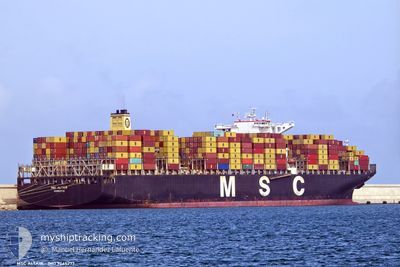
MSC ALTAIR
Container Ship

Current Trip
| Time Travelled | 9 days |
|---|---|
| Remaining Time | --- |
| Distance Travelled | 3201.68 nm |
| Remaining Distance | 3302.98 nm |
| AVG Speed | 13.5 Knots |
| MAX Speed | 19.1 Knots |
| AVG Wind | 7.3 knots |
| MAX Wind | 14 knots |
| MIN Temp | 26.1°C / 78.98°F |
| MAX Temp | 29°C / 84.2°F |
| Draught | 14.4 m |
| Position Received | 9 d ago |
Current Position
| Longitude | --- |
|---|---|
| Latitude | --- |
| Status | Under way using engine |
| Speed | 13.2 Knots |
| Course | 190.4° |
| Area | Arabian Sea |
| Station | T-AIS |
| Position Received | 9 d ago |
Information
The current position of MSC ALTAIR is in Arabian Sea with coordinates 18.74773° / 72.53426° as reported on 2025-03-14 20:47 by AIS to our vessel tracker app. The vessel's current speed is 13.2 Knots and is heading at the port of MUNDRA.
The vessel MSC ALTAIR (IMO: 9465277, MMSI: 636015604) is a Container Ship that was built in 2012 ( 13 years old ). It's sailing under the flag of [LR] Liberia.
In this page you can find informations about the vessels current position, last detected port calls, and current voyage information. If the vessels is not in coverage by AIS you will find the latest position.
The current position of MSC ALTAIR is detected by our AIS receivers and we are not responsible for the reliability of the data. The last position was recorded while the vessel was in Coverage by the Ais receivers of our vessel tracking app.
The current draught of MSC ALTAIR as reported by AIS is 14.4 meters
Weather
| Temperature | 26.6°C / 79.88°F |
|---|---|
| Wind Speed | 10 knots |
| Direction | 232° SW |
| Pressure | 1015 hPa |
| Humidity | 73.6 % |
| Cloud Coverage | 37 % |


Featured Company
Last Port Calls
| Port | Arrival | Departure | Time In Port |
|---|---|---|---|
| 2025-03-14 00:49 | 2025-03-14 23:04 | 22 h | |
| 2025-03-09 15:16 | 2025-03-11 02:01 | 1 d | |
| 2025-03-06 05:13 | 2025-03-07 01:49 | 20 h | |
| 2025-03-03 21:09 | 2025-03-04 20:09 | 23 h | |
| 2025-03-01 22:03 | 2025-03-03 06:26 | 1 d | |
| 2025-02-25 00:49 | 2025-02-26 10:26 | 1 d | |
| 2025-02-22 22:31 | 2025-02-24 14:35 | 1 d | |
| 2025-02-18 16:28 | 2025-02-19 08:31 | 16 h | |
| 2025-01-24 18:58 | 2025-01-26 21:21 | 2 d | |
| 2025-01-18 07:21 | 2025-01-20 11:43 | 2 d |
Most Visited Ports (Last year)
| Port | Arrivals | |
|---|---|---|
| 8 | ||
| 6 | ||
| 6 | ||
| 6 | ||
| 4 | ||
| 4 |
Last Trips
| Origin | Departure | Destination | Arrival | Distance | |
|---|---|---|---|---|---|
| 2025-03-11 02:01 | 2025-03-14 00:49 | 438.16 nm | |||
| 2025-03-07 01:49 | 2025-03-09 15:16 | 1013.94 nm | |||
| 2025-03-04 20:09 | 2025-03-06 05:13 | 355.09 nm | |||
| 2025-03-03 06:26 | 2025-03-03 21:09 | 158.37 nm | |||
| 2025-02-26 10:26 | 2025-03-01 22:03 | 508.12 nm | |||
| 2025-02-24 14:35 | 2025-02-25 00:49 | 59.44 nm | |||
| 2025-02-19 08:31 | 2025-02-22 22:31 | 1058.60 nm | |||
| 2025-01-26 21:21 | 2025-02-18 16:28 | 9314.76 nm | |||
| 2025-01-20 11:43 | 2025-01-24 18:58 | 1738.22 nm | |||
| 2025-01-17 09:29 | 2025-01-18 07:21 | 60.68 nm |
Events
| Time | Event | Details | Position / Dest | Info |
|---|---|---|---|---|
| 2025-03-14 20:50 | Status Changed | Default Under way using engine |
18.73681 / 72.53216
AEAUH>INMUN
|
Speed: 13.2 kn Course: 190.4° |
| 2025-03-14 20:47 | OUT of Coverage |
18.74773 / 72.53426
Arabian Sea
|
Speed: 13.2 kn Course: 190.4° |
|
| 2025-03-14 20:40 | Status Changed | Under way using engine Default |
18.77196 / 72.53887
AEAUH>INMUN
|
Speed: 12.8 kn Course: 190° |
| 2025-03-14 20:35 | Status Changed | Default Under way using engine |
18.79225 / 72.54267
AEAUH>INMUN
|
Speed: 12.5 kn Course: 190.3° |
| 2025-03-14 20:31 | Status Changed | Under way using engine Default |
18.80502 / 72.54511
AEAUH>INMUN
|
Speed: 12.1 kn Course: 193° |
| 2025-03-14 20:24 | Status Changed | Default Under way using engine |
18.82778 / 72.54965
AEAUH>INMUN
|
Speed: 10.9 kn Course: 219.1° |
| 2025-03-14 20:19 | Change Sea Area | Indian part of the Arabian Sea United Arab Emirates part of the Gulf of Oman |
18.84274 / 72.55574
Arabian Sea
|
Speed: 10.9 kn Course: 219.1° |
| 2025-03-14 20:19 | Status Changed | Under way using engine Default |
18.84274 / 72.55574
AEAUH>INMUN
|
Speed: 12 kn Course: 260° |
| 2025-03-14 20:16 | IN Coverage |
18.84274 / 72.55574
Arabian Sea
|
Speed: 10.9 kn Course: 219.1° |
|
| 2025-03-14 17:34 | PORT DEPARTURE |
|
18.95008 / 72.93851
AEAUH>INMUN
|
Speed: 5.9 kn Course: 209° |