
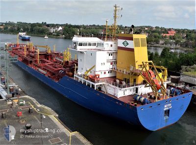
MOYRA
Oil/Chemical Tanker
Current Trip
| Trip Time | 4 days |
|---|---|
| Trip Distance | 878.22 nm |
| AVG Speed | 11.3 Knots |
| MAX Speed | 15.1 Knots |
| Draught | 6.7 m |
| AVG Wind | 9.9 knots |
| MAX Wind | 33.9 knots |
| MIN Temp | 9.6°C / 49.28°F |
| MAX Temp | 23.9°C / 75.02°F |
| Position Received | 2 d ago |
Current Position
| Longitude | -56.96297° |
|---|---|
| Latitude | -38.33385° |
| Status | Under way using engine |
| Speed | 12.4 Knots |
| Course | 225.3° |
| Area | South Atlantic Ocean |
| Station | T-AIS |
| Position Received | 2 d ago |
Info
Information
The current position of MOYRA is in South Atlantic Ocean with coordinates -38.33385° / -56.96297° as reported on 2024-05-08 13:23 by AIS to our vessel tracker app. The vessel's current speed is 12.4 Knots and is currently inside the port of PUERTO GALVAN.
The vessel MOYRA (IMO: 9271999, MMSI: 236271000) is a Oil/Chemical Tanker that was built in 2005 ( 19 years old ). It's sailing under the flag of [GI] Gibraltar.
In this page you can find informations about the vessels current position, last detected port calls, and current voyage information. If the vessels is not in coverage by AIS you will find the latest position.
The current position of MOYRA is detected by our AIS receivers and we are not responsible for the reliability of the data. The last position was recorded while the vessel was in Coverage by the Ais receivers of our vessel tracking app.
The current draught of MOYRA as reported by AIS is 6.7 meters
Weather
| Temperature | 10.1°C / 50.18°F |
|---|---|
| Wind Speed | 5 knots |
| Direction | 157° SSE |
| Pressure | 1021.9 hPa |
| Humidity | 80.9 % |
| Cloud Coverage | 100 % |
Featured Company
Last Port Calls
| Port | Arrival | Departure | Time In Port |
|---|---|---|---|
| 2024-05-10 18:41 | |||
| 2024-05-05 11:15 | 2024-05-06 14:09 | 1 d | |
| 2024-04-25 01:39 | 2024-04-25 01:54 | 15 m | |
| 2024-04-16 17:13 | 2024-04-19 02:47 | 2 d | |
| 2024-04-13 11:00 | 2024-04-15 19:52 | 2 d | |
| 2024-04-07 22:38 | 2024-04-09 18:09 | 1 d | |
| 2024-03-24 09:37 | 2024-03-25 13:21 | 1 d | |
| 2024-03-05 16:49 | 2024-03-05 17:24 | 35 m | |
| 2024-03-02 04:50 |
Most Visited Ports (Last year)
| Port | Arrivals | |
|---|---|---|
| 13 | ||
| 9 | ||
| 7 | ||
| 5 | ||
| 3 | ||
| 1 |
Last Trips
| Origin | Departure | Destination | Arrival | Distance | |
|---|---|---|---|---|---|
| 2024-05-06 11:09 | 2024-05-10 15:41 | 878.22 nm | |||
| 2024-04-24 22:54 | 2024-05-05 08:15 | 1298.83 nm | |||
| 2024-04-18 23:47 | 2024-04-24 22:39 | 1023.23 nm | |||
| 2024-04-15 16:52 | 2024-04-16 14:13 | 36.95 nm | |||
| 2024-04-09 15:09 | 2024-04-13 08:00 | 431.12 nm | |||
| 2024-03-25 10:21 | 2024-04-07 19:38 | 2469.01 nm | |||
| 2024-03-05 14:24 | 2024-03-24 06:37 | 1266.90 nm | |||
| 2024-03-02 01:50 | 2024-03-05 13:49 | 970.48 nm |
Events
| Time | Event | Details | Position / Dest | Info |
|---|---|---|---|---|
| 2024-05-10 18:41 | STOP Moving |
-38.78452 / -62.30615
[AR] PUERTO GALVAN
|
Speed: Course: 117° |
|
| 2024-05-10 18:41 | PORT ARRIVAL |
|
-38.78452 / -62.30615
[AR] PUERTO GALVAN
|
Speed: 3.4 kn Course: 115° |
| 2024-05-10 14:58 | START Moving | 16.24 nm, South East of PUERTO ROSALES |
-39.09228 / -61.79332
ARBHI
|
Speed: 7.7 kn Course: 297° |
| 2024-05-10 01:26 | STOP Moving | 16.7 nm, South East of PUERTO ROSALES |
-39.09647 / -61.78515
ARBHI
|
Speed: Course: 329° |
| 2024-05-09 22:49 | START Moving |
-39.37353 / -61.45383
ARBHI
|
Speed: 3.3 kn Course: 292° |
|
| 2024-05-09 15:27 | STOP Moving |
-39.37495 / -61.45179
ARBHI
|
Speed: 0.2 kn Course: 269° |
|
| 2024-05-08 13:27 | Status Changed | Default Under way using engine |
-38.34312 / -56.97416
ARBHI
|
Speed: 12.4 kn Course: 225.3° |
| 2024-05-08 13:23 | OUT of Coverage |
-38.33385 / -56.96297
South Atlantic Ocean
ARBHI
|
Speed: 12.4 kn Course: 225.3° |
|
| 2024-05-08 13:21 | Status Changed | Under way using engine Default |
-38.32802 / -56.95593
ARBHI
|
Speed: 12.8 kn Course: 223° |
| 2024-05-08 13:02 | Status Changed | Default Under way using engine |
-38.27932 / -56.89704
ARBHI
|
Speed: 12.9 kn Course: 224.8° |